
Sunrise reflecting on a November morning on the Sacramento River, California.
Images
Images
Filter Total Items: 9454

Sunrise on the Sacramento River
Sunrise reflecting on a November morning on the Sacramento River, California.
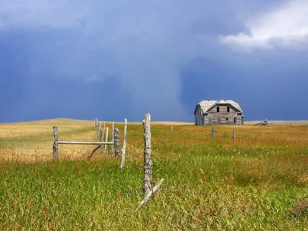
Agricultural Field in the Great Plains Region of Montana
Agricultural Field in the Great Plains Region of MontanaAgricultural fields and an abandoned farmstead in eastern Montana in the Great Plains region. The Great Plains region of the United States has experienced significant land-use change since European settlement, with vast swaths of grasslands converted to agricultural lands.

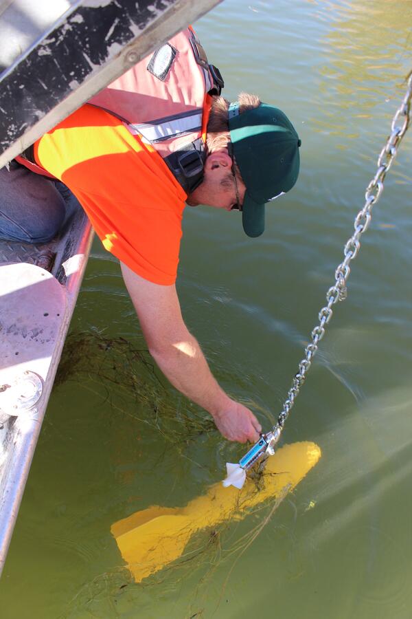
Lowering a Hydroacoustic Transducer
Mikhail Malin, visiting IBIW scientist, prepares to lowers a hydroacoustic transducer into the water from a CERC research vessel below Bagnell Dam on the Osage River, Missouri. The CERC and IBIW collaborated with the Missouri Cooperative Fish and Wildlife Research Unit at the University of Missouri to assess the distribution of paddlefish below the dam us
Mikhail Malin, visiting IBIW scientist, prepares to lowers a hydroacoustic transducer into the water from a CERC research vessel below Bagnell Dam on the Osage River, Missouri. The CERC and IBIW collaborated with the Missouri Cooperative Fish and Wildlife Research Unit at the University of Missouri to assess the distribution of paddlefish below the dam us

Newly Reconstructed Pond
Beau Griffith, a biological technician at CERC, stands at the bottom of one of the newly reconstructed ponds designed to conduct long-term studies with sturgeon and other riverine species. A divider and circulators can be installed in the sandy-bottomed ponds to create the continuous water current that sturgeon prefer.
Beau Griffith, a biological technician at CERC, stands at the bottom of one of the newly reconstructed ponds designed to conduct long-term studies with sturgeon and other riverine species. A divider and circulators can be installed in the sandy-bottomed ponds to create the continuous water current that sturgeon prefer.

Devils Lake Basin Flyover
U.S. Geological Survey participiated in a flyover of the Devils Lake Basin to view continued severe flooding.
U.S. Geological Survey participiated in a flyover of the Devils Lake Basin to view continued severe flooding.

Interior of Rock Magnetics Laboratory in the Tarpaper Shack (room 40)
Interior of Rock Magnetics Laboratory in the Tarpaper Shack (room 40)Interior of room 40 inside the tarpaper shacks on the USGS Menlo Park campus, circa 1965. During the early 1960s, three of the key scientists working on the theory of magnetic reversals operated in the Rock Magnetics Laboratory that was housed in these shacks. The Rock Magnetics Laboratory was designated a National Historic Landmark on October 12, 1994.

USA-NPN Citizen-Scientist Lucille Tower
USA-National Phenology Network citizen-scientist Lucille Tower records the one millionth observation on maple vine in the large nature database.
USA-National Phenology Network citizen-scientist Lucille Tower records the one millionth observation on maple vine in the large nature database.

Herpetology
A USGS herpetologist with a Sonora Mud Turtle (Kinosternon sonoriense; photo left) and Red-eared Slider (Trachemys scripta elegans;
photo right) at Montezuma Well, Montezuma Castle National Monument.
A USGS herpetologist with a Sonora Mud Turtle (Kinosternon sonoriense; photo left) and Red-eared Slider (Trachemys scripta elegans;
photo right) at Montezuma Well, Montezuma Castle National Monument.

House Damage from 2011 Central Virginia Earthquake
House Damage from 2011 Central Virginia EarthquakeDamage to a house in Louisa County, Virginia, after a magnitude 5.8 earthquake on August 23, 2011.
House Damage from 2011 Central Virginia Earthquake
House Damage from 2011 Central Virginia EarthquakeDamage to a house in Louisa County, Virginia, after a magnitude 5.8 earthquake on August 23, 2011.
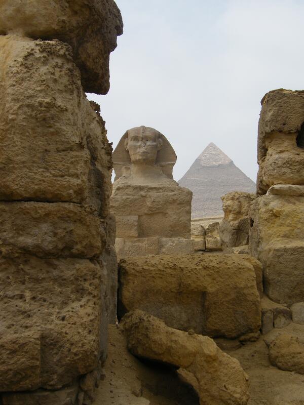
Sphinx and Great Pyramid of Giza, Egypt
The Spinx and the Great Pyramid of Giza, Egypt are pictured here.
The Spinx and the Great Pyramid of Giza, Egypt are pictured here.

Tree-Killing Las Conchas Fire in New Mexico
USGS scientist Craig D. Allen observes the results of the extensive, tree-killing fire that consumed almost all above-ground biomass in this part of the Las Conchas Fire burn area in the Jemez Mountains, New Mexico. Photo taken in late August 2011, two months post-fire.
USGS scientist Craig D. Allen observes the results of the extensive, tree-killing fire that consumed almost all above-ground biomass in this part of the Las Conchas Fire burn area in the Jemez Mountains, New Mexico. Photo taken in late August 2011, two months post-fire.

Drift Wood
Drift wood and other organic material showed up at the Paria Riffle due to high water volumes.
Drift wood and other organic material showed up at the Paria Riffle due to high water volumes.
Taking Readings in the Grand Canyon
USGS Aquatic Ecologist, Ted Kennedy, getting a reading off the flow meter.
USGS Aquatic Ecologist, Ted Kennedy, getting a reading off the flow meter.
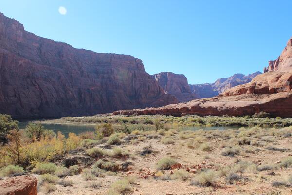
Water Holes Canyon
View of the Colorado River from a bench near Water Holes Canyon.
View of the Colorado River from a bench near Water Holes Canyon.
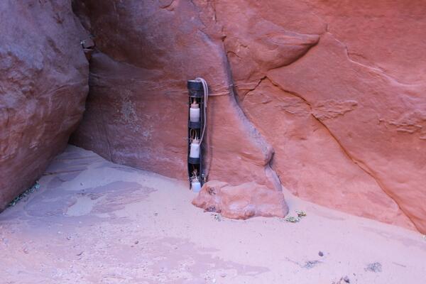
Sediment Monitoring Gauges
USGS Hydrologist David Topping's sediment monitoring gauges.
USGS Hydrologist David Topping's sediment monitoring gauges.

Sampling in the Grand Canyon High Flow Experiment
USGS Aquatic Ecologist Ted Kennedy sampling invertebrate and organic drift at Lees Ferry during the November 19, 2012 HFE.
USGS Aquatic Ecologist Ted Kennedy sampling invertebrate and organic drift at Lees Ferry during the November 19, 2012 HFE.

Suspended Scientists
USGS scientists up on the cable way at Lees Ferry measuring suspended-sediment transport.
USGS scientists up on the cable way at Lees Ferry measuring suspended-sediment transport.

Russian Crown Jewels from the USGS Library
Previously undiscovered photo of undocumented Russian Crown Jewels were recently discovered in the USGS library. The photo appear in a 1922 album called "Russian Diamond Fund," that was uncovered in the rare book room of the library. This brooch was one of the four undocumented jewels.
Previously undiscovered photo of undocumented Russian Crown Jewels were recently discovered in the USGS library. The photo appear in a 1922 album called "Russian Diamond Fund," that was uncovered in the rare book room of the library. This brooch was one of the four undocumented jewels.

Russian Crown Jewels from the USGS Library
Previously undiscovered photo of undocumented Russian Crown Jewels were recently discovered in the USGS library. The photo appear in a 1922 album called "Russian Diamond Fund," that was uncovered in the rare book room of the library. This photo, taken in 1925, shows the entire Russian jewelry collection.
Previously undiscovered photo of undocumented Russian Crown Jewels were recently discovered in the USGS library. The photo appear in a 1922 album called "Russian Diamond Fund," that was uncovered in the rare book room of the library. This photo, taken in 1925, shows the entire Russian jewelry collection.

U.S. Capitol Gatepost
This U.S. Capitol gatepost was built circa 1827 and is made of Aquia Creek Sandstone, the same material that makes up most of the U.S. Capitol building. It stands at the intersection of 15th Street, NW, and Constitution Avenue.
This U.S. Capitol gatepost was built circa 1827 and is made of Aquia Creek Sandstone, the same material that makes up most of the U.S. Capitol building. It stands at the intersection of 15th Street, NW, and Constitution Avenue.

Red Seneca Sandstone
This is red Seneca sandstone, the building block of the Smithsonian Castle. It originated in a quarry on the shores of the Potomac River in Maryland, and is more than 200 million years old.
This is red Seneca sandstone, the building block of the Smithsonian Castle. It originated in a quarry on the shores of the Potomac River in Maryland, and is more than 200 million years old.