How to Edit an Existing Structure
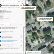
If you are editing an existing structure, you do not need to place a new icon on the map. You will click on a point already on the map, verify its location and attributes (name, address, structure type), make any necessary changes, and save.
Back to Topic: Editing | Previous Section: How to Research a Structure | Next Section: How to Add a New Structure
First, review this section on finding points to edit:
-
Finding Points to Edit
In our previous map editor, points were color-coded to indicate which level of editing they had been through (unedited, standard, peer reviewed, advanced, USGS reviewed). We’ve simplified this aspect of editing, so you’ll no longer have to worry about who has previously edited a point. But if you aren’t scanning the map for different colored points, how do you know which data to edit?
Next, follow these steps for editing existing structures points:
-
Step 1: Check Name and Address
This section will walk you through the process of verifying the name and address of an existing structure point with a red border.
-
Step 2: Check Location
This section will walk you through the process of verifying the location an existing structure point.
-
Step 3: Save Changes to Existing Point
This section will walk you through the process of saving changes to an existing structure point.
Sometimes, the points you check will not need to be updated (the information is correct, and the point is in the right location). In such cases, you can mark the point as reviewed to indicate to other volunteers that the information has been checked, and move on to the next feature:
-
Existing Structures that DO NOT Need to be Updated
What if you click on a point to edit and notice that nothing about the point needs to be changed?
And sometimes you'll need to change the symbol representing a particular feature. This page walks you through the process of changing point symbols:
-
Changing Symbols
If a structure has been labeled with the incorrect symbol (for example, a school serving students in grades PreK – 8 is labeled as an Elementary School when it should be labeled as a General School), then you need to update the symbol.


