



Landsat Fractional Snow Covered Area Science Products
Snow cover is spatially and temporally variable and is often concentrated in remote or inaccessible land regions making spaceborne remote sensing the most feasible approach to measure and monitor snow cover change. Landsat’s spatial resolution offers the capability to resolve snow cover patterns across topographically complex mountainous regions.
Collection 2 Fractional Snow Covered Area
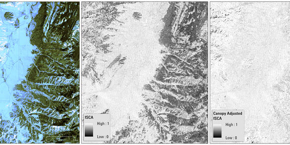
Products created from data acquired 1984 - present for Landsat 4-5 TM, Landsat 7 ETM+, and Landsat 8 OLI/TIRS. Landsat 9 will be added in 2023.
Previous Landsat Collections
Return to Landsat Science Products Overview
While Landsat’s acquisition frequency limits analysis of short-term snow cover variations, longer term changes in snow cover duration and persistence can be detected. The Landsat Fractional Snow Covered Area (fSCA) product provides per-pixel fractional snow cover maps that indicate the percentage of a pixel covered by snow.
The table below displays how different communities use Landsat fSCA products in their research.
| Community | Potential Use |
|---|---|
| Colorado State University | Western U.S. snowpack |
| Various conference connections | Planning and management of fire occurrence or managed lands |
| Landsat science | Reference for other Landsat Science Products |
The images below are examples of how Landsat Fractional Snow Covered Area data are used.


