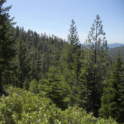
Climate Change and Snowshoe Hares Winter White Fur
Climate Change and Snowshoe Hares Winter White FurSnowshoe hare experiencing camouflage mismatch in the spring at the Seeley Lake, MT, study site.

Official websites use .gov
A .gov website belongs to an official government organization in the United States.
Secure .gov websites use HTTPS
A lock () or https:// means you’ve safely connected to the .gov website. Share sensitive information only on official, secure websites.
The scientific community is certain that the Earth's climate is changing because of the trends that we see in the instrumented climate record and the changes that have been observed in physical and biological systems. The instrumental record of climate change is derived from thousands of temperature and precipitation recording stations around the world. We have very high confidence in these records as a whole. The evidence of a warming trend over the past century is unequivocal.
Many types of instrumental records point to a climate warming trend. Our streamflow records show an earlier peak in spring runoff; borehole temperature records in Alaskan permafrost as well as water temperature records on land and sea show the warming trend. The physical and biological changes that confirm climate warming include the rate of retreat in glaciers around the world, the intensification of rainfall events, changes in the timing of the leafing out of plants and the arrival of spring migrant birds, and shifting of the range of some species.
The USGS is congressionally mandated (2007 Energy Independence and Security Act) to conduct a comprehensive national assessment of storage and flux (flow) of carbon and the fluxes of other greenhouse gases (including carbon dioxide) in ecosystems. At this writing, reports have been completed for Alaska, the Eastern U.S., the Great Plains, and the Western U.S. Learn more: Carbon Emissions and...

Atmospheric carbon dioxide comes from two primary sources—natural and human activities. Natural sources of carbon dioxide include most animals, which exhale carbon dioxide as a waste product. Human activities that lead to carbon dioxide emissions come primarily from energy production, including burning coal, oil, or natural gas. Learn more: Sources of Greenhouse Gas Emissions (EPA)
In 2013, the USGS released the first-ever comprehensive, nation-wide assessment of geologic carbon sequestration, which estimates a mean storage potential of 3,000 metric gigatons of carbon dioxide. The assessment is the first geologically-based, probabilistic assessment, with a range of 2,400 to 3,700 metric gigatons of potential carbon dioxide storage. In addition, the assessment is for the...

Geologic carbon sequestration is the process of storing carbon dioxide (CO2) in underground geologic formations. The CO2 is usually pressurized until it becomes a liquid, and then it is injected into porous rock formations in geologic basins. This method of carbon storage is also sometimes a part of enhanced oil recovery, otherwise known as tertiary recovery, because it is typically used later in...

It is difficult to characterize one area as “the best” for carbon sequestration because the answer depends on the question: best for what? However, the area of the assessment with the most storage potential for carbon dioxide is the Coastal Plains region, which includes coastal basins from Texas to Georgia. That region accounts for 2,000 metric gigatons, or 65 percent, of the storage potential...

Repeat photography and aerial / satellite photo analysis provide evidence of glacier loss in terms of shape and area. The USGS Benchmark Glacier project has collected mass balance data on a network of glaciers in Alaska, Washington, and Montana for decades, quantifying trends of mass loss at all sites. Extensive field data collection at these sites includes twice yearly visits to measure seasonal...

Snowshoe hare experiencing camouflage mismatch in the spring at the Seeley Lake, MT, study site.
Snowshoe hare experiencing camouflage mismatch in the spring at the Seeley Lake, MT, study site.
The USGS is congressionally mandated (2007 Energy Independence and Security Act) to conduct a comprehensive national assessment of storage and flux (flow) of carbon and the fluxes of other greenhouse gases (including carbon dioxide) in ecosystems. At this writing, reports have been completed for Alaska, the Eastern U.S., the Great Plains, and the Western U.S. Learn more: Carbon Emissions and...
Atmospheric carbon dioxide comes from two primary sources—natural and human activities. Natural sources of carbon dioxide include most animals, which exhale carbon dioxide as a waste product. Human activities that lead to carbon dioxide emissions come primarily from energy production, including burning coal, oil, or natural gas. Learn more: Sources of Greenhouse Gas Emissions (EPA)
In 2013, the USGS released the first-ever comprehensive, nation-wide assessment of geologic carbon sequestration, which estimates a mean storage potential of 3,000 metric gigatons of carbon dioxide. The assessment is the first geologically-based, probabilistic assessment, with a range of 2,400 to 3,700 metric gigatons of potential carbon dioxide storage. In addition, the assessment is for the...
Geologic carbon sequestration is the process of storing carbon dioxide (CO2) in underground geologic formations. The CO2 is usually pressurized until it becomes a liquid, and then it is injected into porous rock formations in geologic basins. This method of carbon storage is also sometimes a part of enhanced oil recovery, otherwise known as tertiary recovery, because it is typically used later in...
It is difficult to characterize one area as “the best” for carbon sequestration because the answer depends on the question: best for what? However, the area of the assessment with the most storage potential for carbon dioxide is the Coastal Plains region, which includes coastal basins from Texas to Georgia. That region accounts for 2,000 metric gigatons, or 65 percent, of the storage potential...
Repeat photography and aerial / satellite photo analysis provide evidence of glacier loss in terms of shape and area. The USGS Benchmark Glacier project has collected mass balance data on a network of glaciers in Alaska, Washington, and Montana for decades, quantifying trends of mass loss at all sites. Extensive field data collection at these sites includes twice yearly visits to measure seasonal...
Snowshoe hare experiencing camouflage mismatch in the spring at the Seeley Lake, MT, study site.
Snowshoe hare experiencing camouflage mismatch in the spring at the Seeley Lake, MT, study site.