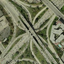
Download medium-resolution scans (400 dpi) of aerial photography products at no charge using EarthExplorer.
We are working on high-resolution scans (25 micron or 1,000 dpi) that can also be downloaded at no charge. With over 8.4 million frames of imagery in our archive, scanning will take many years to complete, but about 80% of high-resolution scans are currently available.
If you can't find a high-resolution scan of the image that you need or if you need a higher-resolution scan, on-demand scanning is available at \$30.00 per frame/scene plus an order fee of \$5.00. Delivery time is 3-4 weeks; no priority service is offered.
All requests must be made online through EarthExplorer. Select the shopping cart to order the image. Change the micron size to 25 micron (1,000 dpi); 14 micron (1,800 dpi); or 7 micron (3,600 dpi). The charge is the same for all high-resolution micron sizes. The 7 micron scans are for black & white imagery only.
For assistance, contact Customer Service at custserv@usgs.gov or call 800-252-4547 or 605-594-6151. They're open Monday-Friday, 8a-4p Central time.
If you have any payment, billing, or account questions, please contact:
U.S Geological Survey, Receivables Management Section
Mail Stop 271
12201 Sunrise Valley Drive
Reston, Va 20192
Email: GS-A-HQ_RMS@usgs.gov
Phone: (703) 648-7683
Learn more: Aerial Photography Frequently Asked Questions
Related Content
Are the scanned aerial photographic images georectified?
Scans of traditional aerial photography film products (air photos) are not georectified.The USGS does, however, offer several orthoimagery (georectified aerial photograph) products:Digital Orthophoto Quadrangle (DOQ)High Resolution Orthoimagery (HRO)National Agriculture Imagery Program (NAIP, NAIP Plus)NAIP orthoimagery has been collected for the entire conterminous United States every 3 years...
How much area does an aerial photograph cover?
The area covered by an aerial photograph (air photo) depends on the scale of the imagery. Most air photos were taken on 9 x 9 inch film. The chart below reflects coverage for a variety of photographic scales.Scale1 inch = feet1 side (miles)Area (square miles)1:12,00010001.702.91:20,00016672.848.11:24,00020003.4111.61:40,00033335.6832.31:58,00048338.2367.731:63,36052809.0081.001:80,000666711.36129...
How do I download orthoimagery products and what are the available formats?
Download orthoimagery (georectified aerial photographs) using EarthExplorer, which has the full catalog of USGS orthoimagery and aerial photography, or The National Map downloader, which has NAIP orthoimagery only. EarthExplorer: Products Overview Format varies by type of orthoimagery: Native format, Georeferenced Tagged Image File Format (GeoTIFF), or compressed 10:1 JPEG2000 The National Map...
Is certification available for scanned aerial photographic products?
The U.S. Geological Survey (USGS) Earth Resources Observation and Science Center (EROS) can only certify that the product downloaded through our website is an authentic reproduction of an official record of the government that is in the legal custody of the USGS EROS Center. See the standard Authenticity of Digital Imagery document.
Will all aerial photographic film held by USGS be digitized?
Yes, there is a plan to scan and digitize all rolls of film. The plan is to first scan all rolls of film that are in danger of decay from vinegar syndrome and then scan everything else. Science and customer requirements are also reviewed on a regular basis, but a formal, online schedule is not available.Learn more:USGS EROS products overviewUSGS EROS Aerial Photography Frequently Asked Questions
Using high-resolution digital aerial imagery to map land cover
Historical Orthoimagery of the Lake Tahoe Basin
Related Content
- FAQ
Are the scanned aerial photographic images georectified?
Scans of traditional aerial photography film products (air photos) are not georectified.The USGS does, however, offer several orthoimagery (georectified aerial photograph) products:Digital Orthophoto Quadrangle (DOQ)High Resolution Orthoimagery (HRO)National Agriculture Imagery Program (NAIP, NAIP Plus)NAIP orthoimagery has been collected for the entire conterminous United States every 3 years...
How much area does an aerial photograph cover?
The area covered by an aerial photograph (air photo) depends on the scale of the imagery. Most air photos were taken on 9 x 9 inch film. The chart below reflects coverage for a variety of photographic scales.Scale1 inch = feet1 side (miles)Area (square miles)1:12,00010001.702.91:20,00016672.848.11:24,00020003.4111.61:40,00033335.6832.31:58,00048338.2367.731:63,36052809.0081.001:80,000666711.36129...
How do I download orthoimagery products and what are the available formats?
Download orthoimagery (georectified aerial photographs) using EarthExplorer, which has the full catalog of USGS orthoimagery and aerial photography, or The National Map downloader, which has NAIP orthoimagery only. EarthExplorer: Products Overview Format varies by type of orthoimagery: Native format, Georeferenced Tagged Image File Format (GeoTIFF), or compressed 10:1 JPEG2000 The National Map...
Is certification available for scanned aerial photographic products?
The U.S. Geological Survey (USGS) Earth Resources Observation and Science Center (EROS) can only certify that the product downloaded through our website is an authentic reproduction of an official record of the government that is in the legal custody of the USGS EROS Center. See the standard Authenticity of Digital Imagery document.
Will all aerial photographic film held by USGS be digitized?
Yes, there is a plan to scan and digitize all rolls of film. The plan is to first scan all rolls of film that are in danger of decay from vinegar syndrome and then scan everything else. Science and customer requirements are also reviewed on a regular basis, but a formal, online schedule is not available.Learn more:USGS EROS products overviewUSGS EROS Aerial Photography Frequently Asked Questions
- Multimedia
- Publications
Using high-resolution digital aerial imagery to map land cover
The Upper Midwest Environmental Sciences Center (UMESC) has used aerial photography to map land cover/land use on federally owned and managed lands for over 20 years. Until recently, that process used 23- by 23-centimeter (9- by 9-inch) analog aerial photos to classify vegetation along the Upper Mississippi River System, on National Wildlife Refuges, and in National Parks. With digital aerial cameAuthorsJ.J. Dieck, Larry RobinsonHistorical Orthoimagery of the Lake Tahoe Basin
The U.S. Geological Survey (USGS) Western Geographic Science Center has developed a series of historical digital orthoimagery (HDO) datasets covering part or all of the Lake Tahoe Basin. Three datasets are available: (A) 1940 HDOs for the southern Lake Tahoe Basin, (B) 1969 HDOs for the entire Lake Tahoe Basin, and (C) 1987 HDOs for the southern Lake Tahoe Basin. The HDOs (for 1940, 1969, and 1987AuthorsChristopher E. Soulard, Christian G. Raumann - News