
USGS New England Water Science Center Priorities and Programs
A look at what USGS water science centers do and the New England Water Science Center's current areas of focus and research.
Who We Are
The U.S. Geological Survey (USGS) New England Water Science Center monitors and studies the water resources of Maine, Massachusetts, New Hampshire, Vermont, Rhode Island and Connecticut. The data we collect and the research we complete provide the comprehensive information necessary to keep our water resources safe and sustainable.

What Water Science Centers Do
All USGS Water Science Centers provide impartial, timely data and research on water quality and quantity in support of Federal, State, and local agencies across the United States. Our science and foundational data address water issues facing the nation.
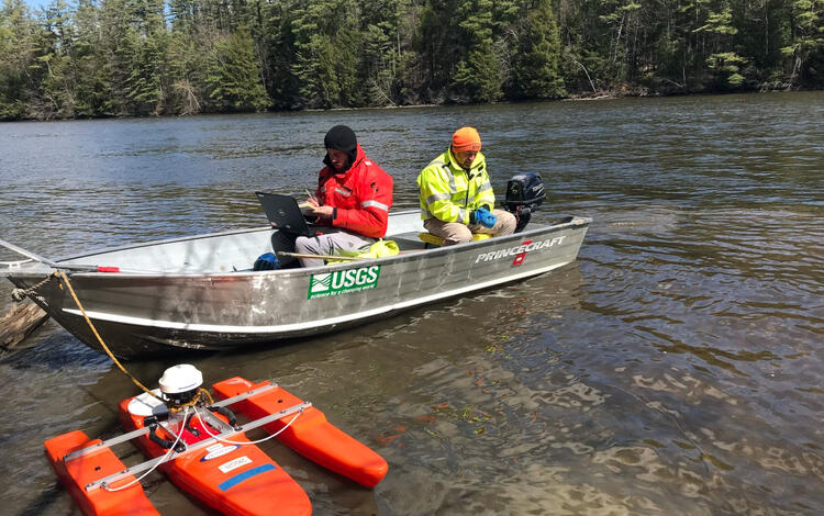
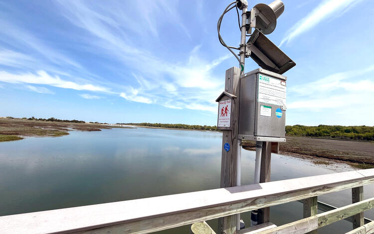
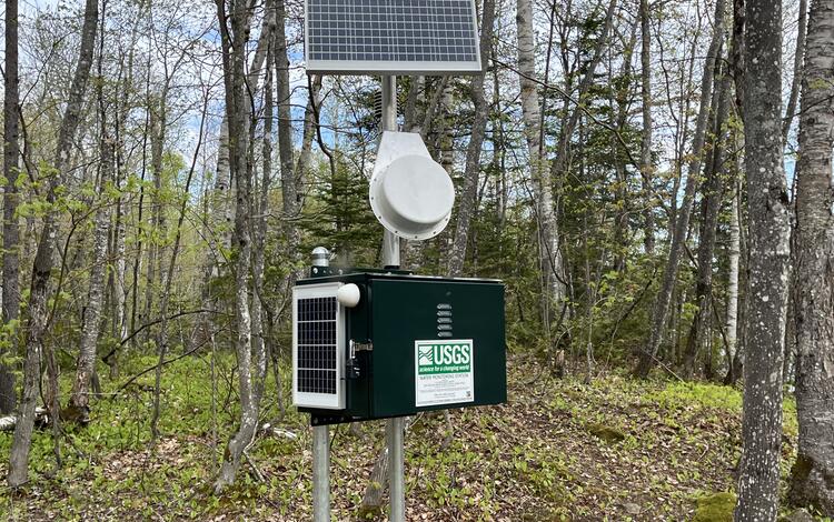
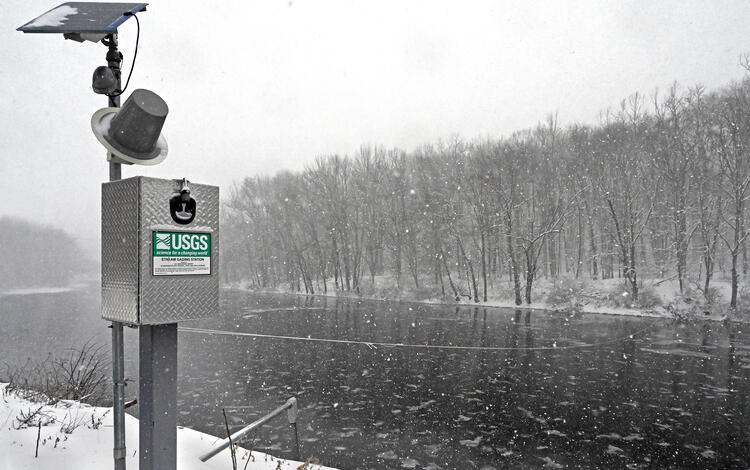
All water science centers manage a monitoring network of streamgages and wells that collect continuous water data on streamflow, water quality, groundwater levels, and atmospheric information.
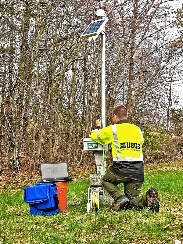
The New England Water Science Center currently operates and manages:
- 968 stream, lake, and tide gages
- 271 groundwater wells
Streamflow, groundwater levels, and water quality data collected from these monitoring locations inform
- Hazard preparation and response associated with drought and flooding
- Water resource analyses conducted by USGS, partner agencies, and other institutions that require long-term consistent datasets
- Water availability and allocation for agriculture, irrigation, domestic needs, and energy development
- Water quality management and standards development to benefit public and environmental health
- Infrastructure design and operation of dams, bridges, and stormwater networks
- Ecosystem, habitat, and species assessments, management, and restoration
- Recreational safety
THE USGS NATIONAL WATER DASHBOARD
What the New England Water Science Center Focuses On
Every region of the United States has a unique climate, ecosystem, geology, population size, and land usage – making water science centers essential throughout the country.
The specific environmental characteristics of New England and the water resource needs of its communities guide the science at our center.
The New England Water Science Center:
- identifies and measure contaminants, such as per- and polyfluoroalkyl substances (PFAS) and arsenic
- studies the impacts of floods and droughts on public safety and water availability
- monitors nutrient and constituent pollution that degrades water quality and aquatic systems
- tracks the effects of a changing climate
Climate Hydrology
Urban Hydrology
PFAS & Toxic Contaminants
Snow Surveying
Geographic Studies
Climate Hydrology
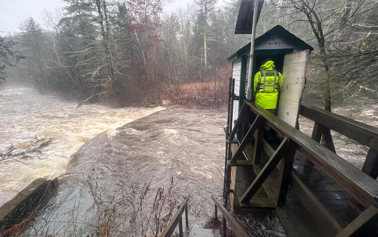
From rising water temperatures to longer and more frequent flooding and drought, the effects of a changing climate impact our hydrology. The New England Water Science Center forecasts future hydrologic changes based on varying climate scenarios. With many coastal communities in New England, the center also researches how rising sea levels could encroach on these towns through saltwater infiltrating into the groundwater, higher water tables, and coastal flooding.
Furthermore, we provide data to Federal and state cooperators in determining and characterizing floods and droughts. The center carries out cooperative research with the Federal Emergency Management Agency during and after severe storms to collect and publish water level data from high-water marks and water-level sensors to document storm surge, tidal reach, freshwater inputs and wave runup to better understand the impact of coastal storms. In addition, our long-term continuous monitoring network of streamgages and wells collect data that are used to define drought severity by comparing current water levels in rivers and aquifers with normal and extreme recorded values.

Urban Hydrology
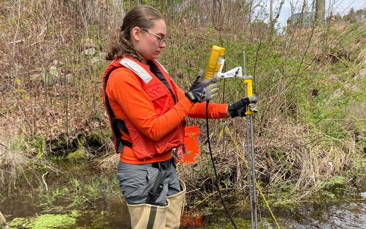
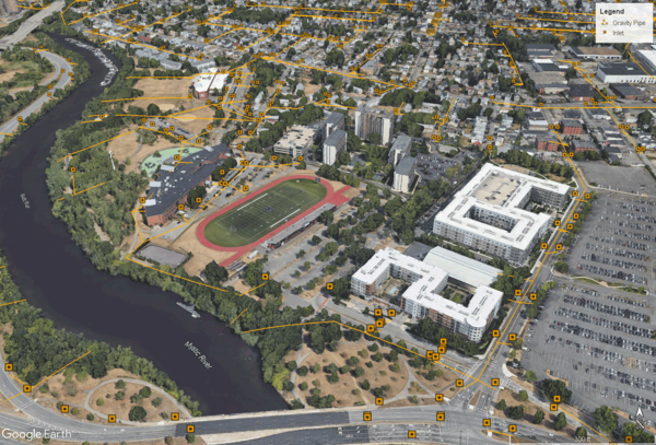
New England is home to thousands of watersheds, some of which include cities and expansive metropolitan areas. The New England Water Science Center studies urban hydrology and water quality within the most-populated parts of the region.
The center’s research measures and estimates many regulated contaminants and nutrients found in urban stormwater runoff. These data help city managers identify areas of concern so they can implement best management practices and minimize pollution. The team has updated the USGS StreamStats to incorporate stormwater infrastructure in the developed areas around Boston that lie within the Neponset and Mystic River watersheds. Updating this public web application supports stormwater management and pollution mitigation in these urbanized Massachusetts watersheds.
We also work with state departments of transportation and the Federal Highway Administration to develop flood-flow estimates, carry out hydraulic studies, and study the water quality of stormflows, or direct runoff. For example, we have studied the sources of chloride that enter the public water supply from road salt and established new methods for quantifying stormwater runoff and constituents entering a river from bridges. The DOT uses this information to keep New England’s infrastructure and roadways safe while limiting any environmental impact.
PFAS and Toxic Contaminant Work
The New England Water Science Center studies metals and toxic contaminants in streams and soil throughout the region. A primary contaminant of concern is per- and polyfluoralkyl substances (PFAS), a group of more than 4,000 man-made compounds. PFAS chemicals were manufactured in the United States and used in a variety of water-repellant and non-stick products and fire-fighting foams, and used in many industrial processes, such as plastic production. PFAS are extremely persistent in the environment and are linked to many health issues, including cancer.
Other contaminants and metals studied at the New England Water Science Center include arsenic, aluminum, and uranium.
Research focuses on determining how the contaminants move in the environment (transport), how long the contaminants persist (persistence), and what happens to the contaminant after it is released (fate).
New England Snow Surveying
New England is known for its cold winters and understanding how much water is being held in the snowpack and frozen ground is vital in understanding to what extent snowmelt will contribute to streamflow from runoff. This information is used to forecast spring flood potential and water availability.
The USGS New England Water Science Center collects data on these snowmelt dynamics in Maine and Vermont. They measure the depth of snow and weigh a core of snow to calculate the snow water equivalent, which is the amount of water contained in the snowpack and represents the depth of water that would result if the snowpack was melted in place.

The Maine Cooperative Snow Survey
USGS and the Maine Geological Survey (MGS) jointly manage the Maine Cooperative Snow Survey, which collects, interprets, and distributes depth and water content information on Maine’s snowpack. The snow survey is carried out in late winter and early spring when flood risk is highest. USGS and MGS prepare datasets and maps that visually represent the amount of water in snowpack throughout the state. The Maine Emergency Management Agency and the National Weather Service use this information to forecast flood potential.
Sleepers River Research Watershed in Vermont
USGS scientists have been taking snow water equivalent, soil frost, and snow depth measurements at Sleepers River Research Watershed since 1993 – but these data have been collected since the 1960s by other entities. There are currently nine sites within the 11,000 hectare in northeastern Vermont where these measurements are taken in the watershed.
Geographic Studies
Cape Cod Program
Cape Cod’s aquifer serves as the single source of drinking water for the community, so research of the groundwater, pollution sources, and potential interactions with rivers, ponds, and bays is essential for public health. The USGS New England Water Science Center has been investigating groundwater and surface-water resources on Cape Cod for more than 50 years.
Cape Cod research has included the study of PFAS in groundwater and surface water from Joint Base Cape Cod (JBCC), nitrogen contamination from septic systems and municipal wastewater, nutrient loading from groundwater to rivers and bays, water-quality of public-supply wells, pond-groundwater interactions, nitrogen-reducing wastewater treatment technologies, and the impacts of sea-level rise and saltwater intrusion.

Long Island Sound Program
Long Island Sound (LIS) is the second largest estuary in the United States and its watershed is home to 9 million people. Increasing population and development in the region have impaired water quality and degraded ecosystems within the Sound and watershed, which includes all of Connecticut and parts of Rhode Island, Massachusetts, New Hampshire, Vermont, New York, and Quebec, Canada.
The USGS New England Water Science Center collects data and conducts research in LIS and its watershed to inform management decisions that will improve the Sound’s water quality in cooperation with state and Federal agencies and non-government organizations.
The Center’s research has focused on:
- Nutrient loading in the LIS watershed (and its largest sub-basin the Connecticut River watershed) through surface water and groundwater sampling and the development of groundwater flow models and surface water models called spatially referenced regressions on watershed attributes (SPARROW)
- Surface water and groundwater quality and resources
- water quality sampling in the Sound and its embayments, rivers, and small tributaries
- effects of a changing climate, including coastal acidification and coastal flood forecasting

Lake Champlain Basin Program
The New England Water Science Center works in collaboration with other Federal, state, university and non-government organizations on research and monitoring in Lake Champlain, including the Lake Champlain Basin Program. The center has carried out a variety of work in Lake Champlain for many years, including flood forecasting and tracking water-quality trends for the Lake Champlain watershed and associated basins. Currently, the center is focusing on water-quality projects in the Lake Champlain basin, including contaminants of emerging concern (such as pharmaceuticals and PFAS) in the lake and harmful algal blooms caused by nutrient pollution.

Southeast New England Program (SNEP)
The Southeast New England Program (SNEP) is an interagency group founded by the EPA that monitors and studies southeastern New England’s coastal watersheds. The Program serves to restore and enhance the watersheds that support the shoreline communities of Rhode Island and southeastern Massachusetts. SNEP’s work serves to find solutions for the area’s primary challenges, such as wetland loss, dam-controlled rivers, and nutrient pollution.
The USGS New England Water Science Center supports this program by providing water quality and quantity data in the region and also spearheads several projects including: characterizing the water quality of the Sakonnet River, evaluating groundwater quality changes after switching from septic systems to sewers or permeable reactive barriers, and monitoring nitrogen levels in surface water and groundwater in response to nutrient management or to identify areas that require nitrogen reduction.

Sleepers River Research Watershed Program
The Sleepers River Research Watershed in Danville, Vermont, has been the site of active hydrologic research since 1959, when the Agricultural Research Service (ARS) of the U.S. Department of Agriculture (USDA) established a research program in the watershed. The Sleepers River site is now operated by the USGS, in cooperation with several other Federal agencies and universities.
The USGS New England Water Science Center measures precipitation, streamflow, water quality, and snowpack at various sites within the Sleepers River watershed.
In addition to collecting long-term data, this research site has served as an outdoor laboratory where scientists can study hydrologic processes and biogeochemical cycling to see how water moves from higher elevation to streams and better understand chemical-change processes and the impacts of a changing climate.
Our current research at the site focuses on organic carbon transformation and stream transport to better understand how that process fits in global carbon cycle. With this knowledge, we can develop predictive capabilities that provide resource managers with early warning when high levels of nutrients or dissolved organic matter are developing upstream.

A look at what USGS water science centers do and the New England Water Science Center's current areas of focus and research.
Who We Are
The U.S. Geological Survey (USGS) New England Water Science Center monitors and studies the water resources of Maine, Massachusetts, New Hampshire, Vermont, Rhode Island and Connecticut. The data we collect and the research we complete provide the comprehensive information necessary to keep our water resources safe and sustainable.
What Water Science Centers Do
All USGS Water Science Centers provide impartial, timely data and research on water quality and quantity in support of Federal, State, and local agencies across the United States. Our science and foundational data address water issues facing the nation.
All water science centers manage a monitoring network of streamgages and wells that collect continuous water data on streamflow, water quality, groundwater levels, and atmospheric information.
The New England Water Science Center currently operates and manages:
- 968 stream, lake, and tide gages
- 271 groundwater wells
Streamflow, groundwater levels, and water quality data collected from these monitoring locations inform
- Hazard preparation and response associated with drought and flooding
- Water resource analyses conducted by USGS, partner agencies, and other institutions that require long-term consistent datasets
- Water availability and allocation for agriculture, irrigation, domestic needs, and energy development
- Water quality management and standards development to benefit public and environmental health
- Infrastructure design and operation of dams, bridges, and stormwater networks
- Ecosystem, habitat, and species assessments, management, and restoration
- Recreational safety
THE USGS NATIONAL WATER DASHBOARD
What the New England Water Science Center Focuses On
Every region of the United States has a unique climate, ecosystem, geology, population size, and land usage – making water science centers essential throughout the country.
The specific environmental characteristics of New England and the water resource needs of its communities guide the science at our center.
The New England Water Science Center:
- identifies and measure contaminants, such as per- and polyfluoroalkyl substances (PFAS) and arsenic
- studies the impacts of floods and droughts on public safety and water availability
- monitors nutrient and constituent pollution that degrades water quality and aquatic systems
- tracks the effects of a changing climate
Climate Hydrology
Urban Hydrology
PFAS & Toxic Contaminants
Snow Surveying
Geographic Studies
Climate Hydrology
From rising water temperatures to longer and more frequent flooding and drought, the effects of a changing climate impact our hydrology. The New England Water Science Center forecasts future hydrologic changes based on varying climate scenarios. With many coastal communities in New England, the center also researches how rising sea levels could encroach on these towns through saltwater infiltrating into the groundwater, higher water tables, and coastal flooding.
Furthermore, we provide data to Federal and state cooperators in determining and characterizing floods and droughts. The center carries out cooperative research with the Federal Emergency Management Agency during and after severe storms to collect and publish water level data from high-water marks and water-level sensors to document storm surge, tidal reach, freshwater inputs and wave runup to better understand the impact of coastal storms. In addition, our long-term continuous monitoring network of streamgages and wells collect data that are used to define drought severity by comparing current water levels in rivers and aquifers with normal and extreme recorded values.
Urban Hydrology
New England is home to thousands of watersheds, some of which include cities and expansive metropolitan areas. The New England Water Science Center studies urban hydrology and water quality within the most-populated parts of the region.
The center’s research measures and estimates many regulated contaminants and nutrients found in urban stormwater runoff. These data help city managers identify areas of concern so they can implement best management practices and minimize pollution. The team has updated the USGS StreamStats to incorporate stormwater infrastructure in the developed areas around Boston that lie within the Neponset and Mystic River watersheds. Updating this public web application supports stormwater management and pollution mitigation in these urbanized Massachusetts watersheds.
We also work with state departments of transportation and the Federal Highway Administration to develop flood-flow estimates, carry out hydraulic studies, and study the water quality of stormflows, or direct runoff. For example, we have studied the sources of chloride that enter the public water supply from road salt and established new methods for quantifying stormwater runoff and constituents entering a river from bridges. The DOT uses this information to keep New England’s infrastructure and roadways safe while limiting any environmental impact.
PFAS and Toxic Contaminant Work
The New England Water Science Center studies metals and toxic contaminants in streams and soil throughout the region. A primary contaminant of concern is per- and polyfluoralkyl substances (PFAS), a group of more than 4,000 man-made compounds. PFAS chemicals were manufactured in the United States and used in a variety of water-repellant and non-stick products and fire-fighting foams, and used in many industrial processes, such as plastic production. PFAS are extremely persistent in the environment and are linked to many health issues, including cancer.
Other contaminants and metals studied at the New England Water Science Center include arsenic, aluminum, and uranium.
Research focuses on determining how the contaminants move in the environment (transport), how long the contaminants persist (persistence), and what happens to the contaminant after it is released (fate).
New England Snow Surveying
New England is known for its cold winters and understanding how much water is being held in the snowpack and frozen ground is vital in understanding to what extent snowmelt will contribute to streamflow from runoff. This information is used to forecast spring flood potential and water availability.
The USGS New England Water Science Center collects data on these snowmelt dynamics in Maine and Vermont. They measure the depth of snow and weigh a core of snow to calculate the snow water equivalent, which is the amount of water contained in the snowpack and represents the depth of water that would result if the snowpack was melted in place.
The Maine Cooperative Snow Survey
USGS and the Maine Geological Survey (MGS) jointly manage the Maine Cooperative Snow Survey, which collects, interprets, and distributes depth and water content information on Maine’s snowpack. The snow survey is carried out in late winter and early spring when flood risk is highest. USGS and MGS prepare datasets and maps that visually represent the amount of water in snowpack throughout the state. The Maine Emergency Management Agency and the National Weather Service use this information to forecast flood potential.
Sleepers River Research Watershed in Vermont
USGS scientists have been taking snow water equivalent, soil frost, and snow depth measurements at Sleepers River Research Watershed since 1993 – but these data have been collected since the 1960s by other entities. There are currently nine sites within the 11,000 hectare in northeastern Vermont where these measurements are taken in the watershed.
Geographic Studies
Cape Cod Program
Cape Cod’s aquifer serves as the single source of drinking water for the community, so research of the groundwater, pollution sources, and potential interactions with rivers, ponds, and bays is essential for public health. The USGS New England Water Science Center has been investigating groundwater and surface-water resources on Cape Cod for more than 50 years.
Cape Cod research has included the study of PFAS in groundwater and surface water from Joint Base Cape Cod (JBCC), nitrogen contamination from septic systems and municipal wastewater, nutrient loading from groundwater to rivers and bays, water-quality of public-supply wells, pond-groundwater interactions, nitrogen-reducing wastewater treatment technologies, and the impacts of sea-level rise and saltwater intrusion.
Long Island Sound Program
Long Island Sound (LIS) is the second largest estuary in the United States and its watershed is home to 9 million people. Increasing population and development in the region have impaired water quality and degraded ecosystems within the Sound and watershed, which includes all of Connecticut and parts of Rhode Island, Massachusetts, New Hampshire, Vermont, New York, and Quebec, Canada.
The USGS New England Water Science Center collects data and conducts research in LIS and its watershed to inform management decisions that will improve the Sound’s water quality in cooperation with state and Federal agencies and non-government organizations.
The Center’s research has focused on:
- Nutrient loading in the LIS watershed (and its largest sub-basin the Connecticut River watershed) through surface water and groundwater sampling and the development of groundwater flow models and surface water models called spatially referenced regressions on watershed attributes (SPARROW)
- Surface water and groundwater quality and resources
- water quality sampling in the Sound and its embayments, rivers, and small tributaries
- effects of a changing climate, including coastal acidification and coastal flood forecasting
Lake Champlain Basin Program
The New England Water Science Center works in collaboration with other Federal, state, university and non-government organizations on research and monitoring in Lake Champlain, including the Lake Champlain Basin Program. The center has carried out a variety of work in Lake Champlain for many years, including flood forecasting and tracking water-quality trends for the Lake Champlain watershed and associated basins. Currently, the center is focusing on water-quality projects in the Lake Champlain basin, including contaminants of emerging concern (such as pharmaceuticals and PFAS) in the lake and harmful algal blooms caused by nutrient pollution.
Southeast New England Program (SNEP)
The Southeast New England Program (SNEP) is an interagency group founded by the EPA that monitors and studies southeastern New England’s coastal watersheds. The Program serves to restore and enhance the watersheds that support the shoreline communities of Rhode Island and southeastern Massachusetts. SNEP’s work serves to find solutions for the area’s primary challenges, such as wetland loss, dam-controlled rivers, and nutrient pollution.
The USGS New England Water Science Center supports this program by providing water quality and quantity data in the region and also spearheads several projects including: characterizing the water quality of the Sakonnet River, evaluating groundwater quality changes after switching from septic systems to sewers or permeable reactive barriers, and monitoring nitrogen levels in surface water and groundwater in response to nutrient management or to identify areas that require nitrogen reduction.
Sleepers River Research Watershed Program
The Sleepers River Research Watershed in Danville, Vermont, has been the site of active hydrologic research since 1959, when the Agricultural Research Service (ARS) of the U.S. Department of Agriculture (USDA) established a research program in the watershed. The Sleepers River site is now operated by the USGS, in cooperation with several other Federal agencies and universities.
The USGS New England Water Science Center measures precipitation, streamflow, water quality, and snowpack at various sites within the Sleepers River watershed.
In addition to collecting long-term data, this research site has served as an outdoor laboratory where scientists can study hydrologic processes and biogeochemical cycling to see how water moves from higher elevation to streams and better understand chemical-change processes and the impacts of a changing climate.
Our current research at the site focuses on organic carbon transformation and stream transport to better understand how that process fits in global carbon cycle. With this knowledge, we can develop predictive capabilities that provide resource managers with early warning when high levels of nutrients or dissolved organic matter are developing upstream.