
U.S. flag

An official website of the United States government

Toxic Substance

Filter Total Items: 14
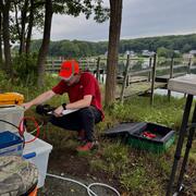
Changes in Nitrogen Contributions from Groundwater to the Niantic River Before and After Sewering

Onsite residential septic systems can be a major nonpoint source of nitrogen contamination. The excess nitrogen entering Connecticut’s Niantic River estuary is associated with high nitrate concentrations in the groundwater of the river’s 28-square-mile watershed, creating unsuitable habitat for the growth and recovery of eelgrass (Zostera marina). In an attempt to improve the river’s water quality...
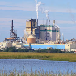
Changes in Nitrogen Contributions from Groundwater to the Niantic River Before and After Sewering

Changes in Nitrogen Contributions from Groundwater to the Niantic River Before and After Sewering

Onsite residential septic systems can be a major nonpoint source of nitrogen contamination. The excess nitrogen entering Connecticut’s Niantic River estuary is associated with high nitrate concentrations in the groundwater of the river’s 28-square-mile watershed, creating unsuitable habitat for the growth and recovery of eelgrass (Zostera marina). In an attempt to improve the river’s water quality...
Learn More

Collaborations with EPA on Contaminated Site Hydrology

The U.S. Geological Survey (USGS), in cooperation with the U.S. Environmental Protection Agency (EPA), is developing tools and methods to help assess the fate and transport of anthropogenic and geologically sourced contaminants in the water cycle at waste sites throughout the nation.
Collaborations with EPA on Contaminated Site Hydrology

Collaborations with EPA on Contaminated Site Hydrology

The U.S. Geological Survey (USGS), in cooperation with the U.S. Environmental Protection Agency (EPA), is developing tools and methods to help assess the fate and transport of anthropogenic and geologically sourced contaminants in the water cycle at waste sites throughout the nation.
Learn More

Augmented Site Characterization of PFAS Manufacturing and Processing Facilities

The U.S. Geological Survey (USGS) is supporting the U.S. Environmental Protection Agency (EPA) in assessing facilities nationwide that have historically produced per- and polyfluoroalkyl substances (PFAS) or used them in chemical manufacturing processes. In collaboration with EPA subcontractors, USGS is providing subject-matter expertise in PFAS fate and transport in the vadose zone and...
Augmented Site Characterization of PFAS Manufacturing and Processing Facilities

Augmented Site Characterization of PFAS Manufacturing and Processing Facilities

The U.S. Geological Survey (USGS) is supporting the U.S. Environmental Protection Agency (EPA) in assessing facilities nationwide that have historically produced per- and polyfluoroalkyl substances (PFAS) or used them in chemical manufacturing processes. In collaboration with EPA subcontractors, USGS is providing subject-matter expertise in PFAS fate and transport in the vadose zone and...
Learn More

Detailed Characterization of the Savage Superfund Site, New Hampshire

The U.S. Geological Survey (USGS), in cooperation with the U.S. Environmental Protection Agency and the New Hampshire Department of Environmental Services, is conducting advanced site characterization activities at the Savage Municipal Water Supply Superfund site in Milford, New Hampshire, and implementing new remediation efforts based on USGS science and tools.
Detailed Characterization of the Savage Superfund Site, New Hampshire

Detailed Characterization of the Savage Superfund Site, New Hampshire

The U.S. Geological Survey (USGS), in cooperation with the U.S. Environmental Protection Agency and the New Hampshire Department of Environmental Services, is conducting advanced site characterization activities at the Savage Municipal Water Supply Superfund site in Milford, New Hampshire, and implementing new remediation efforts based on USGS science and tools.
Learn More

The Aqueous Flow Concentration Estimator (AFCE): Software for Estimation of Ambient Groundwater Flow in Bedrock Open Boreholes

The U.S. Geological Survey (USGS) developed a tool that uses a chemical budget approach to help determine which fractures in a fracture zone may be dominating the water chemistry of open boreholes in bedrock aquifers. The tool uses a Monte Carlo approach and measured concentrations of anthropogenic contaminants to simulate many different scenarios and predict the most likely source direction of...
The Aqueous Flow Concentration Estimator (AFCE): Software for Estimation of Ambient Groundwater Flow in Bedrock Open Boreholes

The Aqueous Flow Concentration Estimator (AFCE): Software for Estimation of Ambient Groundwater Flow in Bedrock Open Boreholes

The U.S. Geological Survey (USGS) developed a tool that uses a chemical budget approach to help determine which fractures in a fracture zone may be dominating the water chemistry of open boreholes in bedrock aquifers. The tool uses a Monte Carlo approach and measured concentrations of anthropogenic contaminants to simulate many different scenarios and predict the most likely source direction of...
Learn More

USGS Assessment of Water Resources near Hanscom Air Force Base

The United States Geological Survey (USGS) New England Water Science Center is expanding its scientific investigation to better understand the water resources at, and in the vicinity of, Hanscom Air Force Base (AFB) and the potential impacts from historical base operations and other sources.
USGS Assessment of Water Resources near Hanscom Air Force Base

USGS Assessment of Water Resources near Hanscom Air Force Base

The United States Geological Survey (USGS) New England Water Science Center is expanding its scientific investigation to better understand the water resources at, and in the vicinity of, Hanscom Air Force Base (AFB) and the potential impacts from historical base operations and other sources.
Learn More

Region 1: North Atlantic-Appalachian PFAS Capability Team

Per- and polyfluoroalkyl substances (PFAS) are a group of anthropogenic emerging contaminants. Some PFAS have been voluntarily phased out, as exposure has been linked to adverse human health effects.
Region 1: North Atlantic-Appalachian PFAS Capability Team

Region 1: North Atlantic-Appalachian PFAS Capability Team

Per- and polyfluoroalkyl substances (PFAS) are a group of anthropogenic emerging contaminants. Some PFAS have been voluntarily phased out, as exposure has been linked to adverse human health effects.
Learn More

Water Quality Data Collection to Support Aluminum Criteria Development in Massachusetts

The U.S. Geological Survey (USGS) and Massachusetts Department of Environmental Protection (MassDEP) are collaborating on a study to collect water-quality data at streams and ponds in Massachusetts that receive aluminum discharges from wastewater treatment (WWTF) or public-water supply (PWS) facilities. The objective of this study is to inform the development of MassDEP guidelines on discharge...
Water Quality Data Collection to Support Aluminum Criteria Development in Massachusetts

Water Quality Data Collection to Support Aluminum Criteria Development in Massachusetts

The U.S. Geological Survey (USGS) and Massachusetts Department of Environmental Protection (MassDEP) are collaborating on a study to collect water-quality data at streams and ponds in Massachusetts that receive aluminum discharges from wastewater treatment (WWTF) or public-water supply (PWS) facilities. The objective of this study is to inform the development of MassDEP guidelines on discharge...
Learn More

Geochemical Fingerprinting of Anthropogenic and Geologically Sourced Uranium at the Homestake Superfund Site, New Mexico

The U.S. Geological Survey (USGS), in cooperation with the U.S. Environmental Protection Agency, the Nuclear Regulatory Commission, and the New Mexico Environment Department, utilized a multiparameter geochemical-isotopic fingerprinting approach to differentiate anthropogenic and natural signatures of uranium contamination near the Homestake uranium mill Superfund site near Milan, New Mexico.
Geochemical Fingerprinting of Anthropogenic and Geologically Sourced Uranium at the Homestake Superfund Site, New Mexico

Geochemical Fingerprinting of Anthropogenic and Geologically Sourced Uranium at the Homestake Superfund Site, New Mexico

The U.S. Geological Survey (USGS), in cooperation with the U.S. Environmental Protection Agency, the Nuclear Regulatory Commission, and the New Mexico Environment Department, utilized a multiparameter geochemical-isotopic fingerprinting approach to differentiate anthropogenic and natural signatures of uranium contamination near the Homestake uranium mill Superfund site near Milan, New Mexico.
Learn More

Study to Test a Novel Shallow Well Design that May Provide Contaminant-Free Water Supply to Domestic Well Users in Arsenic-Prone Parts of the United States

The USGS, the University of New Hampshire, U.S. Environmental Protection Agency, the New Hampshire Department of Environmental Services, and the Maine Geological Survey are collaborating on a study of a novel shallow well design that might be able to provide safe drinking water to domestic well users in arsenic-prone parts of the Nation.
Study to Test a Novel Shallow Well Design that May Provide Contaminant-Free Water Supply to Domestic Well Users in Arsenic-Prone Parts of the United States

Study to Test a Novel Shallow Well Design that May Provide Contaminant-Free Water Supply to Domestic Well Users in Arsenic-Prone Parts of the United States

The USGS, the University of New Hampshire, U.S. Environmental Protection Agency, the New Hampshire Department of Environmental Services, and the Maine Geological Survey are collaborating on a study of a novel shallow well design that might be able to provide safe drinking water to domestic well users in arsenic-prone parts of the Nation.
Learn More

Towards Understanding the Impact of Drought on the Arsenic Hazard for the Private Domestic Well Population in the United States

The USGS and the Centers for Disease Control and Prevention are examining the potential effects of droughts on the arsenic hazard in private well water across the Nation.
Towards Understanding the Impact of Drought on the Arsenic Hazard for the Private Domestic Well Population in the United States

Towards Understanding the Impact of Drought on the Arsenic Hazard for the Private Domestic Well Population in the United States

The USGS and the Centers for Disease Control and Prevention are examining the potential effects of droughts on the arsenic hazard in private well water across the Nation.
Learn More

SELDM: Stochastic Empirical Loading and Dilution Model - Project page

Note: SELDM is now on version 1.1.1. Please use this version for compatibility with 64-bit Microsoft Office environments.
SELDM: Stochastic Empirical Loading and Dilution Model - Project page

SELDM: Stochastic Empirical Loading and Dilution Model - Project page

Note: SELDM is now on version 1.1.1. Please use this version for compatibility with 64-bit Microsoft Office environments.
Learn More
Was this page helpful?