
New Jersey Precipitation and Weather Networks
The New Jersey Water Science Center provides valuable data augmentation to many locations for: Precipitation, Water and Air Temperature, and even Wind Speed and Direction at some of our coastal sites. Our technicians continuously make field measurements and maintain these networks to ensure the accuracy of these data.
New Jersey WSC Rain Gage Network
The New Jersey Water Science Center has developed a robust network of about 90 Rain Gages to collect precipitation data from sites across the state. This data is used in conjunction with our Streamgaging network to help with flood prediction, understanding groundwater recharge, and to gather information on coastal storms.
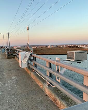
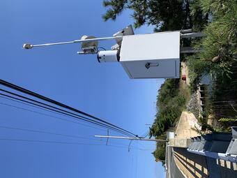
New Jersey WSC Weather Network
Weather data, air temperature, relative humidity, barometric pressure, wind speed, wind direction, and wind gust speed, are collected at many of our Tide Network sites, as well as a couple non-tide sites across the state. This meteorological data can be used by planners to help determine future water elevations, analyze local short-term weather trends, and long-term climatology studies.
Temperature Data
Many of our Streamgaging sites are equipped to provide air temperature, water temperature, or both.

The New Jersey Streamgaging Network

The New Jersey Water Quality Networks

New Jersey Tide Network

New Jersey Subbasin Paired Air & Stream Water Temperature Networks
The New Jersey Water Science Center provides valuable data augmentation to many locations for: Precipitation, Water and Air Temperature, and even Wind Speed and Direction at some of our coastal sites. Our technicians continuously make field measurements and maintain these networks to ensure the accuracy of these data.
New Jersey WSC Rain Gage Network
The New Jersey Water Science Center has developed a robust network of about 90 Rain Gages to collect precipitation data from sites across the state. This data is used in conjunction with our Streamgaging network to help with flood prediction, understanding groundwater recharge, and to gather information on coastal storms.
New Jersey WSC Weather Network
Weather data, air temperature, relative humidity, barometric pressure, wind speed, wind direction, and wind gust speed, are collected at many of our Tide Network sites, as well as a couple non-tide sites across the state. This meteorological data can be used by planners to help determine future water elevations, analyze local short-term weather trends, and long-term climatology studies.
Temperature Data
Many of our Streamgaging sites are equipped to provide air temperature, water temperature, or both.
The New Jersey Streamgaging Network
The New Jersey Water Quality Networks
New Jersey Tide Network