
Groundwater Availability
Groundwater Availability
One of the scientific strengths of the WA WSC is the sophisticated hydrologic analyses we provide to better assess water availability across Washington State, including watershed to regional-scale assessments of groundwater availability; development of computer models to simulate groundwater flow for current and potential future conditions; and compilation of detailed groundwater use data. The tools and information we produce help our partners more effectively manage and allocate groundwater and surface-water resources.
Filter Total Items: 47
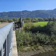
Groundwater/surface-water interaction within the South Fork Nooksack River Basin
The USGS, in partnership with the Nooksack Indian Tribe, is gathering information to better understand the connections between streams, wetlands, and groundwater in the South Fork Nooksack River Basin.

Evaluation of Groundwater Resources in the White River Watershed
The Issue: The White River/Sunrise area of Mount Rainier National Park currently uses surface water for supplying water to local visitor and operational facilities. The Park is considering instead to use groundwater supplies that would likely be more resilient and less prone to contamination, but they need a better understanding of groundwater in the upper White River watershed to assure that park...
Simulated groundwater flow paths and travel times near Joint Base Lewis–McChord, Washington
The Issue: Past activities at Joint Base Lewis–McChord (JBLM)—located in west-central Washington—resulted in releases of hazardous waste and contaminants to the environment, and the most recent chemical of concern is per- and polyfluoroalkyl substances (PFAS). PFAS can enter groundwater and travel through the subsurface. Water-resource managers need to understand where groundwater flows in order...
Improving the understanding of groundwater hydrology near the Yakima Training Center, Washington
The Issue: The Yakima Training Center (YTC) is a military training installation located in south-central Washington. Recent sampling of groundwater wells on and off the base has detected per- and polyfluoroalkyl substances (PFAS)—man-made chemicals that, in some areas, exceed State or Federal drinking-water standards. The local geology is highly complex, featuring folded and faulted bedrock...

Groundwater Model Support for Underground Injection Control Analysis, Pierce County, Washington
The Issue: In Pierce County, Washington, much of the stormwater runoff is managed by underground injection control (UIC) structures, such as dry wells, infiltration trenches, and catch basins. Stormwater is directed into UIC structures to prevent poor-quality water from entering streams. This is good for stream health because stormwater is directed away from streams and into the ground, but there...

Analysis of USGS Surface Water Monitoring Networks
The issue: National interests in water information are important but challenging to incorporate into planning and operation of a monitoring network driven by local information needs. These interests include an understanding of the spatial variability in water availability across the United States, anthro-physical factors including climate and land use that affect water availability, and federal...

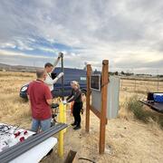
Aquifer Recharge Study and Water-Budget Components of San Juan County, Washington
The Issue: San Juan County encompasses an archipelago within the Salish Sea between the southeastern end of Vancouver Island, British Columbia and Skagit and Whatcom Counties on mainland western Washington. Although the year-round population is generally small (approximately 16,000 in 2010), there is an ever-growing influx of visitors to the scenic islands especially during the summer months. An...

Aquifer Recharge Area Study of Guemes Island
The Issue: Guemes Island is an 8.2-square-mile island in the northern part of Puget Sound in western Washington State. The population of the island is increasing, as is the demand for groundwater, which is the island's sole source of freshwater. Continued growth and development of the island, particularly in nearshore areas, has led to the increasing failure of nearshore wells due to seawater...

Assess the utility of a regional aquifer system groundwater model to inform the USGS National Hydrologic Model
The Issue: In Washington State, groundwater (GW) inflow to streams, or baseflow, is essential for maintaining aquatic habitats, and for out-of-stream uses such as irrigated agriculture during the typically dry summers. However, the National Hydrologic Model (NHM) currently is most suited to predicting total daily streamflow. This project aims to assess the NHM’s performance in simulating baseflow...

Walla Walla River Basin groundwater-flow system, Oregon-Washington
The Issue: Decades of declining groundwater levels in the Walla Walla River Basin (WWRB), which spans Oregon and Washington, are affecting instream flows for threatened and culturally important fish populations and water availability for competing interests across state lines. The public and state resource management agencies have begun implementing efforts to stabilize groundwater levels and...

Southeast Sound Groundwater Flow Model
The Issue: Groundwater is an important resource for domestic, commercial, and industrial usage in the Puyallup River and Chambers-Clover Creek Watersheds, and groundwater discharge helps maintain late-summer and early-fall streamflow (baseflow) in many area streams. Consequently, as the population grows, and commercial and industrial activity increase, so does the demand for groundwater. However...

Puget Sound Groundwater Low Flows Near Term Action Project
The Issue: Groundwater discharge to streams and rivers in the Puget Sound basin is the primary source of water for sustaining summer low flows. A robust understanding of how anthropogenic and natural stressors affect summer low flows across the entire Puget Sound Regional Aquifer System is lacking, and USGS has tools and data—including current water-use data and subbasin-scale groundwater models...