
May 2018 Landsat Level-1 Metadata Changes
Back to Landsat Updates
Over the last twelve months the USGS has been working on streamlining and consolidating Landsat Level-1 metadata fields across all sensors in the Landsat archive. This consolidation effort will ensure consistency for already-archived data, while preparing the archive for the next generation of Landsat missions, starting with the launch of Landsat 9 in December 2020.
During the week of May 14, 2018, the USGS will finalize this consolidation effort.
Beginning Monday, May 14, 2018, access to Landsat Collection 1 Level-1 and Level-2 datasets will be intermittently available from all USGS data portals. Landsat 8 and Landsat 7 Collection 1 Level-1 datasets will be fully available on EarthExplorer (EE) by the end of Monday, with Landsat 4-5 TM and Landsat 1-5 MSS becoming available on Tuesday, May 15. The ordering and processing of Landsat Collection 1 Level-2 on-demand datasets will also resume on Tuesday, May 15.
After this effort, methods used to access and download Landsat Level-1 products will not change, although some metadata fields will be impacted by this update — including the visible metadata on EE, the metadata downloadable exports from EE, and the metadata downloaded from the Landsat Missions Web Site bulk metadata service. The following tables display and describe these changes.
NOTE: The Metadata file (MTL.txt) delivered with the Landsat Level-1 products will not be changing.
Landsat Level-1 Metadata Field Changes
The following visible metadata fields have been changed:

Landsat Level-1 Metadata Field Removals
Several fields have been removed from the metadata available through the EE full metadata display and metadata exports, because they are no longer applicable, such as the fields listed in the table below

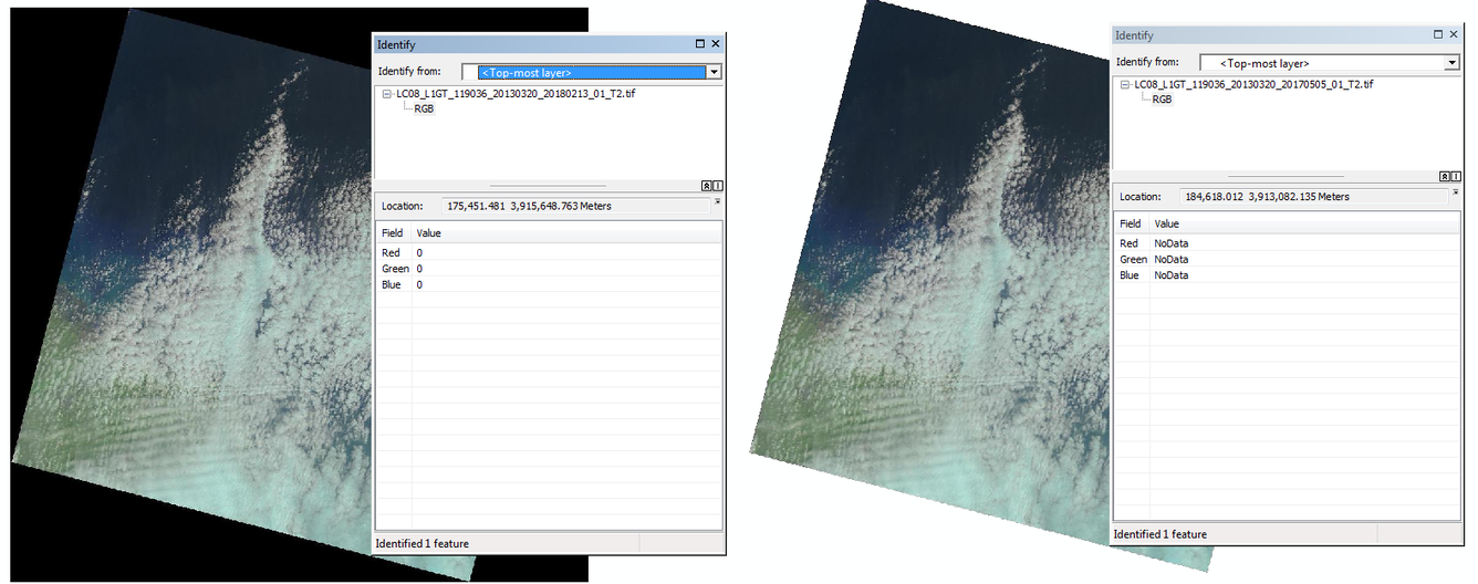
Landsat Full-Resolution Browse Changes
In the Level-1 Full-Resolution Browse, Landsat 1-7 previously used RGB 0,0,0 to represent the fill areas of the image. Going forward, the fill will use NoData (see the images below):
Note: Any use of trade, firm, or product names is for descriptive purposes only and does not imply endorsement by the U.S. Government.