



Landsat Science Team: Tracking Snow Crucial in Water Supply Monitoring
Edward "Ned" Bair, a member of the 2026-2030 Landsat Science Team hopes the mission's newest satellite can provide groundbreaking insight.
Snow remains a difficult target for remote sensing
Brightness, challenging terrain, ever-changing nature and depth are just some of the challenges posed by snow.
Snow, covering more than one-third of the Earth’s land surface seasonally, is a crucial water source for more than 1.2 billon people across the globe.
As significant as it is to the world’s water supply, snow is also one of the most difficult elements to monitor with remote sensing due to its brightness, challenging terrain, ever-changing nature and depth, along with cloud cover and topography.
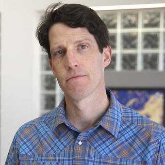
One member of the 2026-2030 Landsat Science Team, Edward (Ned) Bair, is hoping to improve Landsat’s ability to track snow to better inform water managers.
“They depend on snow cover products and need Landsat to do things like proper snow cloud discrimination. The surface reflectance that goes into the snow cover products is very important. All of this leads to actionable water management decisions—from large to small operations,” said Bair, a scientist at Leidos and researcher with the University of California, Santa Barbara (UCSB).
While Landsat has been the gold standard for remote sensing over the past five decades, there’s a pressing need for better snow tracking, Bair said. A 2018 Decadal Survey, by the National Academies of Sciences, Engineering and Medicine said tracking snow accumulation, melt and sublimation was one of the most important priorities.
So, Bair hopes that when Landsat 10 launches, no earlier than 2031, with 26 spectral bands, including new bands designed for snow and ice observation, it will improve the remote sensing community’s ability to track snow.
“The legacy of Landsat, at 54 years, is an incredible legacy, and I’d like to see it continue for another 54 years. The USGS is in charge of monitoring the nation’s water resources, and snow is an important part of that, in the western United States especially,” Bair said. “I want to do my best to make sure those observations continue. I’ve been especially impressed with USGS’ outreach for new approaches and innovations.”
A new approach and validation site
This is Bair’s first term on the Landsat Science Team, but he is no stranger to working on science teams, including the NASA MODIS-VIIRS Science Team. He hopes that experience can pay dividends when it comes to his time on the Landsat Science Team.
“I’ve also worked with NOAA and various other government agencies, so I have a pretty good idea from these science teams about how this process goes, and what motivates people to be here. I’m looking forward to making that contribution here,” Bair said.
To do that, Bair will contribute work he’s used throughout his career, including the Snow Property Inversion for Remote Sensing (SPIReS), an open-source validated approach to snow mapping. SPIReS estimates snow grain size and concentrations of light absorbing particles, providing information about snow pollution and its effects on water supplies and the environment.
“The user community needs reliable snow observations,” Bair said.
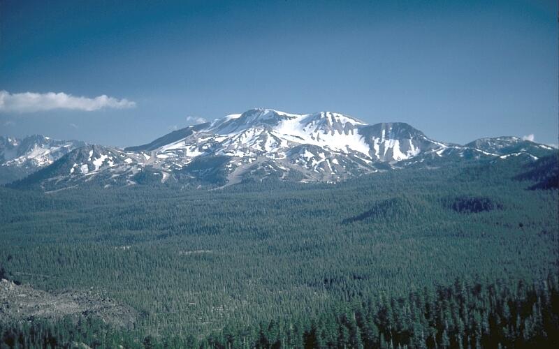
His proposal also calls for a designated snow ground validation site for Landsat on Mammoth Mountain in California. The site, formerly called the Cold Regions Research and Engineering Laboratory and UCSB Energy Site (CUES), and now named The Jeff Dozier Snow Study Site, is situated at 9,633 feet. According to Bair, it is “the most advanced snow energy balance site in the world.”
“The inclusion of [The Jeff Dozier Snow Study Site] as a designated long-term ground-validation site will enable Landsat snow products to be systematically evaluated in a more complex environment,” Bair wrote in a proposal for funding.
The Jeff Dozier Snow Study Site has hosted snow measurements relevant to remote sensing since the 1970s. It has a deep and persistent snowpack from November to March, subject to light absorbing particle pollution. The site aims to advance the utility of Landsat products for snow hydrology, water resources and global climate applications.
Bair’s goals on the Landsat Science Team include the operationalizing the SPIReS algorithm and having the Jeff Dozier Snow Study Site remain as the leading energy balance site for remote sensing and validation.
“With Landsat particularly, there are a lot of tricky things including bright targets, and snow is the brightest natural substance,” Bair said. “I would like to see, of course, a successful launch and a continuation of the Landsat program beyond, and I’m honored to be a part of that.”