



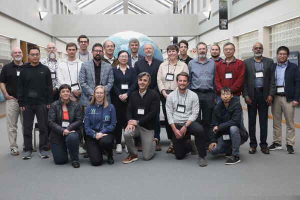
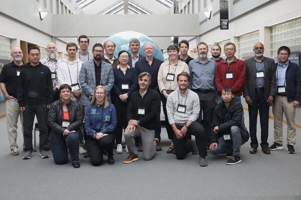
The 2026-2030 Landsat Science Team met for their first in-person meeting May 5-7, 2026 at the USGS EROS Center.
By Landsat Missions
October 20, 2026
Landsat 10 promises improved scientific discovery and innovation with better imaging capabilities for the next generation of Earth observation, continuing the 54-year legacy of the remote sensing program.
The newest satellite, with 26 spectral bands and enhanced resolution, is planned to launch in 2031.
Media
Sources/Usage: Public Domain. View Media Details
Involved in advancing these efforts is the Landsat Science Team, which acts in an advisory role and provides scientific and technical evaluations to help ensure the continued success of the program, which operates as a partnership between the U.S. Geological Survey and NASA. The 2026-2030 Landsat Science Team is made up of experts from universities, private industries and federal and international agencies.
The new team will provide collective analysis and advice on priority issues including atmospheric correction and calibration, interoperability and data processing, agriculture, vegetation and land surface processes, snow and aquatic systems, wildland fires, volcanoes and geothermal systems, science applications and data user engagements.
Several members of the 2026-2030 Landsat Science Team have shared perspectives in the Q&A below and in separate articles on Landsat's impact, their related projects and their vision for the future of remote sensing.
Some responses have been slightly edited and condensed for clarity.
Yun Yang: Agricultural Water Use
Yun Yang: Agricultural Water Use
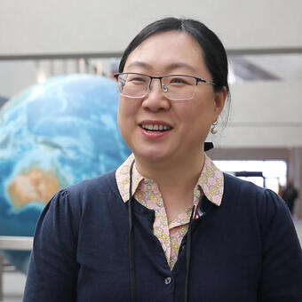
Yun Yang, an assistant professor at Cornell University and member of the OpenET consortium and nonprofit board, works to improve monitoring of plant water use, including enhancing the estimation of evapotranspiration (ET), for farmers and water managers.
Media
Sources/Usage: Public Domain. View Media Details
Q: What inspired you to join the Landsat Science Team?
A: I use Landsat extensively in my research. Landsat is the gold standard for us because it provides the land surface temperature and also the vegetation indexes that we need for ET modeling. So when this opportunity came up, I really wanted to contribute to the Landsat community and help shape the design of future Landsat missions.
Q: With more urgency worldwide to use water wisely, how will your work with albedo and ET help society?
A: This is a really interesting time and also a really urgent time because of increasing water stress. I’m so glad that our work, which looks at plant water use at the field scale using Landsat as a primary input, can provide critical water use information for farmers and stakeholders. They can see how much water has been used from individual fields. They can use this ET information to help determine when to start irrigation, how much to irrigate, and whether there’s any stress signal from their fields.
Albedo is also an important part of this work because it tells us how much sunlight is reflected by the land surface and how much energy is absorbed and potentially available for ET. Together with land surface temperature and vegetation information, it helps us better understand the surface energy balance and improve our estimates of ET.
Q: How does your experience with OpenET help frame your work on the Landsat Science Team and vice versa?
A: Through my work with OpenET, I’ve had many opportunities to interact directly with end users and stakeholders, to really understand what they want and what they need, and to learn how we can better support them. Bringing all of that information back to the Landsat Science Team, I think, can help us to better design satellite products to serve our users. At the same time, what I learn from the Landsat Science Team can help us further improve our algorithms to enhance the data quality and ultimately provide better information to our end users.
Philip Dennison and Mickey Campbell: Non-photosynthetic vegetation
Philip Dennison and Mickey Campbell: Non-photosynthetic vegetation
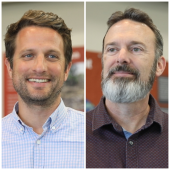
Philip Dennison is a professor in the School of Environment, Society and Sustainability at the University of Utah, and co-principal investigator Michael “Mickey” Campbell is a research assistant professor.
Media
Sources/Usage: Public Domain. View Media Details
Q: What inspired you both to join the Landsat Science Team?
Dennison: Landsat has been a formative part of my experience as a remote sensing scientist, since I started working with Landsat data as a student. The program has a more than 50-year legacy, and I want to contribute to that, help the community, and make sure it’s successful going into the future.
Campbell: Like many in the remote sensing world, I’ve been using Landsat pretty much since day one. For folks like me, who work in the realm of forests and fires, tracking changes over space and time, there’s no better source of long-term, consistent monitoring data than Landsat. To have the opportunity to contribute to this really awesome program is super exciting.
Q: What are a couple of examples of how your proposal and the use of NPV that seem especially valuable to data users and society?
Campbell: Non-photosynthetic vegetation includes things like dead leaves on a tree, making it a very useful proxy for tree mortality. In many regions, including the western United States, tree mortality has been on the rise in recent years due to insect attacks, drought, disease and increased fire activity. At present, we don’t have a robust solution for precisely tracking mortality; Landsat 10’s new NPV mapping capability will provide an unprecedented opportunity to do so.
Dennison: Another area where NPV mapping can help is monitoring fire danger. When vegetation dries out and becomes brown, it becomes more susceptible to fire. With Landsat 10, we’ll be able to monitor where the land is drying out faster, and where fire danger is increasing due to vegetation changes.
Q: What would a successful term on the Landsat Science Team look like to both of you?
Campbell: It would be one that continues to build robust decision support for the wildland fire, forest management and forest ecology communities.
Dennison: I’m really excited about seeing the full cycle of development and understanding how we can best enable the public benefits coming from these new Landsat 10 bands.
Ryan O’Shea: Harmful Algal Blooms
Ryan O’Shea: Harmful Algal Blooms
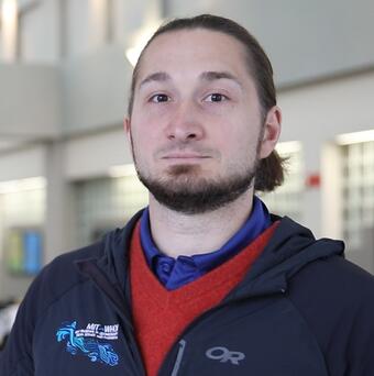
Ryan O’Shea, a lead research scientist at Science Systems and Applications Inc., will work to harmonize inland and coastal water quality monitoring, including monitoring harmful algal blooms, from the Landsat Program including to monitor harmful algal blooms.
Media
Sources/Usage: Public Domain. View Media Details
Q: You’ve worked on Landsat Science Team projects before, but what inspired you to join as a principal investigator, and how will it be different from your previous experience as a contributor on the 2018-2023 team?
A: As part of the team previously, I saw the algorithms that we were developing were doing really well at monitoring these fine spatial scales and I wanted to see that work continue and was super excited about Landsat 10’s capabilities. We’re going to be able to get down to 20-meter scales so we can monitor harmful algal blooms at really fine scales and help monitor small inland water bodies as well as tributaries. So, I joined for the societal benefit.
Q: How will your planned improvements to Landsat help water quality managers take action to benefit society?
A: There are a few different themes in our proposal, one of which is gathering a wider dataset that represents regions that aren’t in our current training dataset. Most of our current data come from North America and Europe currently, so we’re trying to reach out to other continents, including South America. We’re also making a push to add more detailed information by developing algorithms in advance of the Landsat 10 launch to get more specific information on whether there’s cyanobacteria in water bodies and improve sensor harmonization by using similar retrieval algorithms from Landsat and Sentinel (European satellites), which will allow water quality managers to have consistent observations they can work with.
Q: What would a successful term on the Landsat Science Team look like for you?
A: Big picture, I’m hoping to advocate for aquatic applications with design decisions that help support aquatic end-users and improve stakeholder use of our online web platforms so they can take it and integrate it with their decision-making capabilities to better direct their limited resources.
Ned Bair: Snow Cover Mapping and Ground Validation Site
Ned Bair: Snow Cover Mapping and Ground Validation Site
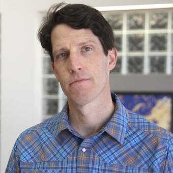
Edward “Ned” Bair is the chief scientist and portfolio manager for the Earth Intelligence Group at Leidos and a researcher with the University of California, Santa Barbara. Bair leads a group that works on a wide range of research and operational topics including geospatial intelligence, remote sensing, numerical weather prediction, cold regions mobility and energy analysis.
Media
Sources/Usage: Public Domain. View Media Details
Q: What inspired you to apply for the Landsat Science Team?
A: The legacy of Landsat, 54 years, is an incredible legacy, and I’d like to see it continue for another 54 years. The USGS is in charge of monitoring the nation’s water resources, and snow is an important part of that, especially in the western United States. I want to do my best to make sure those observations continue.
Q: How important has Landsat been so far in contributing to the knowledge of snow cover?
A: Landsat with its history has been incredibly valuable. My adviser, Jeff Dozier, wrote a paper in 1989 on the spectral signature of alpine snow from the Landsat Thematic Mapper (a sensor? carried by Landsat 4 and 5), where we learned a lot about snow; things like cloud snow discrimination, grain size retrievals. … It really paved the way for our modern snow observations, and Landsat, with that high resolution and continuous record, has been valuable, particularly in steep topography.
Q: What are your goals in improving the fractional snow area method and establishing a new snow cover validation site on Mammoth Mountain in California?
A: The user community really needs reliable snow observations, and there’s a lot that goes into processing that data. All of this leads to actionable decisions from small to large water management operations. Water managers depend on these snow cover products, and they need Landsat to do things like proper cloud-snow discrimination, the surface reflectance that goes into the snow cover product.
Related
Landsat Science Team
Led by USGS and NASA Landsat Project Scientists, Landsat Science Teams consist of USGS and NASA scientists and engineers, external scientists, engineers, and application specialists, representing industry and university research initiatives. The Science Teams are tasked with providing scientific and technical evaluations to the USGS and NASA to ensure the continued success of the Landsat program.

Eyes on Earth Episode 95 – EROS 50th: Landsat Science Team
Landsat Science Teams have advocated for the best data possible for the wide variety of remote sensing users around the world.
2026-2030 Landsat Science Team
The 2026-2030 Landsat Science Team met for their first in-person meeting May 5-7, 2026 at the USGS EROS Center.

Eyes on Earth Episode 95 – EROS 50th: Landsat Science Team
Eyes on Earth Episode 95 – EROS 50th: Landsat Science TeamThe members of the five-year Landsat Science Teams, led jointly by the USGS and NASA with a strong tie to EROS, have brought a wide breadth of expertise, backgrounds and geographic locations to the table.

New Landsat Science Team Announced New Landsat Science Team Announced
The U.S. Geological Survey, in cooperation with NASA, has named the new Landsat Science Team that will support the world’s longest-running Earth observation mission for a planned 2026-2030 term.
Related
Landsat Science Team
Led by USGS and NASA Landsat Project Scientists, Landsat Science Teams consist of USGS and NASA scientists and engineers, external scientists, engineers, and application specialists, representing industry and university research initiatives. The Science Teams are tasked with providing scientific and technical evaluations to the USGS and NASA to ensure the continued success of the Landsat program.
Eyes on Earth Episode 95 – EROS 50th: Landsat Science Team
Landsat Science Teams have advocated for the best data possible for the wide variety of remote sensing users around the world.
2026-2030 Landsat Science Team
The 2026-2030 Landsat Science Team met for their first in-person meeting May 5-7, 2026 at the USGS EROS Center.
The 2026-2030 Landsat Science Team met for their first in-person meeting May 5-7, 2026 at the USGS EROS Center.
Eyes on Earth Episode 95 – EROS 50th: Landsat Science Team
Eyes on Earth Episode 95 – EROS 50th: Landsat Science TeamThe members of the five-year Landsat Science Teams, led jointly by the USGS and NASA with a strong tie to EROS, have brought a wide breadth of expertise, backgrounds and geographic locations to the table.
New Landsat Science Team Announced New Landsat Science Team Announced
The U.S. Geological Survey, in cooperation with NASA, has named the new Landsat Science Team that will support the world’s longest-running Earth observation mission for a planned 2026-2030 term.