
Latest in Landsat May 2025 - Vol. 4 | Issue 4
America's Satellite Sees the Clear Picture
St. Clair River wetlands support critical habitat in this fishing destination
Landsat at Work: A Path to Better Wireless Communication

Landsat’s mission isn’t communications, but its data is helping shape the networks we rely on every day.
Imagine the task of designing clear paths for a wireless communication system, large or small. It could be permanent with towers and antennas, or it could be temporary with a mobile command unit and handheld receivers. Of course, you would take into account the elevation of the land to make sure a hill in between wouldn’t interrupt the radio frequency signal.
Then imagine going to the expense of setting up two towers and feeling stumped when your signal between them is weak anyway. As it turns out, that hill in between is actually lined with trees 150 feet tall—a height within the signal path.
Failing to account for obstacles like trees and buildings and other materials on the land—collectively called “clutter”—could be an expensive error to correct. It could even be hazardous if first responders are relying on the signals during a remote wildfire or a natural disaster that disrupts other forms of communication.
Read more about one company's use of Landsat-derived products to help clear the clutter: Landsat at Work: A Path to Better Wireless Communication.
Embracing Artificial Intelligence to Advance USGS Science
Artificial Intelligence (AI) technology continues to enhance how work and processes are done in all areas of our lives. At the USGS Earth Observation and Science (EROS) Center, it is transforming how new products are created to advance the mission of Earth observation science. Most recently, AI innovations allowed scientists to create the Annual National Land Cover Dataset (NLCD). AI makes it possible to refresh land use information quicker - this allows for dataset updates each year - a striking improvement from previous 5-year cycles.
As the advances in AI expand, USGS EROS will strive to employ the technology where possible to improve the timing and quality of the remotely sensed data stored in the USGS EROS archive.
Below, catch up with recent articles and podcasts that dig into the potential that AI has to make remote sensing information even more robust. Read on to learn more!
-

AI Improving USGS Science and Efficiency AI Improving USGS Science and Efficiency
Over 50 years ago, the first Landsat archive satellite imagery arrived at the U.S. Geological Survey (USGS) Earth Resources Observation and Science (EROS) Center on rolls of film flown in from the East Coast, marking a significant milestone in the new era of Earth observation. Since then, technology has significantly advanced, transforming the data and science at EROS.
Eyes on Earth Episode 132 – Moving Forward with AI at EROS
Artificial intelligence (AI) is helping to make the science work at EROS better and more efficient, as we continue to develop valuable data products.
Eyes on Earth Episode 131 – Using AI in Geospatial Work
Artificial intelligence (AI) is helping to make EROS data products better and more efficient.
Other Interesting News
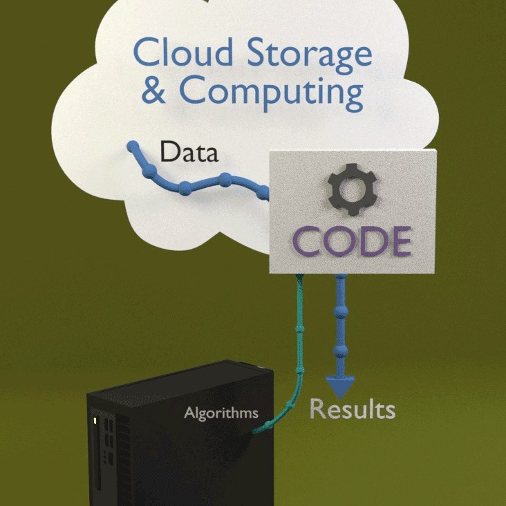
Webinar Introduces Landsat Data "in the Cloud"
In April, 170 virtual attendees tuned in to learn best practices when working with Landsat data in the commercial cloud environment.
Accessing Landsat data in the cloud allows you to process only the data you need without downloading the entire scene. Whether it’s a single pixel or a larger area of interest, working in the cloud saves time, reduces storage needs, and helps you complete your task faster and more effectively.
A recording of the "Introduction to Landsat Data Access and Processing in the Cloud" will be available soon; in the meantime, visit the Landsat Commercial Cloud Data Access webpage to learn more about cloud access.

Landsat MSS products with inaccurate brightness values to be reprocessed
The USGS/NASA Calibration/Validation Team has recently discovered that over 44,000 Landsat 2 and Landsat 3 Multispectral Sensor (MSS) Level-1 products were processed in 2020 with a calibration parameter file (CPF) that contained incorrect gain/offset values.
The incorrect values cause a slightly noticeable difference in the brightness (known as the digital number - DN) values of the pixels within an affected product—Band 4 and Band 5, specifically. The band data display higher or lower DN values than they should, resulting from the coefficient applied during Level-1 processing.
Visit this Landsat Missions News page to learn more about the plans for these products.

See the USA from Landsat's Point of View!
Every state in the United States uses Landsat data in different ways. City, state, and Federal agencies, land managers, and scientists use satellite data to help manage and monitor land surfaces and bodies of water. It is especially useful in industries such as agriculture, mineral mining, wildland fire prevention, water monitoring, and many more.
When you access Landsat's View of the USA, you can learn more about each state by:
- Downloading a satellite image
- Putting together an online puzzle
- Reading a USGS Fact Sheet that contains information about the benefits of Landsat
Flooding in Australia's Lake Eyre Basin
Landsat satellites capture dramatic imagery
Do you have questions about Landsat? Check these out!
-

Landsat Frequently Asked Questions Landsat Frequently Asked Questions
This page lists commonly asked questions pertaining to the Landsat satellite missions, the science behind maintaining high quality Landsat data, and what products are available - and how to download them.
Connect Connect
Explore the Landsat social media channels, discover the latest news and resources, and find answers to your questions about Landsat Missions, science products, and data access. We are here to help you stay informed!
Keep up to date with Latest in Landsat!
Direct to your inbox, Landsat's monthly newsletter features current news, uses, tools, and announcements about America's Earth-observing satellite program.
The Landsat Program is a joint effort of the U.S. Geological Survey (USGS) and the National Aeronautics and Space Administration (NASA). This partnership creates the unprecedented, continuous record of changes to the Earth's surface worldwide.