
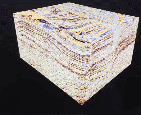
3D seismic profile animation
Detailed Description
A 3D animation of seismic reflection data takes viewers through the layers of a chunk of Earth below the seafloor. Different colors represent different layers of sediment and rock.
Sources/Usage
Public Domain.
Related

Coastal and Marine Geohazards of the U.S. West Coast and Alaska
Coastal and marine geohazards are sudden and extreme events beneath the ocean that threaten coastal populations. These underwater hazards include earthquakes, volcanic eruptions, landslides, and tsunamis. The tectonically active west coast of the Americas is prone to such hazards, as it lies along the boundaries of major tectonic plates that make up the Earth's crust—the North American, Caribbean...
Related
Coastal and Marine Geohazards of the U.S. West Coast and Alaska
Coastal and marine geohazards are sudden and extreme events beneath the ocean that threaten coastal populations. These underwater hazards include earthquakes, volcanic eruptions, landslides, and tsunamis. The tectonically active west coast of the Americas is prone to such hazards, as it lies along the boundaries of major tectonic plates that make up the Earth's crust—the North American, Caribbean...