
Landsat 7 First Light Image of Eastern South Dakota
Detailed Description
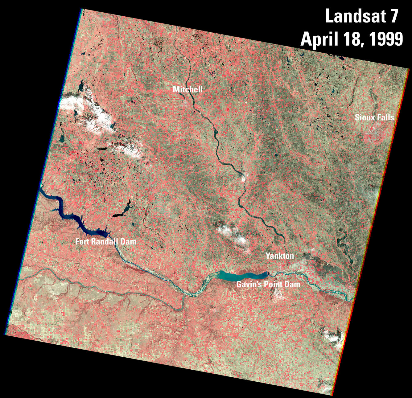
This color infrared image of Southeast South Dakota and Northeast Nebraska was advertised as the first image acquired by Landsat 7's Enhanced Thematic Mapper Plus (ETM+) sensor on April 18, 1999.
The Missouri River, flowing in from the left edge of the image, is stopped by both the Fort Randall Dam, then further downstream, the Gavin’s Point Dam near Yankton. The river defines the South Dakota and Nebraska State lines, from south of Fort Randall Dam to the extreme southeastern tip of South Dakota that is beyond this image.
The James River flows from the top center of the image and flows southeast to meet up with the Missouri River east of Yankton.
Sources/Usage
Public Domain.
Related

First Landsat 7 image of Sioux Falls, South Dakota
This pan sharpened color infrared image of Sioux Falls, South Dakota is from the first scene acquired by Landsat 7's Enhanced Thematic Mapper Plus (ETM+) sensor on April 18, 1999. The image is shown using the near infrared, red, and green bands (Bands 4,3,2). This band combination is useful for analyzing vegetation because chlorophyll reflects near infrared light and appears as red in this image...
Related
First Landsat 7 image of Sioux Falls, South Dakota
This pan sharpened color infrared image of Sioux Falls, South Dakota is from the first scene acquired by Landsat 7's Enhanced Thematic Mapper Plus (ETM+) sensor on April 18, 1999. The image is shown using the near infrared, red, and green bands (Bands 4,3,2). This band combination is useful for analyzing vegetation because chlorophyll reflects near infrared light and appears as red in this image...