U.S. flag

An official website of the United States government

All Multimedia

Access all multimedia to include images, video, audio, webcams, before-after imagery, and more. Filter and explore with filtering options to refine search. 

Filter Total Items: 24981
Two men walk along a path near one building towards another building with trees and a grassy lawn.
Building 1 and Credit Union on USGS Menlo Park campus

Building 1 formerly housed many different USGS groups, including the Western Coastal and Marine Geology team, but slowly has been leased out to other federal agencies like the Transportation Security Administration (TSA) and Veterans Affairs (VA). At the right is the Menlo Survey Federal Credit Union.

Building 1 formerly housed many different USGS groups, including the Western Coastal and Marine Geology team, but slowly has been leased out to other federal agencies like the Transportation Security Administration (TSA) and Veterans Affairs (VA). At the right is the Menlo Survey Federal Credit Union.

image related to volcanoes. See description
This photo looks north along the broad Fissure 8 channel. At its widest section

This photo looks north along the broad Fissure 8 channel. At its widest section, the Fissure 8 channel is about 430 meters (1400 feet wide). In the upper right section of the photo, Highway 132 can be seen cutting through the braided section of the channel. USGS photo by M. Zoeller.

This photo looks north along the broad Fissure 8 channel. At its widest section, the Fissure 8 channel is about 430 meters (1400 feet wide). In the upper right section of the photo, Highway 132 can be seen cutting through the braided section of the channel. USGS photo by M. Zoeller.

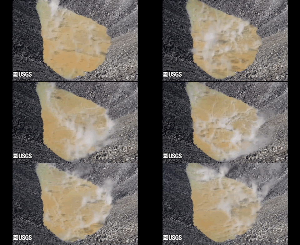
Timelapse video of the water pond at Kīlauea summit

This timelapse sequence shows two hours of activity at the water pond in Halema‘uma‘u, at Kīlauea's summit. Flow is evident along the sharp orange color boundary in the center of the pond, as well as along portions of the shoreline. The pond is 189 m (650 ft) long. The vido was taken on the eastern rim.

This timelapse sequence shows two hours of activity at the water pond in Halema‘uma‘u, at Kīlauea's summit. Flow is evident along the sharp orange color boundary in the center of the pond, as well as along portions of the shoreline. The pond is 189 m (650 ft) long. The vido was taken on the eastern rim.

Photograph of a building in the distance with a flagpole in front of it, trees, cars parked, and grassy lawn in the foreground.
USGS Menlo Park campus

Building 3 on the USGS Western Region campus in Menlo Park, California.

Building 3 on the USGS Western Region campus in Menlo Park, California.

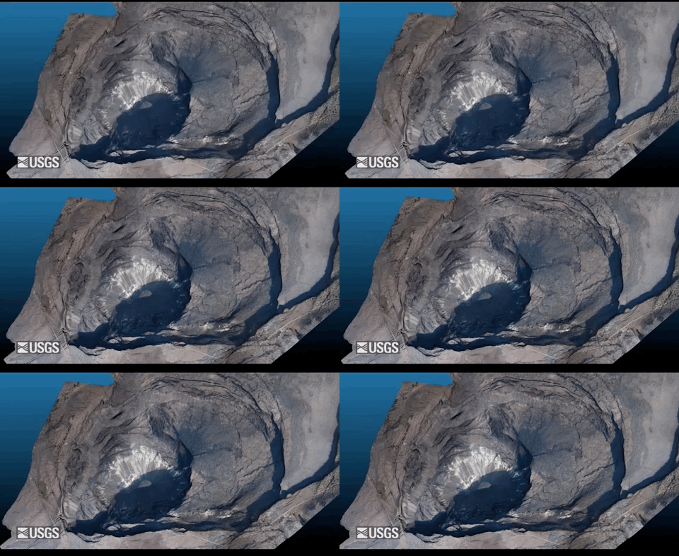
Virtual flyover of Kīlauea summit

An overflight on December 18 provided aerial photographs of Kīlauea caldera, which were used to construct a 3D model. The water pond is visible in the deepest portion of Halema‘uma‘u crater. For scale, the water pond is 189 m (650 ft) long and approximately 600 m (1970 ft) below the western caldera rim.

An overflight on December 18 provided aerial photographs of Kīlauea caldera, which were used to construct a 3D model. The water pond is visible in the deepest portion of Halema‘uma‘u crater. For scale, the water pond is 189 m (650 ft) long and approximately 600 m (1970 ft) below the western caldera rim.

image related to volcanoes. See description
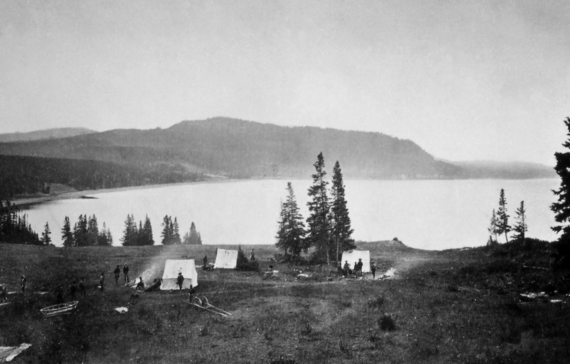
"Earthquake camp" of the Hayden expedition in 1871, located on the north shore o

"Earthquake camp" of the Hayden expedition in 1871, located on the north shore of Yellowstone Lake near Steamboat Point. Photo by William H. Jackson, courtesy Yellowstone National Park (https://www.nps.gov/features/yell/slidefile/history/jacksonphotos/Image…).

Dan Dzurisin conducting a leveling survey at Newberry Volcano
Dan Dzurisin
Dan Dzurisin
Dan Dzurisin

Dan Dzurisin, of the Cascades Volcano Observatory, conducting a leveling survey at Newberry Volcano, Oregon, in 2002.

Dan Dzurisin, of the Cascades Volcano Observatory, conducting a leveling survey at Newberry Volcano, Oregon, in 2002.

Image of the Week - Festive Fields in North Carolina

The smell of a fresh cut Christmas tree can evoke visions of majestic evergreen forests teeming with winter wildlife. In truth, more than half of U.S. Christmas trees come from farms in Oregon, North Carolina, or Michigan. Cut Christmas Trees area commodity, tracked by the U.S. Department of Agriculture just like corn or soybeans.

The smell of a fresh cut Christmas tree can evoke visions of majestic evergreen forests teeming with winter wildlife. In truth, more than half of U.S. Christmas trees come from farms in Oregon, North Carolina, or Michigan. Cut Christmas Trees area commodity, tracked by the U.S. Department of Agriculture just like corn or soybeans.

Lake Ontario
Lake Ontario
Lake Ontario
Lake Ontario

Lake Ontario view from the Queens Royal Park, Ontario, Canada

Lake Ontario view from the Queens Royal Park, Ontario, Canada

image related to volcanoes. See description
Earthquake hazard map showing peak ground accelerations having a 2 percent proba

Earthquake hazard map showing peak ground accelerations having a 2 percent probability of being exceeded in 50 years, for a firm rock site. Black box outlines Yellowstone region. The map is based on the most recent USGS models for the conterminous U.S. (2018), Hawaii (1998), and Alaska (2007).

Earthquake hazard map showing peak ground accelerations having a 2 percent probability of being exceeded in 50 years, for a firm rock site. Black box outlines Yellowstone region. The map is based on the most recent USGS models for the conterminous U.S. (2018), Hawaii (1998), and Alaska (2007).

Lung tissue from a Gyrfalcon
Lung from a captive, adult male, 930-g Gyrfalcon, found dead in WA

Lung from a captive, adult male, 930-g Gyrfalcon, found dead in Washington, USA.  Lung shows diffuse severe congestion and edema.  

image related to volcanoes. See description
Yellowstone earthquakes that occurred during 2010-2019. Blue symbols indicate e

Yellowstone earthquakes that occurred during 2010-2019. Blue symbols indicate events that occurred as part of swarms, while red indicates non-swarm seismicity. Map courtesy of the University of Utah Seismograph Stations.

Yellowstone earthquakes that occurred during 2010-2019. Blue symbols indicate events that occurred as part of swarms, while red indicates non-swarm seismicity. Map courtesy of the University of Utah Seismograph Stations.

Color photomosaic of Kīlauea volcano summit
December 18, 2019 aerial map of Kīlauea summit

The December 18, 2019, overflight provided updated aerial photographs of Kīlauea summit, covering the caldera floor and showing the current size of the water pond in Halema‘uma‘u crater.

The December 18, 2019, overflight provided updated aerial photographs of Kīlauea summit, covering the caldera floor and showing the current size of the water pond in Halema‘uma‘u crater.

Black and white thermal image of Kilauea summit
December 18, 2019 thermal image of Kīlauea summit

The December 18 overflight provided updated thermal images of Kīlauea summit, covering the caldera floor and showing the warm surface of the water pond in Halema‘uma‘u crater. A band of warm temperatures persists along the new cliff formed during the 2018 subsidence.

The December 18 overflight provided updated thermal images of Kīlauea summit, covering the caldera floor and showing the warm surface of the water pond in Halema‘uma‘u crater. A band of warm temperatures persists along the new cliff formed during the 2018 subsidence.

Color photograph of volcanic crater lake
Halema‘uma‘u water lake at the summit of Kīlauea Volcano

The growing lake of groundwater within Halema‘uma‘u at the summit of Kīlauea Volcano as it looked on December 18, 2019. 

​​​​​​​New hydrotechs gage inspection via boat

Photo Contest Winner | Dec. 2019 | Honorable Mention
New hydrotechs, Taylor and Autumn, gage inspection via boat

close up of image
(beetle), Back, Judelot Farm, Maryland

Unknown Beetle. Found on Andelot Farms in Kent County. I am not sure what genus this is. Seems like Acmaeodera, but it doesn't match and of the region's species I know. Captured in June. Photographed by Brooke Alexander.

Unknown Beetle. Found on Andelot Farms in Kent County. I am not sure what genus this is. Seems like Acmaeodera, but it doesn't match and of the region's species I know. Captured in June. Photographed by Brooke Alexander.

Was this page helpful?