U.S. flag

An official website of the United States government

Images

Volcano Hazard Program images.

Filter Total Items: 6279
Subtle folds are common on the lake surface, suggesting that the cr...

Subtle folds are common on the lake surface, suggesting that the crust on the lake surface is thin and flexible. In addition, small "blisters" cover large portions of the lake surface. HVO geologists have seen these blisters form, and they appear to be small bubbles that rise and push up the thin crust, without breaking it.

Subtle folds are common on the lake surface, suggesting that the crust on the lake surface is thin and flexible. In addition, small "blisters" cover large portions of the lake surface. HVO geologists have seen these blisters form, and they appear to be small bubbles that rise and push up the thin crust, without breaking it.

A clearer picture of the folding on the lake surface, which resembl...

A clearer picture of the folding on the lake surface, which resemble folds in a piece of thin fabric. The field of view in this photo is roughly 50 meters (yards) wide.

A view of the northern Overlook crater wall, through passing fume. ...
northern Overlook crater wall, through passing fume. The lake surf...

A view of the northern Overlook crater wall, through passing fume. The lake surface (lower left in photo) was about 22 meters (72 feet) below the crater rim (upper right in photo). The uppermost section of the crater wall is formed by stacks of thin overflows from mid-2015.

A view of the northern Overlook crater wall, through passing fume. The lake surface (lower left in photo) was about 22 meters (72 feet) below the crater rim (upper right in photo). The uppermost section of the crater wall is formed by stacks of thin overflows from mid-2015.

Tracking the latest moves of Kīlauea and Mauna Loa...
Tracking the latest moves of Kīlauea and Mauna Loa

Interferometric Synthetic Aperture Radar (InSAR) images of Kīlauea (left) and Mauna Loa (right) spanning the past several years. Concentric patterns of colored fringes indicate magma accumulation centered near the summit calderas of both volcanoes.

Interferometric Synthetic Aperture Radar (InSAR) images of Kīlauea (left) and Mauna Loa (right) spanning the past several years. Concentric patterns of colored fringes indicate magma accumulation centered near the summit calderas of both volcanoes.

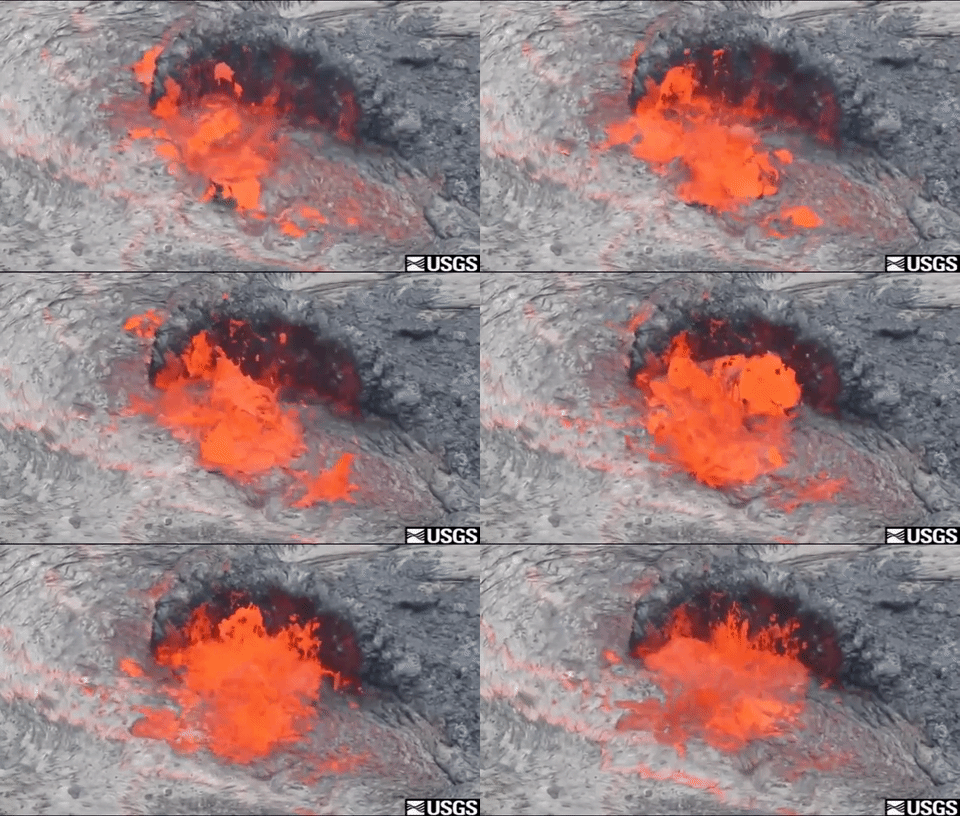
Lava spatters into the air
Lava Spattering
Lava Spattering
Lava Spattering

An animated GIF of lava spattering at  Pu'u 'O 'o crater pulled from the Pu'u 'O'o Producing Spattering video.

The Kamokuna ocean entry and lava delta...
The Kamokuna ocean entry and lava delta

Kīlauea Volcano's Kamokuna ocean entry is fed by lava that erupts from the east flank of the Pu‘u ‘Ō‘ō cone, visible on the skyline at upper left. It travels from the vent to the ocean via a lava tube, marked in places by fume emanating from the tube roof.

Kīlauea Volcano's Kamokuna ocean entry is fed by lava that erupts from the east flank of the Pu‘u ‘Ō‘ō cone, visible on the skyline at upper left. It travels from the vent to the ocean via a lava tube, marked in places by fume emanating from the tube roof.

Map of flow field...
Map of flow field
Map of flow field
Map of flow field

This map shows recent changes to Kīlauea's East Rift Zone lava flow field. The area of the active flow field as of May 3 is shown in pink, while widening and advancement of the active flow as of May 31 is shown in red. Older Pu‘u ‘Ō‘ō lava flows (1983-2016) are shown in gray. The yellow line is the trace of the active lava tube (dashed where uncertain).

This map shows recent changes to Kīlauea's East Rift Zone lava flow field. The area of the active flow field as of May 3 is shown in pink, while widening and advancement of the active flow as of May 31 is shown in red. Older Pu‘u ‘Ō‘ō lava flows (1983-2016) are shown in gray. The yellow line is the trace of the active lava tube (dashed where uncertain).

This video clip shows HVO geologist Tim Orr sampling lava from an a...
Geologist Tim Orr sampling lava from an active pāhoehoe breakout on...

This video clip shows HVO geologist Tim Orr sampling lava from an active pāhoehoe breakout on the episode 61g lava flow. The chemistry of these lava samples provides information on the magma plumbing system. Sampling has been a regular part of monitoring Kīlauea Volcano's ongoing Pu‘u ‘Ō‘ō eruption.

This video clip shows HVO geologist Tim Orr sampling lava from an active pāhoehoe breakout on the episode 61g lava flow. The chemistry of these lava samples provides information on the magma plumbing system. Sampling has been a regular part of monitoring Kīlauea Volcano's ongoing Pu‘u ‘Ō‘ō eruption.

Hawaiian Volcano Observatory and Jaggar Museum...
HVO and Jaggar Museum

Mauna Loa looms in the background behind the USGS Hawaiian Volcano Observatory and Hawai‘i Volcanoes National Park Jaggar Museum complex, perched at the summit of Kīlauea Volcano. The cliff in the foreground is Kīlauea's caldera rim.

Mauna Loa looms in the background behind the USGS Hawaiian Volcano Observatory and Hawai‘i Volcanoes National Park Jaggar Museum complex, perched at the summit of Kīlauea Volcano. The cliff in the foreground is Kīlauea's caldera rim.

Halema‘uma‘u lava lake...
Halema‘uma‘u lava lake

View looking southeast along the long axis of the lava lake in Halema‘uma‘u at Kīlauea's summit. The lava lake is about 260 m (285 yd) long and 200 m (220 yd) wide.

View looking southeast along the long axis of the lava lake in Halema‘uma‘u at Kīlauea's summit. The lava lake is about 260 m (285 yd) long and 200 m (220 yd) wide.

View of the Kamokuna lava delta and the lava structure encasing the...

View of the Kamokuna lava delta and the lava structure encasing the lava stream where it emerges from the mouth of the lava tube in the face of the sea cliff.

Spattering is common in the summit lava lake, and this photo shows ...
Spattering is common in the summit lava lake, and shows spattering ...

Spattering is common in the summit lava lake, and this photo shows spattering in the southeast corner of the lake. Spatter accumulation on the lake margins has built up several small peninsulas that extend a few meters (yards) out from the crater wall.

Spattering is common in the summit lava lake, and this photo shows spattering in the southeast corner of the lake. Spatter accumulation on the lake margins has built up several small peninsulas that extend a few meters (yards) out from the crater wall.

Spattering on summit lava lake and Pele's hair around Halema‘uma‘u ...
Spattering on summit lava lake and Pele's hair around Halema‘uma‘u

Spattering on the summit lava lake within Halema‘uma‘u is ever-changing, but on Sunday (May 28), two sources could be seen—one on the north side of the lake (bright area at left) and one on the southeast side (right). A close-up view of the southeast spattering source is shown in the adjacent photo.

Spattering on the summit lava lake within Halema‘uma‘u is ever-changing, but on Sunday (May 28), two sources could be seen—one on the north side of the lake (bright area at left) and one on the southeast side (right). A close-up view of the southeast spattering source is shown in the adjacent photo.

Sluggish breakouts near the base of the pali...
Sluggish breakouts near base of the pali

Sluggish pāhoehoe breakouts remain active on the coastal plain, near the base of the pali. Over the past week, these breakouts have not advanced any significant distance. There were also several small lava channels on the steep section of the pali today (May 27).

Sluggish pāhoehoe breakouts remain active on the coastal plain, near the base of the pali. Over the past week, these breakouts have not advanced any significant distance. There were also several small lava channels on the steep section of the pali today (May 27).

Numerous fumaroles are present near the rim of Halema‘uma‘u Crater,...
Numerous fumaroles are present near rim of Halema‘uma‘u, and are ev...

Numerous fumaroles are present near the rim of Halema‘uma‘u Crater, and are evident by the bright yellow sulfur deposits. In recent years these fumaroles have been covered by a thick carpet of Pele's hair produced by the lava lake. Moisture emitted by the fumaroles collects as tiny water droplets on the fine hairs, resembling a thin dusting of snow.

Numerous fumaroles are present near the rim of Halema‘uma‘u Crater, and are evident by the bright yellow sulfur deposits. In recent years these fumaroles have been covered by a thick carpet of Pele's hair produced by the lava lake. Moisture emitted by the fumaroles collects as tiny water droplets on the fine hairs, resembling a thin dusting of snow.

Worldview satellite image collected at 14:34 AKDT (22:34 UTC) on Ma...

The eruption began about 18 minutes prior to this image and the cloud rose to an altitude in excess of 40,000 ft above sea level. The white color of the eruption cloud is due to the large amount of water that is incorporated into the eruption column as the vent is located in shallow water. Image data provided under the Digital Globe NextView License.

The eruption began about 18 minutes prior to this image and the cloud rose to an altitude in excess of 40,000 ft above sea level. The white color of the eruption cloud is due to the large amount of water that is incorporated into the eruption column as the vent is located in shallow water. Image data provided under the Digital Globe NextView License.

Volcanoes, Landslides, and Angry Gods—A Pacific Northwest Connectio...
Volcanoes, Landslides, and Angry Gods—A Pacific Northwest Connection

View of headscarp of Red Bluffs landslide (adjacent to the Bonneville landslide), looking northwest and showing the bedded volcaniclastic sediments (gray layers) that are dipping about 7 degrees toward the viewer and in which sliding has occurred. The slightly darker gray and orange-brown unit in the top quarter of the scarp face is Columbia River Basalt.

View of headscarp of Red Bluffs landslide (adjacent to the Bonneville landslide), looking northwest and showing the bedded volcaniclastic sediments (gray layers) that are dipping about 7 degrees toward the viewer and in which sliding has occurred. The slightly darker gray and orange-brown unit in the top quarter of the scarp face is Columbia River Basalt.

Zooming in even closer, the top of the crusted-over firehose flow c...

Zooming in even closer, the top of the crusted-over firehose flow can be seen. Cracks in the hardened tube surface reveal incandescent lava flowing though the tube. Fume from the degassing lava also escapes through these cracks.

Zooming in even closer, the top of the crusted-over firehose flow can be seen. Cracks in the hardened tube surface reveal incandescent lava flowing though the tube. Fume from the degassing lava also escapes through these cracks.

Was this page helpful?