U.S. flag

An official website of the United States government

Images

Volcano Hazard Program images.

Filter Total Items: 6274
This photo, similar to the previous, was taken from the same locati...
This photo, similar to previous, was taken from the same location a...

This photo, similar to the previous, was taken from the same location as photos posted on July 21 and June 9 (and several other dates scattered over the past several months) to provide a comparison to past activity in Pu‘u ‘Ō‘ō.

This photo, similar to the previous, was taken from the same location as photos posted on July 21 and June 9 (and several other dates scattered over the past several months) to provide a comparison to past activity in Pu‘u ‘Ō‘ō.

The active lava lake in Pu‘u ‘Ō‘ō and its levee...
The active lava lake in Pu‘u ‘Ō‘ō and its levee

View looking east into Pu‘u ‘Ō‘ō, its crater partly filled by lava flows accumulating on the crater floor. The active lava lake in the crater is 205 m (673 ft) long and varies in width from 80-115 m (262-377 ft). The West Gap pit is in the central foreground, and the Puka Nui and MLK pits are to the right (the MLK pit is in back).

View looking east into Pu‘u ‘Ō‘ō, its crater partly filled by lava flows accumulating on the crater floor. The active lava lake in the crater is 205 m (673 ft) long and varies in width from 80-115 m (262-377 ft). The West Gap pit is in the central foreground, and the Puka Nui and MLK pits are to the right (the MLK pit is in back).

A breach in the south wall of the perched pond allowed lava to gush...

A breach in the south wall of the perched pond allowed lava to gush out onto the floor of Pu‘u ‘Ō‘ō Crater.

Lava lakes, islands, and bubbles: 100-year-old descriptions still ...
100-year-old descriptions still useful today

"The great inflated cylinder of black glass which formed over the sunken island, Aug. 18, 1911" (Frank Perret).

Stream channel cross-section measurements—instrument that uses lase...

Stream channel cross-section measurements—instrument that uses laser pulses to survey distance to a reflector operated by a second crew member, Mount St. Helens.

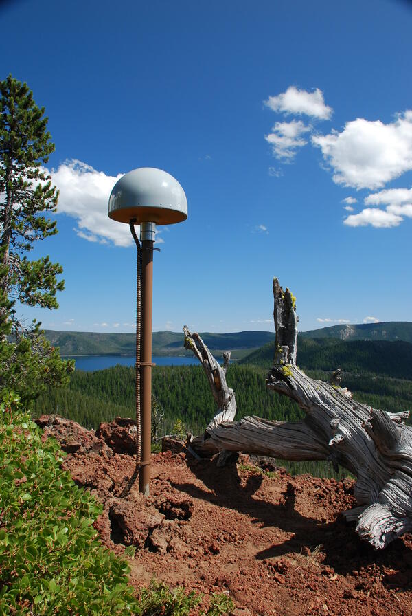
Global Positioning System receiver (called a GPS monument) at North...
Vents on the west flank of Pu‘u ‘Ō‘ō erupt—once again...
Vents on the west flank of Pu‘u ‘Ō‘ō erupt—once again

August 3 photo showing the collapsed floor within Pu‘u ‘Ō‘ō Crater in the foreground and two lava flow branches each burning some forest—northwest branch to the right and south branch to the left.

August 3 photo showing the collapsed floor within Pu‘u ‘Ō‘ō Crater in the foreground and two lava flow branches each burning some forest—northwest branch to the right and south branch to the left.

HVO's first report in 1911—all about the Halema‘uma‘u Crater lava l...
HVO's first report in 1911—all about the Halema‘uma‘u lava lake

Frank Perret's photos from early July 1911 showing the island in the lake at the bottom of a smaller Halema‘uma‘u Crater. The view is looking southwest and the ledge up near the west rim was known as the January 1910 bench, a remnant of an earlier lava level in the crater.

Frank Perret's photos from early July 1911 showing the island in the lake at the bottom of a smaller Halema‘uma‘u Crater. The view is looking southwest and the ledge up near the west rim was known as the January 1910 bench, a remnant of an earlier lava level in the crater.

Gas sampling in Sherman Crater, Mount Baker, Washington. Panoramic ...
Gas sampling in Sherman Crater, Mount Baker, WA. Panoramic photogra...

Gas sampling in Sherman Crater, Mount Baker, Washington. Panoramic photograph with USGS scientist in center-left of photo beneath fumarole.

USGS CVO staff member assisting a teacher with mineral identificati...

USGS CVO staff member assisting a teacher with mineral identification during July 2011 Mount Rainer Teacher Workshop.

A Scroll down to the photo taken on June 29 to compare the amount o...
A Scroll down to photo taken on June 29 to compare the amount of up...

A Scroll down to the photo taken on June 29 to compare the amount of uplift the floor of the crater has endured in the last month. This photo was taken from a similar spot to the lower right of the three photos posted that day.

A Scroll down to the photo taken on June 29 to compare the amount of uplift the floor of the crater has endured in the last month. This photo was taken from a similar spot to the lower right of the three photos posted that day.

Newberry caldera with Paulina Peak, Big Obsidian Flow and Paulina L...
Newberry caldera with Paulina Peak, Big Obsidian Flow and Paulina Lake

View looking south across Newberry caldera towards the Big Obsidian flow (left of center) and Paulina Peak, with Paulina Lake in foreground. Photo taken from the north rim of the caldera.

Perched lava lake rising higher in Pu‘u ‘Ō‘ō crater...
Perched lava lake rising higher in Pu‘u ‘Ō‘ō

Aerial view looking southwest into Pu‘u ‘Ō‘ō crater with its lava lake (shiny surface) perched 5-8 m above the surrounding lava flows.

Clean up of ash in Argentina following the Puyehue-Cordón Caulle 2...
Ash cleanup following the Puyehue-Cordón Caulle 2011 eruption
The Founding of the Hawaiian Volcano Observatory...
The Founding of the HVO

Frank Perret (left) and Thomas Jaggar (right) examine Cone Crater, Kīlauea southwest rift zone, during a return visit by Perret in 1914.

Frank Perret (left) and Thomas Jaggar (right) examine Cone Crater, Kīlauea southwest rift zone, during a return visit by Perret in 1914.

Spectacular views of Pu‘u ‘Ō‘ō crater and the erupting spatter cone...
Spectacular views of Pu‘u ‘Ō‘ō and the erupting spatter cone

Near-vertical view down into the Overlook vent collapse crater. The partly destroyed visitor overlook is at lower right. The gray surface of the lava lake at the bottom of the pit is faintly visible through fume. North is toward the top of the photo.

Near-vertical view down into the Overlook vent collapse crater. The partly destroyed visitor overlook is at lower right. The gray surface of the lava lake at the bottom of the pit is faintly visible through fume. North is toward the top of the photo.

A new ocean entry started overnight, fed by a western branch of the...
A new ocean entry fed by a western branch of the active flow

A new ocean entry started overnight, fed by a western branch of the active flow. The light gray-colored new flow shows up well in the cloud shadow at left edge of the photo. An eastern branch of the flow continues to advance slowly toward Kalapana Gardens, which is visible at the upper right.

A new ocean entry started overnight, fed by a western branch of the active flow. The light gray-colored new flow shows up well in the cloud shadow at left edge of the photo. An eastern branch of the flow continues to advance slowly toward Kalapana Gardens, which is visible at the upper right.

Composite images showing eastern and western lobes that are active ...
Images showing eastern and western lobes are active on coastal plain

This composite image combines a thermal image with a normal photograph of the coastal plain and pali. The active flow field is split into several lobes, and this image shows the eastern lobe that has been approaching Kalapana Gardens subdivision. Active lava has reached the end of the paved access road, where the County lava viewing area is.

This composite image combines a thermal image with a normal photograph of the coastal plain and pali. The active flow field is split into several lobes, and this image shows the eastern lobe that has been approaching Kalapana Gardens subdivision. Active lava has reached the end of the paved access road, where the County lava viewing area is.

Was this page helpful?