



Beach nourishment morphodynamics at the Columbia River Mouth
Beach nourishment projects are often judged by how long newly placed sand remains on the beach. But new research suggests that even when nourishment appears to disappear quickly, it may continue providing important coastal benefits beneath the waves.
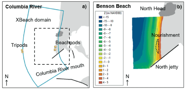
In the study, scientists examined a beach nourishment project at Benson Beach, just north of the mouth of the Columbia River at the Washington/Oregon border, where dredged sand from a nearby engineered inlet was placed on the beach as a beneficial use of dredged sediment.
Although much of the newly placed sand eroded within two weeks, researchers found that it likely remained within the coastal system, where it continued to supply sediment to the beach and help protect nearby dunes.
Beneficial use of dredged sediment
Navigation channels and engineered inlets require periodic dredging to maintain safe passage for ships. Rather than disposing of dredged sediment far offshore, many coastal managers now place that material on nearby beaches, where it can help combat erosion.
Making these projects successful, however, requires understanding how waves and currents move sediment after it is placed.
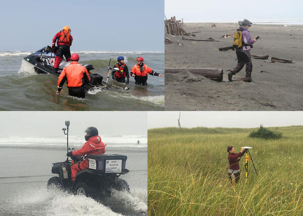
To investigate the outcome of beach nourishment at Benson Beach, researchers combined field observations with the coastal morphodynamics model XBeach, which simulates how waves, currents, and sand interact during changing ocean conditions.

Tracking the sediment’s fate
The nourishment project took place along one of the most energetic stretches of coastline in the Pacific Northwest. Field observations of the placement site found that the newly placed dry beach sand eroded rapidly, over the course of two weeks—this during a period of moderate wave activity with no major storms.
Rather than leaving the nearshore environment entirely, much of the dredged sediment was transported just offshore and deposited around the beach's inner sandbar, a submerged component of the coastal sediment system.
Because the sand stayed within the nearshore environment, it remains available to move back toward the beach under future wave conditions. In effect, the beach nourishment shifted location rather than leaving the system altogether.
The modeling also indicated that while little of the nourishment remained on the upper beach, it acted as a protective buffer that reduced erosion of the adjacent dune system.
These dunes provide natural protection for inland areas by absorbing wave energy during storms. Even though the nourishment eroded rapidly from the upper beach, modeling suggests that its temporary presence helped shield these valuable coastal landforms.
Improving future beach nourishment efforts
The findings underscore the importance of evaluating beach nourishment projects based on the movement of sediment throughout the entire coastal system, not just how long sand remains on the upper beach.
Advanced models like XBeach, combined with field measurements, can help coastal managers better predict where dredged sediment will travel and how it contributes to long-term shoreline resilience.
Read the study, Beach Nourishment Morphodynamics in a High-Energy U.S. West Coast Environment, in Coastal Dynamics.
Related

Coastal Climate Impacts

Dynamic coastlines along the western U.S.

Estuaries and large river deltas in the Pacific Northwest

Coastal Change Hazards
Related
Coastal Climate Impacts
Dynamic coastlines along the western U.S.
Estuaries and large river deltas in the Pacific Northwest