
Earthquakes
Earthquakes
Filter Total Items: 21
Preliminary simulations of the 2010 Chilean tsunami
Preliminary simulations of the 2010 Chilean tsunami from the 27 February 2010 M=8.8 subduction zone earthquake, offshore Bio-Bio, Chile

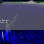
Preliminary simulation of the 2010 tsunami in Indonesia
Preliminary simulation of the tsunami from the October 25, 2010 M=7.7 subduction zone earthquake offshore of the Mentawai Islands, Indonesia

California Seafloor Mapping Program map-set production
USGS and the California Ocean Protection Council (COPC) are supporting development of peer-reviewed map sets for California’s mainland State Waters.

Sea Floor Mapping Group
The Sea Floor Mapping Group (SFMG) is a core capability at the Woods Hole Coastal & Marine Science Center (WHCMSC) that provides support for coastal, lacustrine and marine geologic research. The staff has a wide-range of expertise and is responsible for geophysical and sampling data acquisition, processing, interpretation and publication, logistics, design, and research and development. SFMG has...

USGS Scientists in Samoa and American Samoa Studying Impacts of Tsunami in 2009
On September 29, 2009, an M 8.1 earthquake in the Samoa Islands region of the South Pacific Ocean caused a tsunami that resulted in 100's of lost lives. A rapid-response team of USGS scientists traveled to the Samoa Islands in October-November 2009 to collect time-sensitive data that would have been quickly degraded or destroyed by recovery activity and natural processes.

Preliminary Analysis of the 2009 Samoa Tsunami
The tsunami that was triggered by a magnitude 8.1 earthquake on September 29, 2009, caused significant damage and loss of life on Samoa, American Samoa, and Tonga. In the hopes that disasters such as this can be minimized in the future, we attempt to understand the mechanism and impact of this tsunami. The information presented here is focused on geologic aspects of the disaster.

Tsunami Hazards in the Santa Barbara Channel
Information about the USGS Pacific Coastal and Marine Science Center's study of tsunami hazards in the Santa Barbara Channel from 1993-2003.

Preliminary Analysis of the Tsunami Generated by the June 23, 2001 Peru Earthquake
A preliminary analysis of the tsunami generated by the June 23, 2001 Peru earthquake is presented here.

Descriptive Model of the July 17, 1998 Papua New Guinea Tsunami
The tsunami that struck New Guinea on July 17, 1998 was the most devastating tsunami since the 1976 Moro Gulf, Philippines, tsunami and may surpass that event (Lockridge and Smith, 1984; Satake and Imamura, 1995). The high reported runups and the tremendous loss of life are of great concern to all, including the international scientific community. Scientists closely examined this event in hopes of...