
Publications
Find publications related to USGS Land Change Monitoring, Assessment, and Projection (LCMAP) here.
LCMAP Lessons Learned
LCMAP Lessons Learned

Lessons learned implementing an operational continuous United States national land change monitoring capability: The Land Change Monitoring, Assessment, and Projection (LCMAP) approach.
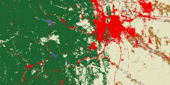
Optimizing LCMAP
Optimizing LCMAP

"Optimizing selection of training and auxiliary data for operational land cover classification for the LCMAP initiative"
Quality Control
Quality Control
"Quality control and assessment of interpreter consistency of annual land cover reference data in an operational national monitoring program"
Filter Total Items: 35
Gap fill of Land surface temperature and reflectance products in Analysis Ready Data Gap fill of Land surface temperature and reflectance products in Analysis Ready Data
The recently released Landsat Analysis Ready Data (ARD) over the United States provides the opportunity to investigate landscape dynamics using dense time series observations at 30-m resolution. However, the dataset often contains data gaps (or missing data) because of cloud contamination or data acquisition strategy. We present a new algorithm that focuses on data gap filling using...
Authors
Qiang Zhou, George Z. Xian, Hua Shi
Quality control and assessment of interpreter consistency of annual land cover reference data in an operational national monitoring program Quality control and assessment of interpreter consistency of annual land cover reference data in an operational national monitoring program
The U.S. Geological Survey Land Change Monitoring, Assessment and Projection (USGS LCMAP) initiative is working toward a comprehensive capability to characterize land cover and land cover change using dense Landsat time series data. A suite of products including annual land cover maps and annual land cover change maps will be produced using the Landsat 4-8 data record. LCMAP products...
Authors
Bruce Pengra, Stephen V. Stehman, Josephine Horton, Daryn Dockter, Todd A. Schroeder, Zhiqiang Yang, Warren B Cohen, Sean P. Healey, Thomas Loveland
Lessons learned implementing an operational continuous United States national land change monitoring capability: The Land Change Monitoring, Assessment, and Projection (LCMAP) approach Lessons learned implementing an operational continuous United States national land change monitoring capability: The Land Change Monitoring, Assessment, and Projection (LCMAP) approach
Growing demands for temporally specific information on land surface change are fueling a new generation of maps and statistics that can contribute to understanding geographic and temporal patterns of change across large regions, provide input into a wide range of environmental modeling studies, clarify the drivers of change, and provide more timely information for land managers. To meet...
Authors
Jesslyn F. Brown, Heather J. Tollerud, Christopher P. Barber, Qiang Zhou, John L. Dwyer, James Vogelmann, Thomas Loveland, Curtis Woodcock, Stephen V. Stehman, Zhe Zhu, Bruce Pengra, Kelcy Smith, Josephine Horton, George Z. Xian, Roger F. Auch, Terry L. Sohl, Kristi L. Sayler, Alisa L. Gallant, Daniel Zelenak, Ryan R. Reker, Jennifer R. Rover
Training data selection for annual land cover classification for the LCMAP initiative Training data selection for annual land cover classification for the LCMAP initiative
The U.S. Geological Survey’s Land Change Monitoring, Assessment, and Projection (LCMAP) initiative characterizes changes in land cover, use, and condition with the goal of producing land change information that improves understanding of the earth system and provides insight into the impacts of land change on society. For LCMAP, all available high-quality data from the Landsat archive is...
Authors
Qiang Zhou, Heather J. Tollerud, Christopher P. Barber, Kelcy Smith, Daniel J. Zelenak
Analysis ready data: Enabling analysis of the Landsat archive Analysis ready data: Enabling analysis of the Landsat archive
Data that have been processed to allow analysis with a minimum of additional user effort are often referred to as Analysis Ready Data (ARD). The ability to perform large scale Landsat analysis relies on the ability to access observations that are geometrically and radiometrically consistent, and have had non-target features (clouds) and poor quality observations flagged so that they can...
Authors
John L. Dwyer, David P. Roy, Brian Sauer, Calli B. Jenkerson, Hankui K. Zhang, Leo Lymburner
U.S. Landsat Analysis Ready Data U.S. Landsat Analysis Ready Data
U.S. Landsat Analysis Ready Data (ARD) are a revolutionary new U.S. Geological Survey science product that allows the Landsat archive to be more accessible and easier to analyze and reduces the amount of time users spend on data processing for monitoring and assessing landscape change. U.S. Landsat ARD are Level-2 products derived from Landsat Collections Level-1 precision and terrain...
Authors
Forest harvest patterns on private lands in the Cascade Mountains, Washington, USA Forest harvest patterns on private lands in the Cascade Mountains, Washington, USA
Forests in Washington State generate substantial economic revenue from commercial timber harvesting on private lands. To investigate the rates, causes, and spatial and temporal patterns of forest harvest on private tracts throughout the Cascade Mountains, we relied on a new generation of annual land-use/land-cover (LULC) products created from the application of the Continuous Change...
Authors
Christopher E. Soulard, Jessica J. Walker, Glenn E. Griffith
Land change monitoring, assessment, and projection (LCMAP) revolutionizes land cover and land change research Land change monitoring, assessment, and projection (LCMAP) revolutionizes land cover and land change research
When nature and humanity change Earth’s landscapes - through flood or fire, public policy, natural resources management, or economic development - the results are often dramatic and lasting. Wildfires can reshape ecosystems. Hurricanes with names like Sandy or Katrina will howl for days while altering the landscape for years. One growing season in the evolution of drought-resistant...
Authors
Steven Young
Optimizing selection of training and auxiliary data for operational land cover classification for the LCMAP initiative Optimizing selection of training and auxiliary data for operational land cover classification for the LCMAP initiative
The U.S. Geological Survey’s Land Change Monitoring, Assessment, and Projection (LCMAP) initiative is a new end-to-end capability to continuously track and characterize changes in land cover, use, and condition to better support research and applications relevant to resource management and environmental change. Among the LCMAP product suite are annual land cover maps that will be...
Authors
Zhe Zhu, Alisa L. Gallant, Curtis Woodcock, Bruce Pengra, Pontus Olofsson, Thomas R. Loveland, Suming Jin, Devendra Dahal, Limin Yang, Roger F. Auch
Evaluation of the initial thematic output from a continuous change-detection algorithm for use in automated operational land-change mapping by the U.S. Geological Survey Evaluation of the initial thematic output from a continuous change-detection algorithm for use in automated operational land-change mapping by the U.S. Geological Survey
The U.S. Geological Survey (USGS) has begun the development of operational, 30-m resolution annual thematic land cover data to meet the needs of a variety of land cover data users. The Continuous Change Detection and Classification (CCDC) algorithm is being evaluated as the likely methodology following early trials. Data for training and testing of CCDC thematic maps have been provided...
Authors
Bruce Pengra, Alisa L. Gallant, Zhe Zhu, Devendra Dahal
A global reference database from very high resolution commercial satellite data and methodology for application to Landsat derived 30 m continuous field tree cover data A global reference database from very high resolution commercial satellite data and methodology for application to Landsat derived 30 m continuous field tree cover data
The methodology for selection, creation, and application of a global remote sensing validation dataset using high resolution commercial satellite data is presented. High resolution data are obtained for a stratified random sample of 500 primary sampling units (5 km × 5 km sample blocks), where the stratification based on Köppen climate classes is used to distribute the sample globally...
Authors
Bruce Pengra, Jordan Long, Devendra Dahal, Stephen V. Stehman, Thomas R. Loveland