
Publications
Find publications related to USGS Land Change Monitoring, Assessment, and Projection (LCMAP) here.
LCMAP Lessons Learned
LCMAP Lessons Learned

Lessons learned implementing an operational continuous United States national land change monitoring capability: The Land Change Monitoring, Assessment, and Projection (LCMAP) approach.
Optimizing LCMAP
Optimizing LCMAP

"Optimizing selection of training and auxiliary data for operational land cover classification for the LCMAP initiative"
Quality Control
Quality Control
"Quality control and assessment of interpreter consistency of annual land cover reference data in an operational national monitoring program"
Filter Total Items: 35
SSEBop evapotranspiration estimates using synthetically derived Landsat data from the continuous change detection and classification algorithm SSEBop evapotranspiration estimates using synthetically derived Landsat data from the continuous change detection and classification algorithm
The operational Simplified Surface Energy Balance (SSEBop) model has been utilized to generate gridded evapotranspiration data from Landsat images. These estimates are primarily driven by two sources of information: reference evapotranspiration and Landsat land surface temperature (LST) values. Hence, SSEBop is limited by the availability of Landsat data. Here, in this proof-of-concept...
Authors
Mikael Peter Hiestand, Heather J. Tollerud, W. Chris Funk, Gabriel B. Senay, MacKenzie Friedrichs, Kate Fickas
Characterization of change in tree cover state and condition over the conterminous United States Characterization of change in tree cover state and condition over the conterminous United States
Variability in the effects of disturbances and extreme climate events can lead to changes in tree cover over time, including partial or complete loss, with diverse ecological consequences. It is therefore critical to identify in space and time the change processes that lead to tree cover change. Studies of change are often hampered by the lack of data capable of consistently detecting...
Authors
Francis K Dwomoh, Roger F. Auch
Assessment of public and private land cover change in the United States from 1985–2018 Assessment of public and private land cover change in the United States from 1985–2018
An assessment of annual land cover on publicly and privately managed lands across the conterminous United States (CONUS) from 1985–2018 was performed, including land cover conversions within their management category, to inform future policy and land-use decision-making in natural resource management. Synthesizing land cover data with land management delineations aids our ability to...
Authors
Nathan C. Healey, Janis L. Taylor, Roger F. Auch
Toward consistent change detection across irregular remote sensing time series observations Toward consistent change detection across irregular remote sensing time series observations
The use of remote sensing in time series analysis enables wall-to-wall monitoring of the land surface and is critical for assessing and understanding land cover and land use change and for understanding the Earth system as a whole. However, variability in remote sensing observation frequency through time and across space presents challenges for producing consistent change detection...
Authors
Heather J. Tollerud, Zhe Zhu, Kelcy Smith, Danika F. Wellington, Reza Hussain, Donna Viola
Trends in tree cover change over three decades related to interannual climate variability and wildfire in California Trends in tree cover change over three decades related to interannual climate variability and wildfire in California
The U.S. State of California has experienced frequent drought events, hotter temperatures and other disruptions to the climate system whose effects on ecosystems have been widely reported in recent decades. Studies primarily confined to specific vegetation communities or species, individual drought incidents, or analysis over a relatively short intervals, has limited our understanding of...
Authors
Francis K Dwomoh, Roger F. Auch, Jesslyn F. Brown, Heather J. Tollerud
Development of the LCMAP annual land cover product across Hawai'i Development of the LCMAP annual land cover product across Hawai'i
Following the completion of land cover and change (LCC) products for the conterminous United States (CONUS), the U.S. Geological Survey's (USGS’s) Land Change Monitoring, Assessment, and Projection initiative has broadened the capability of characterizing continuous historical land change across the full Landsat records for Hawaiʻi at 30-meter resolution. One of the challenges of...
Authors
Congcong Li, George Z. Xian, Danika F. Wellington, Kelcy Smith, Josephine Horton, Qiang Zhou
Tree regrowth duration map from LCMAP collection 1.0 land cover products in the conterminous United States, 1985–2017 Tree regrowth duration map from LCMAP collection 1.0 land cover products in the conterminous United States, 1985–2017
Forest covers about one-third of the land area of the conterminous United States (CONUS) and plays an important role in offsetting carbon emissions and supporting local economies. Growing interest in forests as relatively cost-effective nature-based climate solutions, particularly restoration and reforestation activities, has increased the demand for information on forest regrowth and...
Authors
Qiang Zhou, George Z. Xian, Josephine Horton, Danika F. Wellington, Grant Domke, Roger F. Auch, Congcong Li, Zhe Zhu
Analyzing the effects of land cover change on the water balance for case study watersheds in different forested ecosystems in the USA Analyzing the effects of land cover change on the water balance for case study watersheds in different forested ecosystems in the USA
We analyzed impacts of interannual disturbance on the water balance of watersheds in different forested ecosystem case studies across the United States from 1985 to 2016 using a remotely sensed long-term land cover monitoring record (U.S. Geological Survey Land Change Monitoring, Assessment, and Projection (LCMAP) Collection 1.0 Science products), gridded precipitation and evaporation...
Authors
Nathan C. Healey, Jennifer Rover
Conterminous United States land-cover change (1985-2016): New insights from annual time series Conterminous United States land-cover change (1985-2016): New insights from annual time series
Sample-based estimates augmented by complete coverage land-cover maps were used to estimate area and describe patterns of annual land-cover change across the conterminous United States (CONUS) between 1985 and 2016. Most of the CONUS land cover remained stable in terms of net class change over this time, but a substantial gross change dynamic was captured by the annual and cumulative...
Authors
Roger F. Auch, Danika Fay Wellington, Janis L. Taylor, Stephen V. Stehman, Heather J. Tollerud, Jesslyn F. Brown, Thomas Loveland, Bruce Pengra, Josephine Horton, Zhe Zhu, Alemayehu Midekisa, Kristi L. Sayler, George Z. Xian, Christopher Barnes, Ryan R. Reker
Incorporating interpreter variability into estimation of the total variance of land cover area estimates under simple random sampling Incorporating interpreter variability into estimation of the total variance of land cover area estimates under simple random sampling
Area estimates of land cover and land cover change are often based on reference class labels determined by analysts interpreting satellite imagery and aerial photography. Different interpreters may assign different reference class labels to the same sample unit. This interpreter variability is typically not accounted for in variance estimators applied to area estimates of land cover. A...
Authors
Stephen V. Stehman, John Mousoupetros, Ronald E. McRoberts, Erik Naesset, Bruce Pengra, Dingfan Xing, Josephine Horton
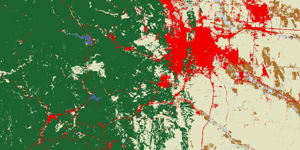
Monitoring and characterizing multi-decadal variations of urban thermal condition using time-series thermal remote sensing and dynamic land cover data Monitoring and characterizing multi-decadal variations of urban thermal condition using time-series thermal remote sensing and dynamic land cover data
Urban development and associated land cover and land use change alter the thermal, hydrological, and physical properties of the land surface. Assessments of surface urban heat island (UHI) usually focused on using remote sensing and land cover data to quantify UHI intensity and spatial distribution within a certain period. However, the mechanisms and complex interactions in landscape...
Authors
George Z. Xian, Hua Shi, Qiang Zhou, Roger F. Auch, Kevin Gallo, Zhuoting Wu, Michael Kolian
A novel regression method for harmonic analysis of time series A novel regression method for harmonic analysis of time series
Harmonic analysis of time series is an important technique in remote sensing to reveal seasonal land surface dynamics. However, frequency selection in the harmonic analysis is often difficult because high-frequency components are useful for delineating seasonal dynamics but sensitive to noise and gaps in time series. On the other hand, it is challenging to obtain temporally continuous...
Authors
Qiang Zhou, Zhe Zhu, George Z. Xian, Congcong Li