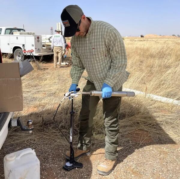
Ben Linhoff preparing to install lysimeters for collection of soil water samples as part of a study of PFAS fate and transport in soil and groundwater at Cannon Air Force Base, New Mexico, collaborative study by USGS Maryland-Delaware-DC and New Mexico Water Science Centers.
Benjamin S. Linhoff, Ph.D.
Dr. Benjamin Linhoff is a research hydrologist for the USGS Water Resources Mission Area, Earth System Process Division.
Ben oversees the USGS Selenium Research Laboratory which is focused on measuring selenium concentration in water, sediment, and biota in support of bioaccumulation and biogeochemistry research. He is a specialist in using hydrogeochemistry, biogeochemistry, and isotope geochemistry to answer questions related to the fate and transport of nutrients, metals, and emerging contaminants in biota, surface water, and groundwater.
Prior to the USGS, his graduate research focused on developing chemical tracers of Greenland Ice Sheet hydrology and the chemical evolution of hypersaline soda lakes in Mongolia. Between graduate degrees, he worked in the Earth and Environmental Sciences Division at Los Alamos National Laboratory where he operated several mass spectrometers and researched groundwater quality in northern New Mexico.
Professional Experience
2023–present: Research Hydrologist, U.S. Geological Survey, Water Resources Mission Area, Earth System Process Division
2021–2023: Research Hydrologist, U.S. Geological Survey, New Mexico Water Science Center, Albuquerque, New Mexico
2016–2021: Hydrologist, U.S. Geological Survey, New Mexico Water Science Center, Albuquerque, New Mexico
2009–2010: Post Masters Graduate Research Assistant, Los Alamos National Laboratory, Los Alamos, New Mexico
2006: Fulbright Fellowship, Mongolia
Education and Certifications
PhD, Geochemistry, Massachusetts Institute of Technology and Woods Hole Oceanographic Institution Joint Program, 2016
MS, Hydrology, The University of Texas at Austin, 2009
BS, Geology, Boise State, 2005
Affiliations and Memberships*
American Geophysical Union: 2009–present
Geochemical Society: 2005–present
Science and Products
Testing Low-Tech Strategies for Stream Resilience in the Rio Grande Basin
Nitrate Contamination in the Albuquerque Basin
Uncrewed Aerial System Digital Surface Model and Multispectral Footprints for the Rio De Las Vacas, New Mexico, USA, Summer 2025 Uncrewed Aerial System Digital Surface Model and Multispectral Footprints for the Rio De Las Vacas, New Mexico, USA, Summer 2025
Lagrangian water quality monitoring of the Animas River: Data release from a sonde-equipped raft sampling campaign that occurred on the Animas River between Trimble, CO to Farmington, NM in June, 2022 Lagrangian water quality monitoring of the Animas River: Data release from a sonde-equipped raft sampling campaign that occurred on the Animas River between Trimble, CO to Farmington, NM in June, 2022
Data Collected to Evaluate Sources, Fate, and Mobility of Per- and Polyfluoroalkyl Substances (PFAS) at Cannon Air Force Base, New Mexico Data Collected to Evaluate Sources, Fate, and Mobility of Per- and Polyfluoroalkyl Substances (PFAS) at Cannon Air Force Base, New Mexico
MODFLOW-2005 and MODPATH models in support of groundwater flow model investigation of water resources at Chaco Culture National Historical Park MODFLOW-2005 and MODPATH models in support of groundwater flow model investigation of water resources at Chaco Culture National Historical Park
Ben Linhoff preparing to install lysimeters for collection of soil water samples as part of a study of PFAS fate and transport in soil and groundwater at Cannon Air Force Base, New Mexico, collaborative study by USGS Maryland-Delaware-DC and New Mexico Water Science Centers.
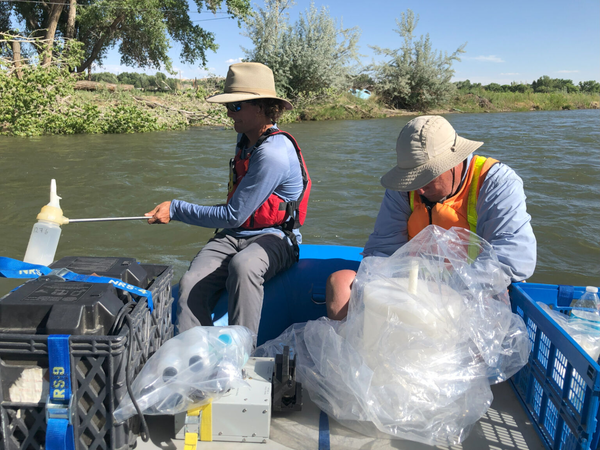
Sampling surface water on the Animas River, New Mexico, 2022
Sampling surface water on the Animas River, New Mexico, 2022USGS researchers collect surface water samples on the Animas River, New Mexico, June 2022
Sampling surface water on the Animas River, New Mexico, 2022
Sampling surface water on the Animas River, New Mexico, 2022USGS researchers collect surface water samples on the Animas River, New Mexico, June 2022
Beaver dam analogs as nature-based solutions to mitigate snowpack loss in northern New Mexico Beaver dam analogs as nature-based solutions to mitigate snowpack loss in northern New Mexico
Using sediment chemical fractions and multivariate statistics on water to identify sources, mobility, and bioavailability of aluminum in the Florida River near Durango, Colorado Using sediment chemical fractions and multivariate statistics on water to identify sources, mobility, and bioavailability of aluminum in the Florida River near Durango, Colorado
Groundwater flow model investigation of the vulnerability of water resources at Chaco Culture National Historical Park related to unconventional oil and gas development Groundwater flow model investigation of the vulnerability of water resources at Chaco Culture National Historical Park related to unconventional oil and gas development
Water quality at Chaco Culture National Historical Park and the potential effects of hydrocarbon extraction Water quality at Chaco Culture National Historical Park and the potential effects of hydrocarbon extraction
Deciphering natural and anthropogenic nitrate and recharge sources in arid region groundwater Deciphering natural and anthropogenic nitrate and recharge sources in arid region groundwater
Utilizing multiple hydrogeologic and anthropogenic indicators to understand zones of groundwater contribution to water-supply wells near Kirtland Air Force Base Bulk Fuels Facility in southeast Albuquerque, New Mexico Utilizing multiple hydrogeologic and anthropogenic indicators to understand zones of groundwater contribution to water-supply wells near Kirtland Air Force Base Bulk Fuels Facility in southeast Albuquerque, New Mexico
Discovery of a large subsoil nitrate reservoir in an arroyo floodplain and associated aquifer contamination Discovery of a large subsoil nitrate reservoir in an arroyo floodplain and associated aquifer contamination
Non-USGS Publications**
**Disclaimer: The views expressed in Non-USGS publications are those of the author and do not represent the views of the USGS, Department of the Interior, or the U.S. Government.
Albuquerque Region Nitrate Map Viewer Albuquerque Region Nitrate Map Viewer
Science and Products
Testing Low-Tech Strategies for Stream Resilience in the Rio Grande Basin
Nitrate Contamination in the Albuquerque Basin
Uncrewed Aerial System Digital Surface Model and Multispectral Footprints for the Rio De Las Vacas, New Mexico, USA, Summer 2025 Uncrewed Aerial System Digital Surface Model and Multispectral Footprints for the Rio De Las Vacas, New Mexico, USA, Summer 2025
Lagrangian water quality monitoring of the Animas River: Data release from a sonde-equipped raft sampling campaign that occurred on the Animas River between Trimble, CO to Farmington, NM in June, 2022 Lagrangian water quality monitoring of the Animas River: Data release from a sonde-equipped raft sampling campaign that occurred on the Animas River between Trimble, CO to Farmington, NM in June, 2022
Data Collected to Evaluate Sources, Fate, and Mobility of Per- and Polyfluoroalkyl Substances (PFAS) at Cannon Air Force Base, New Mexico Data Collected to Evaluate Sources, Fate, and Mobility of Per- and Polyfluoroalkyl Substances (PFAS) at Cannon Air Force Base, New Mexico
MODFLOW-2005 and MODPATH models in support of groundwater flow model investigation of water resources at Chaco Culture National Historical Park MODFLOW-2005 and MODPATH models in support of groundwater flow model investigation of water resources at Chaco Culture National Historical Park
Ben Linhoff preparing to install lysimeters for collection of soil water samples as part of a study of PFAS fate and transport in soil and groundwater at Cannon Air Force Base, New Mexico, collaborative study by USGS Maryland-Delaware-DC and New Mexico Water Science Centers.
Sampling surface water on the Animas River, New Mexico, 2022
Sampling surface water on the Animas River, New Mexico, 2022USGS researchers collect surface water samples on the Animas River, New Mexico, June 2022
Sampling surface water on the Animas River, New Mexico, 2022
Sampling surface water on the Animas River, New Mexico, 2022USGS researchers collect surface water samples on the Animas River, New Mexico, June 2022
Beaver dam analogs as nature-based solutions to mitigate snowpack loss in northern New Mexico Beaver dam analogs as nature-based solutions to mitigate snowpack loss in northern New Mexico
Using sediment chemical fractions and multivariate statistics on water to identify sources, mobility, and bioavailability of aluminum in the Florida River near Durango, Colorado Using sediment chemical fractions and multivariate statistics on water to identify sources, mobility, and bioavailability of aluminum in the Florida River near Durango, Colorado
Groundwater flow model investigation of the vulnerability of water resources at Chaco Culture National Historical Park related to unconventional oil and gas development Groundwater flow model investigation of the vulnerability of water resources at Chaco Culture National Historical Park related to unconventional oil and gas development
Water quality at Chaco Culture National Historical Park and the potential effects of hydrocarbon extraction Water quality at Chaco Culture National Historical Park and the potential effects of hydrocarbon extraction
Deciphering natural and anthropogenic nitrate and recharge sources in arid region groundwater Deciphering natural and anthropogenic nitrate and recharge sources in arid region groundwater
Utilizing multiple hydrogeologic and anthropogenic indicators to understand zones of groundwater contribution to water-supply wells near Kirtland Air Force Base Bulk Fuels Facility in southeast Albuquerque, New Mexico Utilizing multiple hydrogeologic and anthropogenic indicators to understand zones of groundwater contribution to water-supply wells near Kirtland Air Force Base Bulk Fuels Facility in southeast Albuquerque, New Mexico
Discovery of a large subsoil nitrate reservoir in an arroyo floodplain and associated aquifer contamination Discovery of a large subsoil nitrate reservoir in an arroyo floodplain and associated aquifer contamination
Non-USGS Publications**
**Disclaimer: The views expressed in Non-USGS publications are those of the author and do not represent the views of the USGS, Department of the Interior, or the U.S. Government.
Albuquerque Region Nitrate Map Viewer Albuquerque Region Nitrate Map Viewer
*Disclaimer: Listing outside positions with professional scientific organizations on this Staff Profile are for informational purposes only and do not constitute an endorsement of those professional scientific organizations or their activities by the USGS, Department of the Interior, or U.S. Government