



Jason M Stoker, Ph.D.
Dr. Jason Stoker oversees strategic planning, development and coordination of the 3D Elevation Program and science and application related data, tools, and services. Jason provides technical expertise, prepares roadmaps, and plans for elevation products and services, and helps determine the long-term vision for 3DEP products and services.
Science and Products
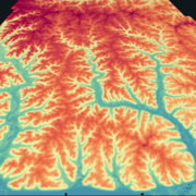
Geospatial Data Supported by Supplemental Appropriations for Disaster Recovery Activities
Geospatial Data supported by Supplemental Appropriations for Disaster Recovery Activities.

Developing General Coastal Vegetation Maps for Coastal Morphodynamic Models
The USGS is collaborating with researchers from other agencies, academia, and industry to predict coastal impacts from hurricanes. The results from this study will better inform coastal morphological change models, which will lead to improved hurricane impact projections.

A National Topographic Change Mapping and Monitoring System
The three-dimensional (3D) form of the Earth’s surface results from both abiotic and biotic forces. Major abiotic forces, such as tectonic uplift, erosion, and climate, exert strong influence over land surface morphology. Biotic forces, including, significantly, humans, also shape the landscape, but often at different temporal and spatial scales and magnitudes than geologic forces...

Evaluation and testing of standardized forest vegetation metrics derived from lidar data
The USGS 3D Elevation Program (3DEP) is managing the acquisition of lidar data across the Nation for high resolution mapping of the land surface, useful for multiple applications. Lidar data is initially collected as 3-dimensional “point clouds” that map the interaction of the airborne laser with earth surface features, including vegetation, buildings, and ground features. Generally the...
Science and Products
Geospatial Data Supported by Supplemental Appropriations for Disaster Recovery Activities
Geospatial Data supported by Supplemental Appropriations for Disaster Recovery Activities.
Developing General Coastal Vegetation Maps for Coastal Morphodynamic Models
The USGS is collaborating with researchers from other agencies, academia, and industry to predict coastal impacts from hurricanes. The results from this study will better inform coastal morphological change models, which will lead to improved hurricane impact projections.
A National Topographic Change Mapping and Monitoring System
The three-dimensional (3D) form of the Earth’s surface results from both abiotic and biotic forces. Major abiotic forces, such as tectonic uplift, erosion, and climate, exert strong influence over land surface morphology. Biotic forces, including, significantly, humans, also shape the landscape, but often at different temporal and spatial scales and magnitudes than geologic forces...
Evaluation and testing of standardized forest vegetation metrics derived from lidar data
The USGS 3D Elevation Program (3DEP) is managing the acquisition of lidar data across the Nation for high resolution mapping of the land surface, useful for multiple applications. Lidar data is initially collected as 3-dimensional “point clouds” that map the interaction of the airborne laser with earth surface features, including vegetation, buildings, and ground features. Generally the...
*Disclaimer: Listing outside positions with professional scientific organizations on this Staff Profile are for informational purposes only and do not constitute an endorsement of those professional scientific organizations or their activities by the USGS, Department of the Interior, or U.S. Government