
Jeff P Raffensperger, Ph.D. (Former Employee)
Science and Products

Modeling Capabilities @ MD-DE-DC
USGS models are widely used to predict responses of hydrologic systems to changing stresses, such as increases in precipitation or ground-water pumping rates, as well as to predict the fate and movement of solutes and contaminants in water. The USGS is at the forefront of devising new techniques and computer software to solve practical problems in the study of water resources. Predictive models...

Coding and Statistical Data Capabilities @ MD-DE-DC
This site is dedicated to Coding and Statistical Data that is produced and analyzed by scientists at the MD-DE-DC WSC. We use many tools at the USGS including software exclusively developed for, sometimes written by the USGS.
Groundwater Capabilities at MD-DE-DC
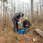
Our region's water supply comes from streams and rivers, groundwater, and reservoirs. Areas not served by public-water supply rely on groundwater withdrawn from fractured rock aquifers in western Maryland, or surficial (water table) and confined aquifers within the Atlantic Coastal Plain Aquifer System in Maryland, Delaware, and Washington, D.C. The MD-DE-DC WSC collects data from about 400...

USGS-Chesapeake Bay Program Watershed Model
The USGS is collaborating with the Chesapeake Bay Program (CBP) to incorporate the USGS Potomac Watershed and Chesapeake Bay Virginia Watershed models into Phase 5 of the Chesapeake Bay Watershed Model (CBWM).
Science and Products
Modeling Capabilities @ MD-DE-DC
USGS models are widely used to predict responses of hydrologic systems to changing stresses, such as increases in precipitation or ground-water pumping rates, as well as to predict the fate and movement of solutes and contaminants in water. The USGS is at the forefront of devising new techniques and computer software to solve practical problems in the study of water resources. Predictive models...
Coding and Statistical Data Capabilities @ MD-DE-DC
This site is dedicated to Coding and Statistical Data that is produced and analyzed by scientists at the MD-DE-DC WSC. We use many tools at the USGS including software exclusively developed for, sometimes written by the USGS.
Groundwater Capabilities at MD-DE-DC
Our region's water supply comes from streams and rivers, groundwater, and reservoirs. Areas not served by public-water supply rely on groundwater withdrawn from fractured rock aquifers in western Maryland, or surficial (water table) and confined aquifers within the Atlantic Coastal Plain Aquifer System in Maryland, Delaware, and Washington, D.C. The MD-DE-DC WSC collects data from about 400...
USGS-Chesapeake Bay Program Watershed Model
The USGS is collaborating with the Chesapeake Bay Program (CBP) to incorporate the USGS Potomac Watershed and Chesapeake Bay Virginia Watershed models into Phase 5 of the Chesapeake Bay Watershed Model (CBWM).