
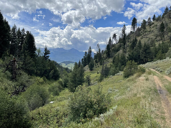
Bison waiting by field technician's truck after a sample collection in Montana.
Lisa McKeon (Former Employee)
Science and Products
Filter Total Items: 63

Grinnell Glacier 1938-2019
USGS employees have taken photos of Grinnell Glacier from this vantage point many times since beginning the Repeat Photography Project in 1997. Each successive photo has shown the glacier to be smaller resulting in the growth of Upper Grinnell Lake. Image Use Most of the repeat photography images available on this website are in the public domain and may be reproduced without permission. Images...

Jackson Glacier 1941-2019
This vantage point of Jackson Glacier is familiar to many visitors who stop along Going to the Sun Road to view the glacier. These images are particularly descriptive of the change in the glacier's size because both images show the glacier without much seasonal snow, allowing for a more accurate assessment of the glacier's true size. Image Use Most of the repeat photography images available on...

Kintla Glacier 1901-2019
In the 118 years between photos, Kintla Glacier has receded into much smaller, distinct patches. Image Use Most of the repeat photography images available on this website are in the public domain and may be reproduced without permission. Images with restrictions are noted below the downloadable image. Please respect the photographer: When using these photographs, please credit the photographer and...

Grinnell Glacier from Mount Gould, 1938 - 1981 - 1998 - 2015
Oblique view of Grinnell Glacier taken from the summit of Mount Gould, Glacier National Park. The relative sensitivity of glaciers to climate change is illustrated by the dramatic recession of Grinnell Glacier while surrounding vegetation patterns remain stable. Image Use Most of the repeat photography images available on this website are in the public domain and may be reproduced without...

Grinnell Ridge, Gem & Salamander Glaciers 1910 - 2017
In 1910, Morton Elrod documented how Grinnell Glacier’s mass filled the basin and how the glacier was then joined with the ice apron we now call the Salamander (right). Close inspection of Gem Glacier (top-center) reveals a loss of thickness / volume over the past 107 years as well. Image Use Most of the repeat photography images available on this website are in the public domain and may be...

Grinnell Glacier 1938 - 2016
Notice the man standing on the glacier in the center of the historic photograph. The figure lends a frame of reference to the photo pair, allowing the viewer to more easily interpret the depth of ice and the loss of volume when compared to the 2016 image.

Grinnell Glacier 1911 - 2016
The historic image shows how the upper bench of ice flowed into the main body of Grinnell Glacier. By the early 1920s, the glacier’s volume had been reduced to the point that the two pieces became disconnected. The upper bench, considered a separate glacier, was later renamed The Salamander Glacier for its salamander-like profile against the headwall. The Continental Divide runs along the ridge...

Grinnell Glacier, circa 1888-2016
This historic image is one of the oldest images re-photographed among the collection. The massive wall of ice that constituted the terminus of Grinnell Glacier has receded beyond view from this point. Each summer thousands of hikers take the well-worn trail to be rewarded with the sight of the remnant Grinnell Glacier and Upper Grinnell Lake. Image Use Most of the repeat photography images...

Time Series of Glacier Retreat
The retreat of glaciers (see PDF at end of page) in Glacier National Park, Montana, has received widespread attention by the media, the public, and scientists because it is a clear and poignant indicator of change in the northern Rocky Mountains of the USA. In 2017, the USGS and Portland State University released a dataset which describes the areas of the 37 named glaciers in Glacier National Park...

Climate Change in Mountain Ecosystems (CCME)
Climate change is widely acknowledged to have a profound effect on the biosphere and cryosphere with many and diverse impacts on global resources. Mountain ecosystems in the western U.S., and the U.S. Northern Rocky Mountains in particular, are highly sensitive to climate change. Warming in western Montana is nearly 2 times greater than the rise in global temperatures over the last 100+ years...

Vegetation - Hidden Lake (b)
Alpine regions along the shores of Hidden Lake (1943 m) show tremendous expansion of vegetation in this photo comparison, especially at the base of Bearhat Mountain.

Vegetation - Sperry Glacier
This view of the northeast portion of Sperry Glacier shows evidence of the glacier's recession as well as the advancement of conifer species and other vegetation on the glacial moraines.

Bison by sampler parking area
Bison waiting by field technician's truck after a sample collection in Montana.

eDNA sampler filter with turbid sample
A filter from the Smith-Root sampler that collects eDNA when water is pushed through. This pattern is indicative of turbid water passing through the filter.
A filter from the Smith-Root sampler that collects eDNA when water is pushed through. This pattern is indicative of turbid water passing through the filter.
Robotic sampler deployed streamside at Flying D Ranch
Robotic sampler deployed streamside at Flying D RanchAn autonomous sampler (white box) is visible alongside a stream site in Montana
Robotic sampler deployed streamside at Flying D Ranch
Robotic sampler deployed streamside at Flying D RanchAn autonomous sampler (white box) is visible alongside a stream site in Montana

Getting the Shot
USGS scientist shoots a repeat photograph of Grinnell Glacier in Glacier National Park to illustrate glacial recession due to impacts of climate change.
USGS scientist shoots a repeat photograph of Grinnell Glacier in Glacier National Park to illustrate glacial recession due to impacts of climate change.
Science and Products
Filter Total Items: 63
Grinnell Glacier 1938-2019
USGS employees have taken photos of Grinnell Glacier from this vantage point many times since beginning the Repeat Photography Project in 1997. Each successive photo has shown the glacier to be smaller resulting in the growth of Upper Grinnell Lake. Image Use Most of the repeat photography images available on this website are in the public domain and may be reproduced without permission. Images...
Jackson Glacier 1941-2019
This vantage point of Jackson Glacier is familiar to many visitors who stop along Going to the Sun Road to view the glacier. These images are particularly descriptive of the change in the glacier's size because both images show the glacier without much seasonal snow, allowing for a more accurate assessment of the glacier's true size. Image Use Most of the repeat photography images available on...
Kintla Glacier 1901-2019
In the 118 years between photos, Kintla Glacier has receded into much smaller, distinct patches. Image Use Most of the repeat photography images available on this website are in the public domain and may be reproduced without permission. Images with restrictions are noted below the downloadable image. Please respect the photographer: When using these photographs, please credit the photographer and...
Grinnell Glacier from Mount Gould, 1938 - 1981 - 1998 - 2015
Oblique view of Grinnell Glacier taken from the summit of Mount Gould, Glacier National Park. The relative sensitivity of glaciers to climate change is illustrated by the dramatic recession of Grinnell Glacier while surrounding vegetation patterns remain stable. Image Use Most of the repeat photography images available on this website are in the public domain and may be reproduced without...
Grinnell Ridge, Gem & Salamander Glaciers 1910 - 2017
In 1910, Morton Elrod documented how Grinnell Glacier’s mass filled the basin and how the glacier was then joined with the ice apron we now call the Salamander (right). Close inspection of Gem Glacier (top-center) reveals a loss of thickness / volume over the past 107 years as well. Image Use Most of the repeat photography images available on this website are in the public domain and may be...
Grinnell Glacier 1938 - 2016
Notice the man standing on the glacier in the center of the historic photograph. The figure lends a frame of reference to the photo pair, allowing the viewer to more easily interpret the depth of ice and the loss of volume when compared to the 2016 image.
Grinnell Glacier 1911 - 2016
The historic image shows how the upper bench of ice flowed into the main body of Grinnell Glacier. By the early 1920s, the glacier’s volume had been reduced to the point that the two pieces became disconnected. The upper bench, considered a separate glacier, was later renamed The Salamander Glacier for its salamander-like profile against the headwall. The Continental Divide runs along the ridge...
Grinnell Glacier, circa 1888-2016
This historic image is one of the oldest images re-photographed among the collection. The massive wall of ice that constituted the terminus of Grinnell Glacier has receded beyond view from this point. Each summer thousands of hikers take the well-worn trail to be rewarded with the sight of the remnant Grinnell Glacier and Upper Grinnell Lake. Image Use Most of the repeat photography images...
Time Series of Glacier Retreat
The retreat of glaciers (see PDF at end of page) in Glacier National Park, Montana, has received widespread attention by the media, the public, and scientists because it is a clear and poignant indicator of change in the northern Rocky Mountains of the USA. In 2017, the USGS and Portland State University released a dataset which describes the areas of the 37 named glaciers in Glacier National Park...
Climate Change in Mountain Ecosystems (CCME)
Climate change is widely acknowledged to have a profound effect on the biosphere and cryosphere with many and diverse impacts on global resources. Mountain ecosystems in the western U.S., and the U.S. Northern Rocky Mountains in particular, are highly sensitive to climate change. Warming in western Montana is nearly 2 times greater than the rise in global temperatures over the last 100+ years...
Vegetation - Hidden Lake (b)
Alpine regions along the shores of Hidden Lake (1943 m) show tremendous expansion of vegetation in this photo comparison, especially at the base of Bearhat Mountain.
Vegetation - Sperry Glacier
This view of the northeast portion of Sperry Glacier shows evidence of the glacier's recession as well as the advancement of conifer species and other vegetation on the glacial moraines.
Bison by sampler parking area
Bison waiting by field technician's truck after a sample collection in Montana.
Bison waiting by field technician's truck after a sample collection in Montana.
eDNA sampler filter with turbid sample
A filter from the Smith-Root sampler that collects eDNA when water is pushed through. This pattern is indicative of turbid water passing through the filter.
A filter from the Smith-Root sampler that collects eDNA when water is pushed through. This pattern is indicative of turbid water passing through the filter.
Robotic sampler deployed streamside at Flying D Ranch
Robotic sampler deployed streamside at Flying D RanchAn autonomous sampler (white box) is visible alongside a stream site in Montana
Robotic sampler deployed streamside at Flying D Ranch
Robotic sampler deployed streamside at Flying D RanchAn autonomous sampler (white box) is visible alongside a stream site in Montana
Getting the Shot
USGS scientist shoots a repeat photograph of Grinnell Glacier in Glacier National Park to illustrate glacial recession due to impacts of climate change.
USGS scientist shoots a repeat photograph of Grinnell Glacier in Glacier National Park to illustrate glacial recession due to impacts of climate change.