Marie Allison Zuck is a hydrologic technician, New York Water Science Center.
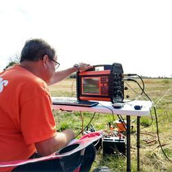
Marie Allison Zuck is a hydrologic technician with the US Geological Survey, New York Water Science Center, responsible for making Time domain electromagnetic (TDEM) surveys to provide soundings of subsurface bulk resistivity, Estimating the depth to bedrock using horizontal to vertical (H/V) ambient-noise seismic measurements, recording routine measurements of water level elevations at observations wells; data base management, well maintenance and leveling, storm sensor deployment/recovery and processing the collected storm surge data, as well as making measurements of stream flow and assisting in the collection of water quality samples.
Project Webpages
Surge, Wave, and Tide Hydrodynamics (SWaTH) Network
http://water.usgs.gov/floods/swath/
Groundwater Monitoring on Long Island and New York City
http://ny.water.usgs.gov/projects/LI_PRJ/
Surface-Water Information and Data
http://ny.water.usgs.gov/infodata/surfacewater.html
Annual Water-Data Reports
http://wdr.water.usgs.gov/
http://ny.water.usgs.gov/htmls/pub/data.html
Professional Experience
A hydrologic technician with the US Geological Survey, New York Water Science Center,
Education and Certifications
Hofstra University, Garden City, NY
B.A. in Geology, with Minor in Sustainability Studies and Fine Arts
Science and Products
Delineation of the freshwater-saltwater interface on southwestern Long Island, New York, through use of surface and borehole geophysical methods
Use of time domain electromagnetic soundings and borehole electromagnetic induction logs to delineate the freshwater/saltwater interface on southwestern Long Island, New York, 2015–17
Surge, Wave, and Tide Hydrodynamics (SWaTH) Network
Current Water Conditions in New York
Saltwater-Interface Mapping - Long Island, New York
Hydrogeologic-Framework Mapping - Long Island, New York
Groundwater Monitoring on Long Island, New York and the Five Boroughs of New York City
Time-domain Electromagnetic Soundings to Estimate the Extent of Saltwater Intrusion on Shelter Island, New York (2017-2018)
Time Domain Electromagnetic Surveys Collected to Estimate the Extent of Saltwater Intrusion in Nassau and Queens County, New York, October-November 2017
Annual Water Data Reports for New York
Water resources data are published annually for use by engineers, scientists, managers, educators, and the general public. Annual Water Data Reports and Discontinued Sites for New York :
Annual Water Data Reports
Annual Water Data Reports were published annually for many decades as static archival products that supplemented direct access to current and historical water data provided by the National Water Information System (NWIS). This site helps users access historical Water Data Reports, electronic Site Data Sheets, or current on-demand, print-ready Water-Year Summaries.
Science and Products
- Publications
Delineation of the freshwater-saltwater interface on southwestern Long Island, New York, through use of surface and borehole geophysical methods
The U.S. Geological Survey used surface and borehole geophysical methods to delineate the freshwater-saltwater interface in coastal plain aquifers along the southwestern part of Long Island, New York. Over pumping of groundwater in the early 20th century combined with freshwater-saltwater interfaces at the coastline created saltwater intrusion in the upper glacial, Jameco, Magothy, and Lloyd aquifUse of time domain electromagnetic soundings and borehole electromagnetic induction logs to delineate the freshwater/saltwater interface on southwestern Long Island, New York, 2015–17
The U.S. Geological Survey, in cooperation with the New York State Department of Environmental Conservation, used surface and borehole geophysical methods to delineate the freshwater/saltwater interface in coastal plain aquifers along the southwestern part of Long Island, New York. Over pumping of groundwater in the early 20th century combined with freshwater/saltwater interfaces at the coastline - Science
Surge, Wave, and Tide Hydrodynamics (SWaTH) Network
During large coastal storms, the storm surge and waves are the main cause of destruction and landscape change, transporting saline water, sediment, and debris inland. The USGS, in collaboration with stakeholders, has constructed a national Surge, Wave, and Tide Hydrodynamics (SWaTH) Network for the Atlantic, Eastern Pacific, and Central Pacific. SWaTH monitors and documents the height, extent, and...Current Water Conditions in New York
• National Water Information System (NWIS): Find water-resources data collected at approximately 1.5 million sites, using menu-based and map-based front ends. • WaterWatch: View maps, graphs, and tables describing real-time, recent, and past streamflow conditions for the United States.Saltwater-Interface Mapping - Long Island, New York
HomeSaltwater intrusion is the most common type of water-quality degradation in coastal-plain aquifers. In coastal areas, the hydraulic head under predevelopment (nonpumping) conditions is higher on land than in the surrounding saltwater embayments; thus, fresh groundwater flows seaward (from areas of high potential to areas of lower potential) and meets saltwater at an equilibrium point...Hydrogeologic-Framework Mapping - Long Island, New York
HomeLong Island is underlain by unconsolidated Holocene deposits, glacial deposits of Pleistocene age, and coastal-plain deposits of Late Cretaceous age. These sediments consist of gravel, sand, silt, and clay underlain by crystalline bedrock of early Paleozoic age (fig. 1). The bedrock is relatively impermeable, and forms the base of the groundwater-flow system on Long Island. The geologic and...Groundwater Monitoring on Long Island, New York and the Five Boroughs of New York City
The groundwater data-collection network of the USGS New York Water Science Center, Coram Program Office encompasses data collection from approximately 600 groundwater-monitoring wells on Long Island and in the five boroughs of New York City. Data from these stations are collected in varying frequencies to supply our cooperators, stakeholders, and the public with mission critical information. - Data
Time-domain Electromagnetic Soundings to Estimate the Extent of Saltwater Intrusion on Shelter Island, New York (2017-2018)
Twenty-six time-domain electromagnetic (TDEM) soundings were collected on Shelter Island, New York between March of 2017 and October of 2018. Soundings were collected using the Geonics ProTEM and ABEM WalkTEM acquisition systems. Depending on the size of the site, one of the following square-loop transmitter geometries was used: 1) 20 by 20 meter, 2) 40 by 40 meter, or 3) 100 by 100 meter. A highTime Domain Electromagnetic Surveys Collected to Estimate the Extent of Saltwater Intrusion in Nassau and Queens County, New York, October-November 2017
During October-November 2017 twelve time domain electromagnetic (TDEM) surveys were collected in Nassau and Queens County. The data were collected to estimate the extent of saltwater intrusion in support of the Long Island Groundwater Sustainability Project in cooperation with the New York State Department of Environmental Conservation. In the TDEM method, an electrical current is run through a wAnnual Water Data Reports for New York
Water resources data are published annually for use by engineers, scientists, managers, educators, and the general public. Annual Water Data Reports and Discontinued Sites for New York :
- Web Tools
Annual Water Data Reports
Annual Water Data Reports were published annually for many decades as static archival products that supplemented direct access to current and historical water data provided by the National Water Information System (NWIS). This site helps users access historical Water Data Reports, electronic Site Data Sheets, or current on-demand, print-ready Water-Year Summaries.