
A female cactus ferruginous pygmy-owl (Glaucidium brasilianum cactorum) in N. Sonora, Mexico, June 2022. Photo by Aaron Flesch, University of Arizona, Tucson, used with permission by USGS.
Pamela Nagler, Ph.D.
Expertise: Remote sensing applications in ecohydrology with a focus on scaling ground-based evapotranspiration (water use) measurements of plants in riparian ecosystems, their uplands and adjacent agriculture fields. Applications include mapping vegetation communities and phenological change in the Sonoran and Mojave Deserts and the transboundary region of northwestern Mexico and southwestern U.S.
Dr. Pamela Nagler’s interest in landscapes developed naturally through her experiences with a variety of lands and cultures throughout her early years. She first worked with USGS as a hydrological technician with the Water Resources Division, mentored by Drs. Jake Peters and Jamie Shanley. After obtaining a B.S. in Geography, Pamela interned with the late Barry Bishop (a member of the first American team to reach the summit of Mount Everest in 1963) at the National Geographic Society in Washington DC, where she was greatly influenced to pursue her passion for geography as a career. She then worked for the Solid Waste Division of the EPA followed by a couple of years with the Defense Mapping Agency. At the University of Maryland at College Park, Pamela earned an M.A. in Geography with an emphasis on Land Remote Sensing; her Advisor, Dr. Sam Goward, served as the Landsat Science Team Leader from 1992 and completed Landsat’s Enduring Legacy: 50 years in 2017. As his mentee, she gained experience and skills needed to address environmental applications using remote sensing tools. During her Master’s program, Pamela had a research assistantship with the USDA Agriculture Research Service under the guidance of Dr. Craig Daughtry, and helped develop techniques using hyperspectral data to distinguish soil from litter in the landscape. Pamela continued this research in Japan with a fellowship sponsored by NSF. Dr. Yoshio Inoue, her academic host at the Japan National Institute of Agro-Environmental Studies in 1996-1997, encouraged Pamela to return to the US to continue her academic studies. Pamela spent time in ten Asian countries before starting her Ph.D. research with Dr. Alfredo Huete at the University of Arizona in Tucson, AZ. Pamela's dissertation research used remote sensing tools to study environmental applications in the Colorado River delta in Mexico and her post-doctoral work with Dr. Edward Glenn was funded through a NASA grant. With direction from Ed Glenn, she studied seaweed productivity while living in Molokai, Hawaii, phytoremediation at DOE Legacy Mine sites on Navajo Nation near Monument Valley, and conservation and policy of the Colorado River Delta in the Borderlands of the U.S. and Mexico. Pamela received a PECASE Award at the White House with POTUS Obama in 2010, became a Kavli Fellow with the Academy of Sciences in 2011, and was internationally recognized by CSIRO in 2013. Pamela spent a year at CSIRO in their Land and Water Division in Adelaide, South Australia. Pamela serves students in three departments at the University of Arizona, including SNRE, SWES and more recently, Biosystems Engineering. She also serves on three journal Editorial Boards and as a Board Member of the FWS Sonoran Joint Venture.
Science and Products

Measuring Water Requirements Of Riparian Regions in the Southwestern U.S. Compared with Drylands in Australia
Floodplain red gum forests are sites of high biodiversity in arid regions of south Australia. They depend on periodic floods from rivers, but dams and diversions have reduced flood frequencies, leading to deterioration of the trees. We determined the water requirements of red gum trees so environmental flows can be used to restore and maintain the forests. We used measurements of transpiration of...

Using Imagery to Monitor Riparian and Upland Vegetation Along the San Pedro River, Arizona
The Upper San Pedro River is one of the few remaining undammed rivers that maintain a vibrant riparian ecosystem in the southwest. However, its riparian forest is threatened by diminishing groundwater and surface water inputs, due to either changes in watershed characteristics such as changes in riparian and upland vegetation, or human activities such as regional groundwater pumping. We used...

Global Croplands and Their Water Use for Food Security in the Twenty-first Century
Global climate change is putting unprecedented pressure on global croplands and their water use, vital for ensuring future food security for the world's rapidly expanding human population. The end of the green green revolution (productivity per unit of land) era has meant declining global per capita agricultural production requiring immediate policy responses to safeguard food security...

Cactus ferruginous pygmy-owl in N. Sonora, Mexico
A female cactus ferruginous pygmy-owl (Glaucidium brasilianum cactorum) in N. Sonora, Mexico, June 2022. Photo by Aaron Flesch, University of Arizona, Tucson, used with permission by USGS.
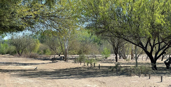
A restored riparian area in the lower Colorado River delta
A restored riparian area in the lower Colorado River deltaA roadrunner runs through a riparian area in the lower Colorado River delta. The area was restored with water from Minute 323 flows, a US/Mexico binational agreement water treaty. Photo courtesy of Neda Abbasi, University of Arizona.

A single species stand of nonnative tamarisk
Single species stand of nonnative tamarisk on the Lower Colorado River at Cibola National Wildlife Refuge, California
Single species stand of nonnative tamarisk on the Lower Colorado River at Cibola National Wildlife Refuge, California
Science and Products
Measuring Water Requirements Of Riparian Regions in the Southwestern U.S. Compared with Drylands in Australia
Floodplain red gum forests are sites of high biodiversity in arid regions of south Australia. They depend on periodic floods from rivers, but dams and diversions have reduced flood frequencies, leading to deterioration of the trees. We determined the water requirements of red gum trees so environmental flows can be used to restore and maintain the forests. We used measurements of transpiration of...
Using Imagery to Monitor Riparian and Upland Vegetation Along the San Pedro River, Arizona
The Upper San Pedro River is one of the few remaining undammed rivers that maintain a vibrant riparian ecosystem in the southwest. However, its riparian forest is threatened by diminishing groundwater and surface water inputs, due to either changes in watershed characteristics such as changes in riparian and upland vegetation, or human activities such as regional groundwater pumping. We used...
Global Croplands and Their Water Use for Food Security in the Twenty-first Century
Global climate change is putting unprecedented pressure on global croplands and their water use, vital for ensuring future food security for the world's rapidly expanding human population. The end of the green green revolution (productivity per unit of land) era has meant declining global per capita agricultural production requiring immediate policy responses to safeguard food security...
Cactus ferruginous pygmy-owl in N. Sonora, Mexico
A female cactus ferruginous pygmy-owl (Glaucidium brasilianum cactorum) in N. Sonora, Mexico, June 2022. Photo by Aaron Flesch, University of Arizona, Tucson, used with permission by USGS.
A female cactus ferruginous pygmy-owl (Glaucidium brasilianum cactorum) in N. Sonora, Mexico, June 2022. Photo by Aaron Flesch, University of Arizona, Tucson, used with permission by USGS.
A restored riparian area in the lower Colorado River delta
A restored riparian area in the lower Colorado River deltaA roadrunner runs through a riparian area in the lower Colorado River delta. The area was restored with water from Minute 323 flows, a US/Mexico binational agreement water treaty. Photo courtesy of Neda Abbasi, University of Arizona.
A single species stand of nonnative tamarisk
Single species stand of nonnative tamarisk on the Lower Colorado River at Cibola National Wildlife Refuge, California
Single species stand of nonnative tamarisk on the Lower Colorado River at Cibola National Wildlife Refuge, California