The Department of the Interior (DOI) and U.S. Geological Survey (USGS) took an interest in uncrewed aircraft system (UAS) technologies in the early 2000s, when UAS were predominantly being used for military applications.
Victoria M Scholl
(she/her)Victoria Scholl is a Physical Scientist at the National Unmanned Aircraft Systems Project Office in the Geosciences and Environmental Change Science Center.
Victoria is a Physical Scientist with a background in imaging science. As a member of the USGS National Uncrewed Systems Office, she is a DOI-certified UAS remote pilot who collects, processes, and analyzes geospatial remote sensing data in support of diverse environmental research applications. Victoria has published research in peer-reviewed journals and is a proponent of open, reproducible science and science communication.
Professional Experience
Physical Scientist, U.S. Geological Survey (2021 - Present)
Data Analyst & Field Assistant intern, U.S. Geological Survey (2018 - 2021)
Education and Certifications
M.A. in Geography (2019) University of Colorado at Boulder
B.S. in Imaging Science (2016) Rochester Institute of Technology
Science and Products
National Uncrewed Systems Office
Hyperspectral image transects and field measurements of reflectance, visible dye concentration, and flow velocity acquired during a tracer experiment on the Missouri River near Lexington, MO, on May 11, 2024
Spectral reflectance measurements of standard reference materials in laboratory setting using an Analytical Spectral Devices (ASD) FieldSpec® 4 Hi-Res and Ocean Optics OCEAN-HDX-VIS-NIR® (HDX), suitable for comparison to other spectroradiometer measuremen
Uncrewed Aircraft Systems (UAS) natural color, multispectral, lidar, and hyperspectral remote sensing data products collected at dryland sites 40 km south of Moab, Utah in May 2023
Topographic and multispectral reflectance products, aerial imagery, ground spectra, vegetation, and associated GPS data collected during uncrewed aircraft system operations - Dog Head Marsh at South Cape Beach, Mashpee, MA, October 7-8, 2021
Spectral reflectance measurements of radiometric calibration panels for UAS image calibration
The Department of the Interior (DOI) and U.S. Geological Survey (USGS) took an interest in uncrewed aircraft system (UAS) technologies in the early 2000s, when UAS were predominantly being used for military applications.
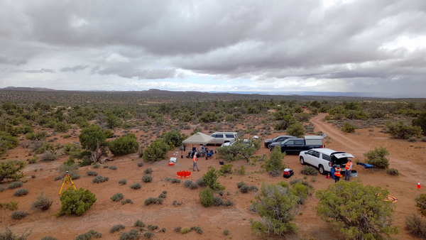
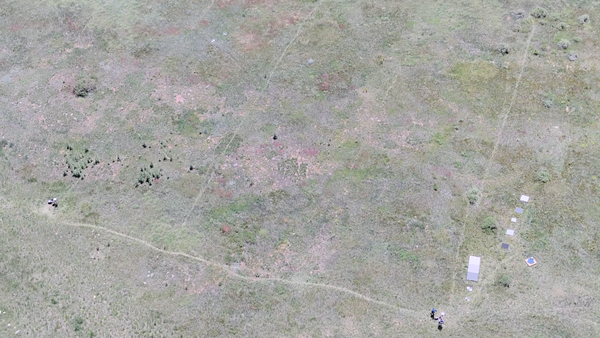
In support of U.S. Geological Survey (USGS) Southwest Biological Science Center research, the USGS National Uncrewed Systems Office (NUSO) conducted uncrewed aircraft systems (UAS) remote sensing flights near Moab, Utah in May 2023 for multi-scale carbon sequestration research on public lands.
As permafrost soils in the Arctic warm and thaw, greenhouse gases including methane are released into the atmosphere. USGS Ecologist Kristen Manies of the USGS Geology, Minerals, Energy, and Geophysics Science Center (GMEGSC) is researching low-cost ways to measure methane emissions across these changing ecosystems.
In August 2023, the USGS National Uncrewed Systems Office (NUSO) participated in a collaborative field campaign to collect remote sensing data over agricultural crop fields in California's Central Valley.
Collaborators Kristen Manies (Geology, Minerals, Energy, and Geophysics Science Center), Joe Adams (National Uncrewed Systems Office, NUSO), Victoria Scholl (NUSO), Brian Gullett U.S.
USGS researchers teamed up for a biological soil crust (biocrust) remote sensing and field data campaign near Moab, Utah in February of 2022.
Permafrost is ground that has been frozen for at least two years. With the warming climate, permafrost across Alaska is thawing and greenhouse gases such as methane are released as a result. Ecologist Kristen Manies of the U.S.
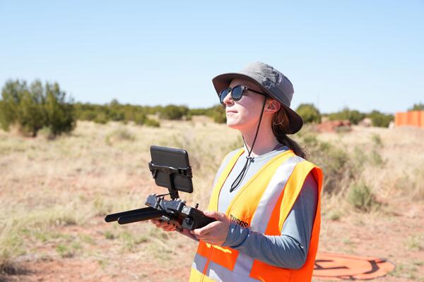
Victoria Scholl, USGS Physical Scientist. A photo shows USGS scientist Victoria Scholl smiling off to the right of the photographer. Victoria stands in front of a gravel parking lot with mountains in the background. Victoria is using an iPad and controller to pilot a drone. Victoria wears a brimmed-hat, sunglasses, and a grey T-shirt.
Victoria Scholl, USGS Physical Scientist. This graphic shows a quote from Victoria’s narrative. It reads: “My background is in imaging science: the capture, processing, display, and analysis of imagery.“ Yellow quotation marks bookend her quote.
Victoria works on the USGS UAS equipment. Victoria is crouched down in the snow, working on the USGS drone. The drone is black with yellow accents. Victoria is wearing dark snowgear and a ballcap. Snow covers the foreground. In the distant background, snowy mountains and a few evergreen trees dot the landscape.
Hyperspectral Image Transects during Transient Events in Rivers (HITTER): Framework development and application to a tracer experiment on the Missouri River, USA
Guidelines for calibration of uncrewed aircraft systems imagery
Democratizing macroecology: Integrating unoccupied aerial systems with the National Ecological Observatory Network
Science and Products
National Uncrewed Systems Office
Hyperspectral image transects and field measurements of reflectance, visible dye concentration, and flow velocity acquired during a tracer experiment on the Missouri River near Lexington, MO, on May 11, 2024
Spectral reflectance measurements of standard reference materials in laboratory setting using an Analytical Spectral Devices (ASD) FieldSpec® 4 Hi-Res and Ocean Optics OCEAN-HDX-VIS-NIR® (HDX), suitable for comparison to other spectroradiometer measuremen
Uncrewed Aircraft Systems (UAS) natural color, multispectral, lidar, and hyperspectral remote sensing data products collected at dryland sites 40 km south of Moab, Utah in May 2023
Topographic and multispectral reflectance products, aerial imagery, ground spectra, vegetation, and associated GPS data collected during uncrewed aircraft system operations - Dog Head Marsh at South Cape Beach, Mashpee, MA, October 7-8, 2021
Spectral reflectance measurements of radiometric calibration panels for UAS image calibration
The Department of the Interior (DOI) and U.S. Geological Survey (USGS) took an interest in uncrewed aircraft system (UAS) technologies in the early 2000s, when UAS were predominantly being used for military applications.
In support of U.S. Geological Survey (USGS) Southwest Biological Science Center research, the USGS National Uncrewed Systems Office (NUSO) conducted uncrewed aircraft systems (UAS) remote sensing flights near Moab, Utah in May 2023 for multi-scale carbon sequestration research on public lands.
As permafrost soils in the Arctic warm and thaw, greenhouse gases including methane are released into the atmosphere. USGS Ecologist Kristen Manies of the USGS Geology, Minerals, Energy, and Geophysics Science Center (GMEGSC) is researching low-cost ways to measure methane emissions across these changing ecosystems.
In August 2023, the USGS National Uncrewed Systems Office (NUSO) participated in a collaborative field campaign to collect remote sensing data over agricultural crop fields in California's Central Valley.
Collaborators Kristen Manies (Geology, Minerals, Energy, and Geophysics Science Center), Joe Adams (National Uncrewed Systems Office, NUSO), Victoria Scholl (NUSO), Brian Gullett U.S.
USGS researchers teamed up for a biological soil crust (biocrust) remote sensing and field data campaign near Moab, Utah in February of 2022.
Permafrost is ground that has been frozen for at least two years. With the warming climate, permafrost across Alaska is thawing and greenhouse gases such as methane are released as a result. Ecologist Kristen Manies of the U.S.
Victoria Scholl, USGS Physical Scientist. A photo shows USGS scientist Victoria Scholl smiling off to the right of the photographer. Victoria stands in front of a gravel parking lot with mountains in the background. Victoria is using an iPad and controller to pilot a drone. Victoria wears a brimmed-hat, sunglasses, and a grey T-shirt.
Victoria Scholl, USGS Physical Scientist. This graphic shows a quote from Victoria’s narrative. It reads: “My background is in imaging science: the capture, processing, display, and analysis of imagery.“ Yellow quotation marks bookend her quote.
Victoria works on the USGS UAS equipment. Victoria is crouched down in the snow, working on the USGS drone. The drone is black with yellow accents. Victoria is wearing dark snowgear and a ballcap. Snow covers the foreground. In the distant background, snowy mountains and a few evergreen trees dot the landscape.