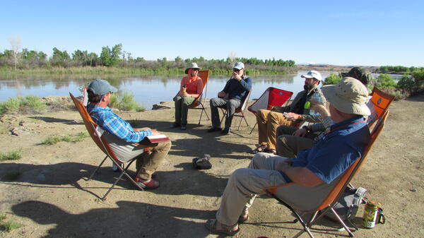
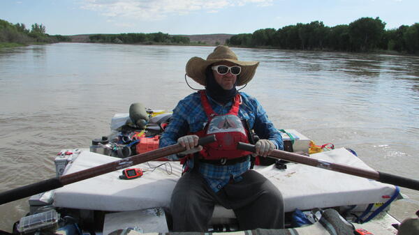
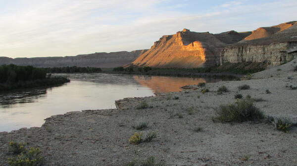
William C Burton is a Scientist Emeritus at the Florence Bascom Geoscience Center.
Professional Studies/Experience
- Bedrock mapping, western Connecticut (2016-). Detailed bedrock mapping of two 7.5-minute quadrangles in western CT highlands in response to elevated U levels in domestic water wells and ground-water supply and quality in local watershed. Includes complexly deformed Paleozoic plutonic and metamorphic rocks affected by Taconic and Acadian orogenies, plus early Mesozoic sedimentary/volcanic rift basin. Logistical support from CT Geological Survey and Pomperaug River Watershed Coalition.
- Bedrock mapping, southern Virginia (2018-). Detailed mapping of two 7.5-minute quadrangles as an eastern continuation of USGS mapping of Mt. Rogers National Recreation Area. Includes Mesoproterozoic and Neoproterozoic plutonic, metasedimentary, and metavolcanic rocks.
- Volcano hazard monitoring, USGS Volcano Hazards Program. Analyzes incoming remote-sensing data from active volcanic regions, both domestic and international, as part of a USGS volcano monitoring team, and advises on the trend and timing of eruptive activity. Three major monitored eruptions in 2018 that impacted thousands of people include Fuego in Guatemala and Merapi and Agung volcanoes in Indonesia.
- Bedrock mapping, Central VA Seismic Zone (2012-2018). One of a team of USGS, State, and University geologists that studied the Central Virginia Seismic Zone in the wake of the August, 2011 M5.8 earthquake near Mineral, Va. Detailed bedrock mapping of the epicentral region determined that the subsurface fault that triggered the earthquake may have reactivated an ancient contact between granite and schist. First author on one scientific paper and one field guide about the earthquake, and three 1:24,000-scale geologic maps. Coauthor on two 1:24,000-scale geologic maps and one scientific paper.
- Previous mapping and research (1983-2012). Bedrock geologic controls on flow, distribution, and chemistry of ground water; bedrock geologic mapping, geochronology, and structural analysis of complexly deformed orogenic belts; mapping and tectonic history of Neoproterozoic and Mesoproterozoic rocks. 1:12,000 to 1:50,000-scale analog and digital geologic mapping of complexly deformed Mesoproterozoic metamorphic and igneous rocks of the central and northern Appalachian mountains; Neoproterozoic metavolcanic and metasedimentary rocks of accreted terranes in the southern Appalachians; autochthonous Neoproterozoic through Ordovician metasedimentary and metavolcanic rocks of the southern, central and northern Appalachians; Silurian and Devonian metamorphic and igneous rocks of the northern Appalachians; Neoproterozoic to early Paleozoic volcanic, intrusive, and sedimentary rocks of the Jebel Saghro range, Morocco; Neoproterozoic intrusive, volcanic and sedimentary rocks of northern Madagascar; and clastic sediments and volcanics of the Early Mesozoic rift basins,
Science and Products
Database for the Geologic Map of the South Boston 30' x 60' Quadrangle, Virginia and North Carolina
Photoluminescence Imaging of Whole Zircon Grains on a Petrographic Microscope - An Underused Aide for Geochronologic Studies
Geologic map of the South Boston 30' × 60' quadrangle, Virginia and North Carolina
This 1:100,000-scale geologic map of the South Boston 30' × 60' quadrangle, Virginia and North Carolina, provides geologic information for the Piedmont along the I–85 and U.S. Route 58 corridors and in the Roanoke River watershed, which includes the John H. Kerr Reservoir and Lake Gaston. The Raleigh terrane (located on the eastern side of the map) contains Neoproterozoic to early Paleozoic(?) pol
Geologic map of the Ferncliff and Louisa quadrangles, Louisa, Fluvanna, and Goochland Counties, Virginia
Geologic Map of the Frederick 30' x 60' Quadrangle, Maryland, Virginia, and West Virginia
Bedrock Geologic Map of the Headwaters Region of the Cullasaja River, Macon and Jackson Counties, North Carolina
Geologic Map of Loudoun County, Virginia
Paleozoic and Mesozoic tectonic events west of the Waterbury Dome: Results of new mapping in the western Connecticut Highlands
Photoluminescence imaging of whole zircon grains on a petrographic microscope—An underused aide for geochronologic studies
The refractory nature of zircon to temperature and pressure allows even a single zircon grain to preserve a rich history of magmatic, metamorphic, and hydrothermal processes. Isotopic dating of micro-domains exposed in cross-sections of zircon grains allows us to interrogate this history. Unfortunately, our ability to select the zircon grains in a heavy mineral concentrate that records the most ge
Geochronologic age constraints on tectonostratigraphic units of the central Virginia Piedmont, USA
New geologic mapping coupled with uranium-lead (U-Pb) zircon geochronology (sensitive high-resolution ion microprobe-reverse geometry [SHRIMP-RG] and laser ablation-inductively coupled plasma-mass spectrometry [LA-ICP-MS]) analyses of 10 samples, provides new constraints on the tectonostratigraphic framework of the central Virginia Piedmont. Detrital zircon analysis confirms that the Silurian-Devo
Geology of the Mineral and Lake Anna West Quadrangles, Virginia
Preliminary bedrock geologic map of the Lahore 7.5-minute quadrangle, Orange, Spotsylvania, and Louisa Counties, Virginia
Geologic map of the Washington West 30’ × 60’ quadrangle, Maryland, Virginia, and Washington D.C.
Geology of the eastern Piedmont in Virginia
Geologic framework and evidence for neotectonism in the epicentral area of the 2011 Mineral, Virginia, earthquake
Geology and neotectonism in the epicentral area of the 2011 M5.8 Mineral, Virginia, earthquake
Subsurface geologic features of the 2011 central Virginia earthquakes revealed by airborne geophysics
Stitching the western Piedmont of Virginia: Early Paleozoic tectonic history of the Ellisville Pluton and the Potomac and Chopawamsic Terranes
Bedrock geologic and joint trend map of the Pinardville quadrangle, Hillsborough County, New Hampshire
Science and Products
- Data
Database for the Geologic Map of the South Boston 30' x 60' Quadrangle, Virginia and North Carolina
The 1:100,000-scale geologic map database of the South Boston 30' x 60' quadrangle, Virginia and North Carolina, provides geologic information for the Piedmont along the I-85 and U.S. Route 58 corridors and in the Roanoke River watershed, which includes the John H. Kerr Reservoir and Lake Gaston. The Raleigh terrane (located on the eastern side of the map) contains Neoproterozoic to early PaleozoiPhotoluminescence Imaging of Whole Zircon Grains on a Petrographic Microscope - An Underused Aide for Geochronologic Studies
The refractory nature of zircon to temperature and pressure allows even a single zircon grain to preserve a rich history of magmatic, metamorphic, and hydrothermal processes. Isotopic dating of micro-domains exposed in cross-sections of zircon grains allows us to interrogate this history. Unfortunately, our ability to select the zircon grains in a heavy mineral concentrate that records the most ge - Maps
Geologic map of the South Boston 30' × 60' quadrangle, Virginia and North Carolina
This 1:100,000-scale geologic map of the South Boston 30’ × 60’ quadrangle, Virginia and North Carolina, provides geologic information for the Piedmont along the I–85 and U.S. Route 58 corridors and in the Roanoke River watershed, which includes the John H. Kerr Reservoir and Lake Gaston. The Raleigh terrane (located on the eastern side of the map) contains Neoproterozoic to early Paleozoic(?) polGeologic map of the South Boston 30' × 60' quadrangle, Virginia and North Carolina
This 1:100,000-scale geologic map of the South Boston 30' × 60' quadrangle, Virginia and North Carolina, provides geologic information for the Piedmont along the I–85 and U.S. Route 58 corridors and in the Roanoke River watershed, which includes the John H. Kerr Reservoir and Lake Gaston. The Raleigh terrane (located on the eastern side of the map) contains Neoproterozoic to early Paleozoic(?) pol
Geologic map of the Ferncliff and Louisa quadrangles, Louisa, Fluvanna, and Goochland Counties, Virginia
The area encompassed by the geologic map of the Ferncliff and Louisa, Va., 7.5-minute quadrangles includes the hypothetical surface projection of the Quail fault, which is the subsurface fault that was responsible for the 2011 magnitude 5.8 (M5.8) Mineral, Va., earthquake. The mapping shows that the Quail fault appears to have reactivated the Harris Creek fault, a Paleozoic fault that has been mapGeologic Map of the Frederick 30' x 60' Quadrangle, Maryland, Virginia, and West Virginia
The Frederick 30? ? 60? quadrangle lies within the Potomac River watershed of the Chesapeake Bay drainage basin. The map area covers parts of Montgomery, Howard, Carroll, Frederick, and Washington Counties in Maryland; Loudoun, Clarke, and Fairfax Counties in Virginia; and Jefferson and Berkeley Counties in West Virginia. Many geologic features (such as faults and folds) are named for geographic fBedrock Geologic Map of the Headwaters Region of the Cullasaja River, Macon and Jackson Counties, North Carolina
The headwaters region of the Cullasaja River is underlain by metasedimentary and meta-igneous rocks of the Neoproterozoic Ashe Metamorphic Suite, including gneiss, schist, and amphibolite, that were intruded during Ordovician time by elongate bodies of trondhjemite, a felsic plutonic rock. Deformation, metamorphism, and intrusion occurred roughly simultaneously during the Taconic orogeny, about 47Geologic Map of Loudoun County, Virginia
Introduction The geology of Loudoun County, Va., was mapped from 1988 through 1991 under a cooperative agreement between the U.S. Geological Survey (USGS) and the Loudoun County Office of Mapping and Geographic Information. This geologic map was compiled in 1993 from a series of detailed published and unpublished field investigations at scales of 1:12,000 and 1:24,000. Some of these same data w - Multimedia
- Publications
Filter Total Items: 36
Paleozoic and Mesozoic tectonic events west of the Waterbury Dome: Results of new mapping in the western Connecticut Highlands
This field trip highlights the results of recent U.S. Geological Survey (USGS) bedrock geologic mapping in four 7.5 min quadrangles in the western Connecticut highlands near Southbury, Connecticut, USA. The rocks are broadly within what Rodgers (1985) called the Hartland and Gneiss Dome belts of the Connecticut Valley Synclinorium (Rodgers, 1985; Fig. 1), the latter of which is now known as the CoAuthorsWilliam C. Burton, William J. DevlinPhotoluminescence imaging of whole zircon grains on a petrographic microscope—An underused aide for geochronologic studies
The refractory nature of zircon to temperature and pressure allows even a single zircon grain to preserve a rich history of magmatic, metamorphic, and hydrothermal processes. Isotopic dating of micro-domains exposed in cross-sections of zircon grains allows us to interrogate this history. Unfortunately, our ability to select the zircon grains in a heavy mineral concentrate that records the most ge
AuthorsRyan J. McAleer, Aaron M. Jubb, Paul C. Hackley, Gregory J. Walsh, Arthur J. Merschat, Sean P. Regan, William C. Burton, Jorge A. VazquezGeochronologic age constraints on tectonostratigraphic units of the central Virginia Piedmont, USA
New geologic mapping coupled with uranium-lead (U-Pb) zircon geochronology (sensitive high-resolution ion microprobe-reverse geometry [SHRIMP-RG] and laser ablation-inductively coupled plasma-mass spectrometry [LA-ICP-MS]) analyses of 10 samples, provides new constraints on the tectonostratigraphic framework of the central Virginia Piedmont. Detrital zircon analysis confirms that the Silurian-Devo
AuthorsMark W. Carter, Ryan J. McAleer, Christopher S. Holm-Denoma, David B. Spears, Sean P. Regan, William C. Burton, Nick H. EvansGeology of the Mineral and Lake Anna West Quadrangles, Virginia
This map product is a cooperator series publication and, as such, does not have a specific abstract. Geologic mapping for this map product was completed between 2014 and 2017, with most of the field work occurring between January 2016 and May 2017. Numerous foot traverses were completed along creeks and roads throughout the field area; the shore of Lake Anna was accessed by kayak to provide additAuthorsMark W. Carter, William C. Burton, Ryan J. McAleer, Mary DiGiacomo-Cohen, R. Tyler SauerPreliminary bedrock geologic map of the Lahore 7.5-minute quadrangle, Orange, Spotsylvania, and Louisa Counties, Virginia
IntroductionBedrock geologic mapping of the Lahore, Va., 7.5-minute quadrangle was completed as part of a broader project, undertaken jointly between the U.S. Geological Survey, the Virginia Division of Geology and Mineral Resources, and other Federal and State agencies to better understand the causative mechanisms of the magnitude-5.8 (M5.8) earthquake that occurred near Mineral, Va., on August 2AuthorsWilliam C. BurtonGeologic map of the Washington West 30’ × 60’ quadrangle, Maryland, Virginia, and Washington D.C.
The Washington West 30’ × 60’ quadrangle covers an area of approximately 4,884 square kilometers (1,343 square miles) in and west of the Washington, D.C., metropolitan area. The eastern part of the area is highly urbanized, and more rural areas to the west are rapidly being developed. The area lies entirely within the Chesapeake Bay drainage basin and mostly within the Potomac River watershed. ItAuthorsPeter T. Lyttle, John N. Aleinikoff, William C. Burton, E. Allen Crider, Avery A. Drake, Albert J. Froelich, J. Wright Horton, Gregorios Kasselas, Robert B. Mixon, Lucy McCartan, Arthur E. Nelson, Wayne L. Newell, Louis Pavlides, David S. Powars, C. Scott Southworth, Robert E. WeemsGeology of the eastern Piedmont in Virginia
No abstract available.AuthorsJ. Wright Horton, Brent E. Owens, Paul C. Hackley, William C. Burton, Paul E. Sacks, James P. HibbardGeologic framework and evidence for neotectonism in the epicentral area of the 2011 Mineral, Virginia, earthquake
The epicenters of the main shock and associated aftershocks of the 2011 moment magnitude, Mw 5.8 Mineral, Virginia (USA), earthquake, and the updip projection of the possible fault plane that triggered the quakes, are contained in the areas of 2 adjoining 7.5′ quadrangles in the central Virginia Piedmont. These quadrangles have therefore been the focus of concentrated geologic study in the form ofAuthorsWilliam C. Burton, Richard W. Harrison, David B. Spears, Nicholas H. Evans, Shannon A. MahanGeology and neotectonism in the epicentral area of the 2011 M5.8 Mineral, Virginia, earthquake
This fi eld guide covers a two-day west-to-east transect across the epicentral region of the 2011 M5.8 Mineral, Virginia, earthquake, the largest ever recorded in the Central Virginia seismic zone. The fi eld trip highlights results of recent bedrock and surficial geologic mapping in two adjoining 7.5-min quadrangles, the Ferncliff and the Pendleton, which together encompass the epicenter and mostAuthorsWilliam C. Burton, David B. Spears, Richard W. Harrison, Nicholas H. Evans, J. Stephen Schindler, Ronald C. CountsSubsurface geologic features of the 2011 central Virginia earthquakes revealed by airborne geophysics
Characterizing geologic features associated with major earthquakes provides insights into mechanisms contributing to fault slip and assists evaluation of seismic hazard. We use high-resolution airborne geophysical data combined with ground sample measurements to image subsurface geologic features associated with the 2011 moment magnitude (Mw) 5.8 central Virginia (USA) intraplate earthquake and itAuthorsAnjana K. Shah, J. Wright Horton, William C. Burton, David Spears, Amy K GilmerStitching the western Piedmont of Virginia: Early Paleozoic tectonic history of the Ellisville Pluton and the Potomac and Chopawamsic Terranes
The theme of the 2014 Virginia Geological Field Conference is the tectonic development, economic geology, and seismicity of the western Piedmont of Louisa County, Virginia. It is timely for the conference to turn its attention here, for during the past decade these aspects of western Piedmont geology have garnered the renewed attention of researchers. In terms of regional tectonics, it has been hyAuthorsK. S. Hughes, J. P. Hibbard, R.T. Sauer, William C. BurtonBedrock geologic and joint trend map of the Pinardville quadrangle, Hillsborough County, New Hampshire
The bedrock geology of the Pinardville quadrangle includes the Massabesic Gneiss Complex, exposed in the core of a regional northeast-trending anticlinorium, and highly deformed metasedimentary rocks of the Rangeley Formation, exposed along the northwest limb of the anticlinorium. Both formations were subjected to high-grade metamorphism and partial melting: the Rangeley during the middle PaleozoiAuthorsWilliam C. Burton, Thomas R. Armstrong