
Rhode Island
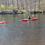
Rhode Island, smallest of the 50 states, is densely populated and highly industrialized. It is a major center for jewelry manufacturing, electronics, metal and plastic products, as well as boat and ship construction . Officially nicknamed "The Ocean State", the state's geography contains several large bays and inlets that amount to about 14% of its 1,241 square miles.
News
Most Popular Social Media of 2025
Most Popular Social Media of 2025
Drought Conditions Expand in Northern New England
Drought Conditions Expand in Northern New England
Inaugural USGS Wildlife Health Awareness Day - April 25, 2025
Inaugural USGS Wildlife Health Awareness Day - April 25, 2025
Publications
Quantitative mineral resource assessment of lithium pegmatite deposits in the northern Appalachian orogen, USA Quantitative mineral resource assessment of lithium pegmatite deposits in the northern Appalachian orogen, USA
Lithium demand is projected to increase more than 48 times by 2040 due to electric vehicle production and other energy storage needs. Most lithium production is outside of the USA, thereby increasing supply chain vulnerability. The combined end use importance and heightened supply risk of lithium make this lightest metallic element a critical commodity to the USA. To mitigate this supply...
Watershed forest cover and habitat restoration can offset some negative impacts of climate change on freshwater fishes and mussels Watershed forest cover and habitat restoration can offset some negative impacts of climate change on freshwater fishes and mussels
Many species of freshwater fishes and freshwater mussels have experienced population declines over the past century due to threats including habitat degradation, overexploitation, species invasion, and climate change. Management actions may offset climate-related changes to biodiversity, although identifying appropriate strategies is challenging. Our goal was to identify the impacts of...
Potential interactions between birds and floating photovoltaic solar energy: Spatially informed species vulnerabilities, techno-ecological risks, and sustainability trade-offs Potential interactions between birds and floating photovoltaic solar energy: Spatially informed species vulnerabilities, techno-ecological risks, and sustainability trade-offs
Floating photovoltaics (floating solar panels; FPV) can reduce the negative impacts of solar energy development in terrestrial environments, but their effects on freshwater ecosystems remain poorly understood. We examined potential FPV interactions with avian biodiversity, using previously modeled technical potential of FPV in the northeastern United States. We developed a vulnerability...
Science
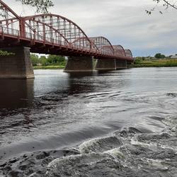
Hydrologic Monitoring Branch
The Hydrologic Monitoring Branch (HMB) provides water data for all six New England states through an expansive network of monitoring locations. The HMB is responsible for a wide range of hydrologic monitoring activities, including collecting and analyzing streamflow, groundwater and coastal water levels, precipitation, and continuous water-quality information, such as water temperature and...

Applied Hydrology Branch
The Applied Hydrology Branch provides hydrologic data, research, and tools to water resource managers, stakeholders and policy makers that inform critical water management decisions throughout New England. This branch is divided into the Hydrology and Hydraulics Section, Water Quality Networks Section, Connecticut Water Quality Monitoring Section, and Massachusetts/Rhode Island Water Quality...
Hydrologic Interpretive Branch
The Hydrologic Interpretive Branch collaborates with stakeholders to design, execute, and publish scientific studies that address issues associated with water resources at local, regional, and national scales. This branch has three sections that focus on watershed and urban hydrology, integrated modeling of hydrologic systems, and the development of new statistical and geospatial tools.