Map of the 1926 Mauna Loa lava flows (red), with all Mauna Loa lava flows since 1843 shown in peach.
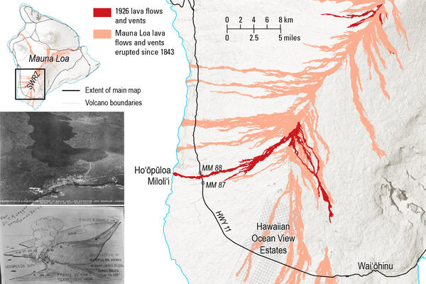
Map of the 1926 Mauna Loa lava flows (red), with all Mauna Loa lava flows since 1843 shown in peach.Map of the 1926 Mauna Loa lava flows (red), with all Mauna Loa lava flows since 1843 shown in peach. The eruption started at the summit (top right of main map) on April 10.