
On August 2,2024, Hawaiian Volcano Observatory Gas Scientists flew via helicopter to the Sulfur Cone Multi-Gas instrumentation site on Mauna Loa's Southwest Rift Zone, which is at an elevation of 3,430 meters (11,240 feet) above sea level.
Multimedia
Images

August 2, 2024—Sulfur Cone gas monitoring maintenance
On August 2,2024, Hawaiian Volcano Observatory Gas Scientists flew via helicopter to the Sulfur Cone Multi-Gas instrumentation site on Mauna Loa's Southwest Rift Zone, which is at an elevation of 3,430 meters (11,240 feet) above sea level.

August 2, 2024—Sulfur Cone gas monitoring maintenance
This photograph shows the inside of the Hawaiian Volcano Observatory (HVO) Multi-Gas site at Sulfur Cone. Currently, HVO has 2 of these continuous gas monitoring sites in operation on the Island of Hawai‘i. This one at Sulfur Cone high on Mauna Loa's Southwest Rift Zone, along with one at the summit of Kīlauea.
This photograph shows the inside of the Hawaiian Volcano Observatory (HVO) Multi-Gas site at Sulfur Cone. Currently, HVO has 2 of these continuous gas monitoring sites in operation on the Island of Hawai‘i. This one at Sulfur Cone high on Mauna Loa's Southwest Rift Zone, along with one at the summit of Kīlauea.

August 2, 2024—Sulfur Cone gas monitoring maintenance
The continuously monitoring Multi-Gas instrument at Sulfur Cone is housed inside the black Pelican case shown here. Air is pulled into the instrument via a small pump to be analyzed for volcanic gases (Sulfur Dioxide, Hydrogen Sulfide, Carbon Dioxide and Water Vapor).
The continuously monitoring Multi-Gas instrument at Sulfur Cone is housed inside the black Pelican case shown here. Air is pulled into the instrument via a small pump to be analyzed for volcanic gases (Sulfur Dioxide, Hydrogen Sulfide, Carbon Dioxide and Water Vapor).

August 2, 2024—Sulfur Cone gas monitoring maintenance
A Hawaiian Volcano Observatory gas scientist works on installing a newly calibrated Multi-Gas instrument at the Sulfur Cone gas monitoring site high up on Mauna Loa's Southwest Rift Zone at an elevation of 3,430 meters (11,240 feet) above sea level. USGS photo by M. Cappos.
A Hawaiian Volcano Observatory gas scientist works on installing a newly calibrated Multi-Gas instrument at the Sulfur Cone gas monitoring site high up on Mauna Loa's Southwest Rift Zone at an elevation of 3,430 meters (11,240 feet) above sea level. USGS photo by M. Cappos.

Map of volcanoes and infrastructure on the Island of Hawaiʻi
Map of Island of Hawaiʻi, highlighting the four active or potentially active volcanoes of the Island, the number of people living on each volcano based on 2020 census data, major roads (transportation corridors) and minor roads (proxy for population density), when each volcano last erupted, and each volcano’s national threat assessment designation.
Map of Island of Hawaiʻi, highlighting the four active or potentially active volcanoes of the Island, the number of people living on each volcano based on 2020 census data, major roads (transportation corridors) and minor roads (proxy for population density), when each volcano last erupted, and each volcano’s national threat assessment designation.
Videos
")
Mauna Loa 2022 Eruption Anniversary (AD)
Mauna Loa 2022 eruption anniversary video. Mauna Loa is Earth's largest active volcano and covers just over half of the Island of Hawaiʻi. It erupted most recently in November-December 2022, and it will erupt again.
Mauna Loa 2022 eruption anniversary video. Mauna Loa is Earth's largest active volcano and covers just over half of the Island of Hawaiʻi. It erupted most recently in November-December 2022, and it will erupt again.
Mauna Loa 2022 Eruption Anniversary
Mauna Loa 2022 eruption anniversary video. Mauna Loa is Earth's largest active volcano and covers just over half of the Island of Hawaiʻi. It erupted most recently in November-December 2022, and it will erupt again.
Mauna Loa 2022 eruption anniversary video. Mauna Loa is Earth's largest active volcano and covers just over half of the Island of Hawaiʻi. It erupted most recently in November-December 2022, and it will erupt again.

December 9, 2022 — Mauna Loa Fissure 3
Aerial view of fissure 3 erupting on the Northeast Rift Zone of Mauna Loa on December 9, 2022. The eruption continues but the vigor has greatly reduced over the past 24 hours. USGS video by M. Patrick.
Aerial view of fissure 3 erupting on the Northeast Rift Zone of Mauna Loa on December 9, 2022. The eruption continues but the vigor has greatly reduced over the past 24 hours. USGS video by M. Patrick.

December 8, 2022 — Mauna Loa Fissure 3
During a morning overflight on December 9, 2022, Hawaiian Volcano Observatory geologists noted a reduced output of lava at fissure 3 on the Northeast Rift Zone of Mauna Loa. The lava fountain is much lower than yesterday and the lava in the channel is much lower than the levees. USGS video by M. Patrick.
During a morning overflight on December 9, 2022, Hawaiian Volcano Observatory geologists noted a reduced output of lava at fissure 3 on the Northeast Rift Zone of Mauna Loa. The lava fountain is much lower than yesterday and the lava in the channel is much lower than the levees. USGS video by M. Patrick.

December 9, 2022 — Mauna Loa Fissure 3 Lava Channel
Aerial view of the upper lava channel from fissure 3 on the Northeast Rift Zone of Mauna Loa. On December 9, 2022, Hawaiian Volcano Observatory geologists noted a reduced output of lava at fissure 3 and this photo shows that the level of lava in the channel is the lowest it has been since the eruption started. USGS video by M. Patrick.
Aerial view of the upper lava channel from fissure 3 on the Northeast Rift Zone of Mauna Loa. On December 9, 2022, Hawaiian Volcano Observatory geologists noted a reduced output of lava at fissure 3 and this photo shows that the level of lava in the channel is the lowest it has been since the eruption started. USGS video by M. Patrick.

December 8, 2022 — Mauna Loa Fissure 3
The Northeast Rift Zone eruption of Mauna Loa continues with a major change overnight. The fissure 3 (F3) vent continues to erupt but the supply of lava appears to be much reduced this morning. Lava is overtopping channels near the vent with flows extending no farther than 2.5 mi (4 km) from the vent.
The Northeast Rift Zone eruption of Mauna Loa continues with a major change overnight. The fissure 3 (F3) vent continues to erupt but the supply of lava appears to be much reduced this morning. Lava is overtopping channels near the vent with flows extending no farther than 2.5 mi (4 km) from the vent.
Webcams

[MDLcam] The Upper and Middle Parts of Mauna Loa's Southwest Rift Zone
Live image of Mauna Loa's upper and middle Southwest Rift Zone from Dandelion Cone along the middle part of the rift zone [MDLcam]. This camera is a pan-tilt-zoom model and the view may change depending on activity.
Disclaimer
Live image of Mauna Loa's upper and middle Southwest Rift Zone from Dandelion Cone along the middle part of the rift zone [MDLcam]. This camera is a pan-tilt-zoom model and the view may change depending on activity.
Disclaimer

[MSPcam] Mauna Loa's Southwest Rift Zone from the South Point area
Live image of Mauna Loa's Southwest Rift Zone from the South Point area [MSPcam]. This camera is a pan-tilt-zoom model and the view may change depending on activity.
Disclaimer
Live image of Mauna Loa's Southwest Rift Zone from the South Point area [MSPcam]. This camera is a pan-tilt-zoom model and the view may change depending on activity.
Disclaimer

[HLcam] Live Image of Mauna Loa's northwest flank from Hualālai volcano
Live view of the northwest flank of Mauna Loa; the view is from the southeast flank of Hualālai [HLcam]. This camera is a pan-tilt-zoom model and the view may change depending on activity.
Live view of the northwest flank of Mauna Loa; the view is from the southeast flank of Hualālai [HLcam]. This camera is a pan-tilt-zoom model and the view may change depending on activity.
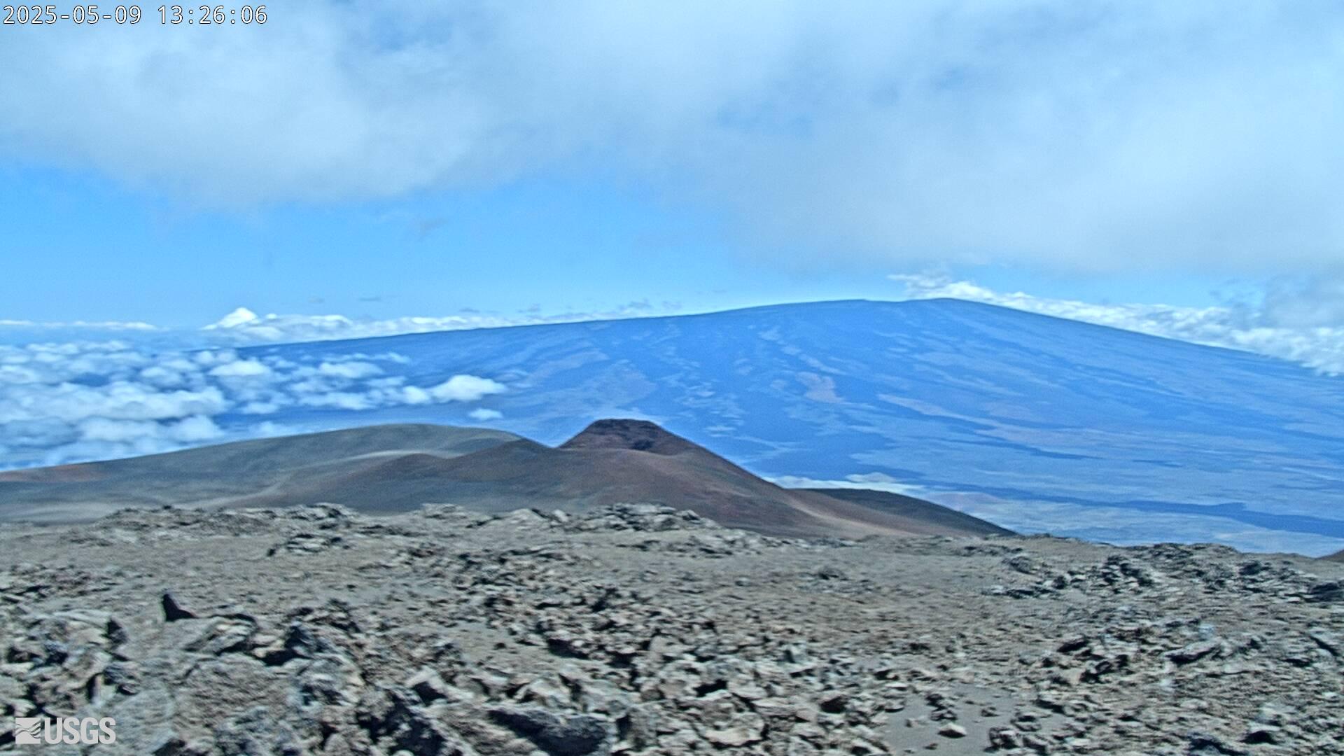
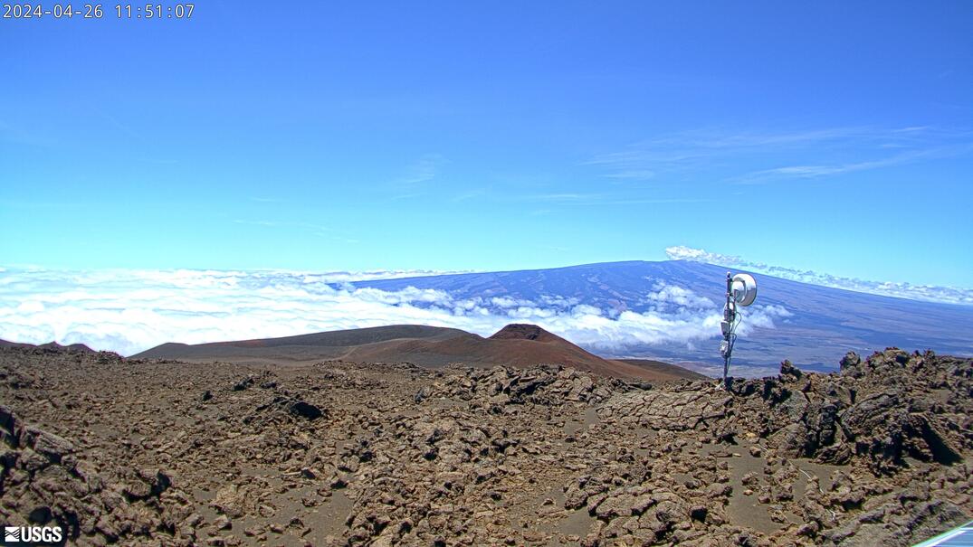
[MK2cam] Mauna Loa's Summit and Northeast Rift Zone from Mauna Kea
Live Image of Mauna Loa's Summit and Northeast Rift Zone from Mauna Kea [MK2cam]. This camera is a pan-tilt-zoom model and the view may change depending on activity.
Live Image of Mauna Loa's Summit and Northeast Rift Zone from Mauna Kea [MK2cam]. This camera is a pan-tilt-zoom model and the view may change depending on activity.
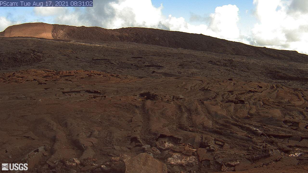
[PScam] Puʻu ʻŌʻō South Flank from the South Rim
This image is from a temporary research camera positioned just south of Puʻu ʻŌʻō, looking north at the southern flank of Puʻu ʻŌʻō's cone.
Disclaimer
This image is from a temporary research camera positioned just south of Puʻu ʻŌʻō, looking north at the southern flank of Puʻu ʻŌʻō's cone.
Disclaimer
[MKcam]: Mauna Loa's Summit and Northeast Rift Zone from Mauna Kea
Live Image of Mauna Loa's Summit and Northeast Rift Zone from Mauna Kea [MKcam].
Live Image of Mauna Loa's Summit and Northeast Rift Zone from Mauna Kea [MKcam].