
About 3DEP Products & Services
What is Lidar data and where can I download it?
What types of elevation datasets are available, what formats do they come in, and where can I download them?
The 3DEP products and services available through The National Map consist of lidar point clouds and digital elevation models (DEMs) at various horizontal resolutions. All 3DEP products are available, free of charge and without use restrictions.
3DEP Spatial Metadata

Spatial metadata for the 3D Elevation Program (3DEP) is now published and available by work unit in the Work Unit Extent Spatial Metadata (WESM) geopackage.
3DEP Product Metadata

Two classes of metadata are provided for each product: textual metadata (XML files) and spatial metadata (Geopackage file).
Source Data Products
Source data products include lidar point clouds, source (original) resolution DEMs from which the 3DEP standard DEM datasets were produced, and additional data types produced from IfSAR collections.

Lidar point cloud: These data are the foundational data for 3DEP in the conterminous U.S., and contain the original three-dimensional information from which the DEM products are derived. Most of the data collected in 2014 and later meet 3DEP specifications for quality level 2 nominal pulse spacing and vertical accuracy, and data collected prior to 2014 often do not meet the quality level 2 specification. Distinctions in nominal pulse spacing are provided in the lidar point cloud status graphics and in the download platform; however, other qualities such as vertical accuracy must be examined to determine if the data meet particular 3DEP quality level specifications.
Source resolution DEMs: These data are the original bare earth DEMs derived from the lidar point cloud source. Source DEMs (also called "original product resolution" [OPR] DEMs) processed by the USGS after January 2015 are provided where the original DEM horizontal resolution or projection differ from the 3DEP standard DEM datasets.

IfSAR orthorectified radar intensity image (ORI): These rasters (resolutions vary), available only in Alaska, are radar reflectance intensity recordings detected by the IfSAR sensor.
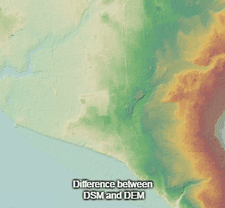
IfSAR digital surface model (DSM): These 5 meter rasters, available only in Alaska, are the initial IfSAR product. DSMs provide elevation values of landscape features on the earth's surface. This topographic product contains the height of the highest surface on the ground including vegetation, man-made structures, and bare earth.
IfSAR digital terrain model (DTM): provide elevation values of the underlying terrain of the earth’s surface. This topographic product reflects the height of bare earth where the elevations of vegetation and man-made features have been removed. The USGS Earth Resources Observation and Science (EROS) Center distributes IFSAR Alaska products in Georeferenced Tagged Image File Format (GeoTIFF). The pixel values for the grayscale images represent elevation numbers. EarthExplorer can be used to search, preview, and download IFSAR Alaska data. The collection is located under the Digital Elevation category.
Standard DEMs
Standard DEMs represent the topographic surface of the earth and contain flattened water surfaces. Each DEM dataset is identified by its horizontal resolution and is produced to a consistent set of specifications. Standard DEMs are characterized either as project-based or seamless. Project-based DEMs are available for the full areal extents of projects when produced from light detection and ranging (lidar), or as one-degree blocks with overedge when produced from IfSAR. Seamless DEMs are produced by blending only the highest quality project data into a continuous terrain surface for the U.S. These data are distributed in tiles that can be merged to support analysis across large geographic areas.
Project-based
- 1-meter – This dataset was introduced in 2015 with limited coverage of the U.S., but will be expanding as new DEMs from 3DEP quality level 2 or better lidar data are acquired. Horizontal coordinates are referenced to the Universal Transverse Mercator projection.
- 1/9 arc-second – This dataset covers about 25 percent of the conterminous U.S. and is produced from 3-meter or higher resolution DEMs acquired by the USGS prior to January 2015. Horizontal coordinates are referenced to geographic coordinates (longitude, latitude). The 1/9 arc-second dataset will no longer be updated with newly acquired DEMs; however, it will continue to be distributed.
- 5 meter – This dataset is comprised of 5-meter IfSAR-derived DEMs (3DEP quality level 5) over Alaska only. Horizontal coordinates are referenced to Albers Equal Area Conical projection.
Seamless
- 1-meter seamless (S1M) – This is the highest resolution seamless elevation dataset that 3DEP produces for the Nation. The S1M is built from multiple lidar projects aligned to a common reference system. Each 10 km by 10km tile is in a cloud-optimized geotiff format and includes detailed metadata about source data and processing. Production of the S1M is in progress since mid-2025, and new tiles are added as they become available. Ground spacing is 1 meter.
- 1/3 arc-second – This is a medium resolution seamless DEM dataset for the U.S. with full coverage of the 48 conterminous states, Alaska, Hawaii, and U.S. territories. Ground spacing is approximately 10 meters north/south, but variable east/west due to convergence of meridians with latitude.
- 1 arc-second – This is a lower resolution seamless dataset providing complete coverage over the conterminous U.S. and Alaska. Most of Canada and Mexico are also covered by the 1 arc-second dataset. Ground spacing is approximately 30 meters north/south, but variable east/west depending on latitude.
- 2 arc-second – This seamless dataset is the lowest resolution seamless dataset available and covers only Alaska. Although ground spacing is approximately 60 meters north-south, east-west spacing can vary from 35 meters in southern Alaska to 20 meters on the North Shore.
The 3DEP Bare Earth DEM Dynamic Service and Viewer
The 3DEP Bare Earth Digital Elevation Model (DEM) dynamic service allows users to explore multiple-resolutions of 3DEP data available in the National Map. In addition, Open Geospatial Consortium (OGC) Web Map Service (WMS) and Web Coverage Service (WCS) interfaces are enabled to support interoperability across systems.
The DEM viewer creates multi-resolution visualizations DEMs on-the-fly generated dynamically from the USGS 3D Elevation Program elevation data. Users may explore a variety of representations including: aspect; contours; tinted hillshade; hillshade; hillshade stretched; multi-directional hillshade and slope maps.

Aspect
A color visualization of the compass direction that a hillside or slope faces, measured clockwise in degrees from 0 (due north) to 360 (again due north)
Contour
Lines that connect locations of equal elevation generated with specified intervals and options for smoothing to create more cartographically pleasing contours
Elevation Tinted Hillshade
Combines hillshade with a color tint applied to the same terrain to represent elevation
Hillshade
Generated by setting a solar azimuth of 315 degrees and solar altitude of 45 degrees position to calculate the illumination values of each cell in relation to neighboring cells
Multi-directional Hillshade
The hillshade computed from 6 different directions
Slope
A color visualization of the maximum rate of change in value from that cell to its neighbors; flat surfaces are gray, shallow slopes are yellow and steep slopes are orange
-

Elevation Videos Elevation Videos
The videos linked below provide information on elevation topics such as 3DEP products and services, and how to use 3DEP data in various software applications.
Applications & Visualization Services Applications & Visualization Services
Our listing of all web map services used in our National Map Viewer.
-

Program Benefits and Uses Program Benefits and Uses
A core mission of the U.S. Geological Survey (USGS) is to provide information that leads to reduced loss of life and damage to property and infrastructure from hazards like landslides, earthquakes, floods, hurricanes and wildfires. 3DEP data provides 3D information of the Earth including, terrain, vegetation characteristics and human-made features, enabling production of mapping products.
Related

Lesson 10e1: Products and Services of the 3D Elevation Program
In this lesson, you will learn about the lidar products available through the 3D Elevation Program (which is abbreviated as “3DEP”). The lesson will introduce 3DEP, discuss the lidar data available, and where to find the data. Please note that some of our URLs in the video have changed. All URLs beginning with 'viewer.nationalmap.gov/...' have been updated to 'apps.nationalmap.gov/...'. These URLs...
Related
Lesson 10e1: Products and Services of the 3D Elevation Program
In this lesson, you will learn about the lidar products available through the 3D Elevation Program (which is abbreviated as “3DEP”). The lesson will introduce 3DEP, discuss the lidar data available, and where to find the data. Please note that some of our URLs in the video have changed. All URLs beginning with 'viewer.nationalmap.gov/...' have been updated to 'apps.nationalmap.gov/...'. These URLs...