
Red Mountain #1 in the San Juan Mountains of Colorado is an example of natural mineral weathering, where the USGS is working to understand metal mobilization processes in mine workings and groundwater.
Multimedia
Some collected images, video, and live web cameras in Colorado.
Images
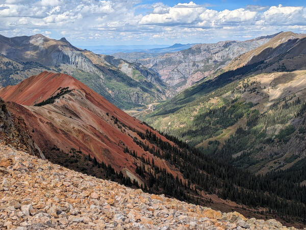
Red Mountain #1
Red Mountain #1 in the San Juan Mountains of Colorado is an example of natural mineral weathering, where the USGS is working to understand metal mobilization processes in mine workings and groundwater.
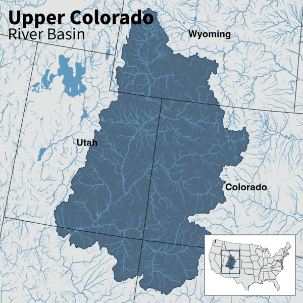
Map of Upper Colorado River Basin - Integrated Water Availability
Map of Upper Colorado River Basin - Integrated Water AvailabilityMap of the Upper Colorado River Basin —referred to as an Integrated Water Science (IWS) basins—are intensively monitored study basins representing a wide range of environmental, hydrologic, and landscape settings and human stressors of water resources to improve our understanding of water availability across the Nation.
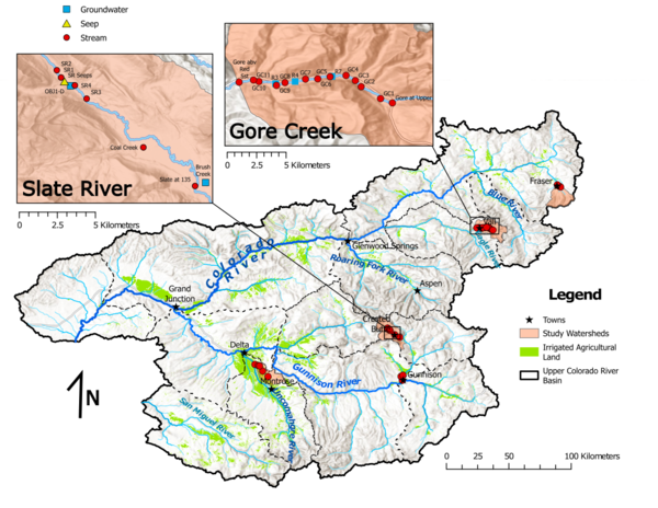
NGWOS Upper Colorado River Basin study area map
Map of the NGWOS Upper Colorado River Basin study area and the focus study watersheds for studies of groundwater/surface-water connections.
Map of the NGWOS Upper Colorado River Basin study area and the focus study watersheds for studies of groundwater/surface-water connections.
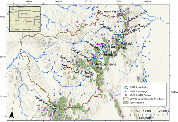
NGWOS site location map
Map of the Upper Colorado River Basin showing locations of USGS snow stations, USGS streamgages, and Natural Resources Conservation Service (NRCS) Snow Telemetry (SNOTEL) stations.
Map of the Upper Colorado River Basin showing locations of USGS snow stations, USGS streamgages, and Natural Resources Conservation Service (NRCS) Snow Telemetry (SNOTEL) stations.
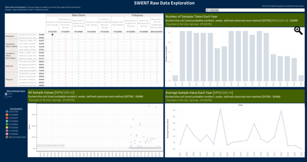
Fountain Creek Watershed Water Quality Trends
The Colorado Water Science Center is conducting a study for the City of Colorado Springs Stormwater Enterprise (SWENT) to analyze trends in Water Quality data. This worksheet provides an interactive means to explore the data available for 5 mainstem sites and 4 tributary sites within the Fountain Creek Watershed.
The Colorado Water Science Center is conducting a study for the City of Colorado Springs Stormwater Enterprise (SWENT) to analyze trends in Water Quality data. This worksheet provides an interactive means to explore the data available for 5 mainstem sites and 4 tributary sites within the Fountain Creek Watershed.

Water Isotope Network map
Map showing the major tritium-monitoring sites in the NGWOS study area of the Upper Colorado River Basin where Water Isotope Network samples of precipitation and streamflow are collected, as well as sites where snowpack samples are collected for comparison to total precipitation.
Map showing the major tritium-monitoring sites in the NGWOS study area of the Upper Colorado River Basin where Water Isotope Network samples of precipitation and streamflow are collected, as well as sites where snowpack samples are collected for comparison to total precipitation.
Videos

John Wesley Powell, Canyon Geologist
Webcams
Blue River below Dillon, CO (09050700)
Webcam at USGS Streamgage 09050700 Blue River below Dillon, CO.
Visit Water Data For the Nation to get current data for this site.
Webcam at USGS Streamgage 09050700 Blue River below Dillon, CO.
Visit Water Data For the Nation to get current data for this site.
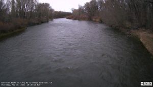
Gunnison River at County Road 32 below Gunnison, CO (383103106594200)
Gunnison River at County Road 32 below Gunnison, CO (383103106594200)Webcam at USGS Streamgage 383103106594200 Gunnison River at County Road 32 below Gunnison, CO.
Visit Water Data For the Nation to get current data for this site.

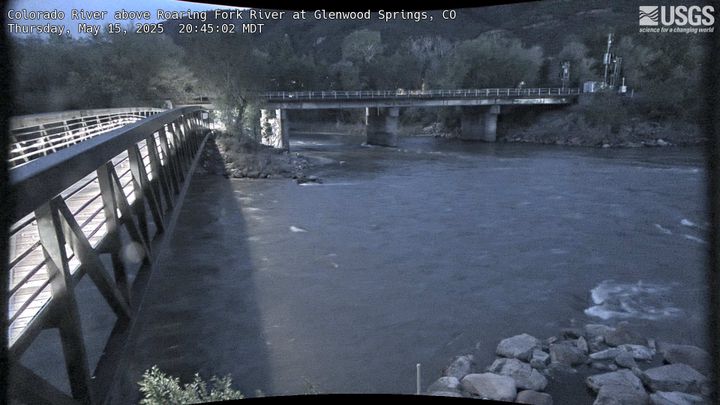
Colorado River above Roaring Fork River at Glenwood Springs, CO (393259107194801)
Colorado River above Roaring Fork River at Glenwood Springs, CO (393259107194801)Webcam at USGS Streamgage 393259107194801 Colorado River above Roaring Fork River at Glenwood Springs, CO.
Colorado River above Roaring Fork River at Glenwood Springs, CO (393259107194801)
Colorado River above Roaring Fork River at Glenwood Springs, CO (393259107194801)Webcam at USGS Streamgage 393259107194801 Colorado River above Roaring Fork River at Glenwood Springs, CO.
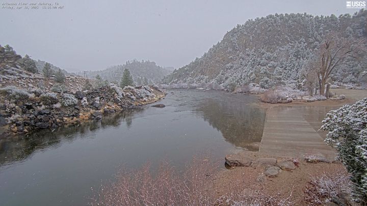
Arkansas River near Nathrop, CO (07091200)
Webcam at USGS Streamgage 07091200 Arkansas River near Nathrop, CO.
Visit Water Data For the Nation to get current data for this site.
Webcam at USGS Streamgage 07091200 Arkansas River near Nathrop, CO.
Visit Water Data For the Nation to get current data for this site.
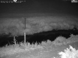
Harvard Gulch at Harvard Park at Denver, CO (06711575)
Harvard Gulch at Harvard Park at Denver, CO (06711575)Webcam at USGS Streamgage 06711575 Harvard Gulch at Harvard Park at Denver, CO.
Visit Water Data For the Nation to get current data for this site.
Harvard Gulch at Harvard Park at Denver, CO (06711575)
Harvard Gulch at Harvard Park at Denver, CO (06711575)Webcam at USGS Streamgage 06711575 Harvard Gulch at Harvard Park at Denver, CO.
Visit Water Data For the Nation to get current data for this site.
Roaring Fork River at Glenwood Springs, CO (09085000)
Roaring Fork River at Glenwood Springs, CO (09085000)Webcam at USGS Streamgage 09085000 Roaring Fork River at Glenwood Springs, CO.
Visit Water Data For the Nation to get current data for this site.
Roaring Fork River at Glenwood Springs, CO (09085000)
Roaring Fork River at Glenwood Springs, CO (09085000)Webcam at USGS Streamgage 09085000 Roaring Fork River at Glenwood Springs, CO.
Visit Water Data For the Nation to get current data for this site.