
Data
At the Eastern Ecological Science Center (EESC), we strive to provide world-class science to inform natural resource decisions that preserve and enhance our quality of life.
Connect with Us
Connect with Us
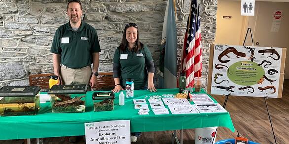
Find locations, staff profiles and contact information for our team.
EESC's Latest Findings
EESC's Latest Findings

Search for EESC publications by location, author, year or keyword.
Filter Total Items: 310
Long-term effects of timber harvest on vernal pool availability and occupancy of two obligate amphibians Long-term effects of timber harvest on vernal pool availability and occupancy of two obligate amphibians
This data set is comprised of 3 files of information collected on amphibians and vernal pool habitats at Canaan Valley National Wildlife Refuge from 2004 - 2016.
Abiotic and biotic factors reduce viability of a high-elevation salamander in its native range Abiotic and biotic factors reduce viability of a high-elevation salamander in its native range
Includes data used to estimate population demographic parameters for an exemplary high-elevation amphibian species, the federally endangered Shenandoah salamander (Plethodon shenandoah). These parameters were entered into a Markov projection model which we used to forecast the future population status of the Shenandoah salamander.
Brook trout abundance in streams across southern Appalachia from 1958-2021 Brook trout abundance in streams across southern Appalachia from 1958-2021
This Data Release compiles records of brook trout abundance from 745 unique sites across the southern Appalachian mountains from 1958-2021. Records were compiled from 10 institutions, primarily state natural resource agencies. Data were collected from wadeable stream environments with standard backpack electrofishing methods, and observed abundances of adult and juvenile brook trout are...
Immune Function of Wild Smallmouth Bass Collected from Sites within the Chesapeake Bay Watershed, 2016-2021 Immune Function of Wild Smallmouth Bass Collected from Sites within the Chesapeake Bay Watershed, 2016-2021
Adult and young of the year smallmouth bass from the Chesapeake Bay watershed have faced health issues (mortality events, disease by a variety of pathogens, endocrine disruption in male fish, evidence of oxidative damage to tissues, and signs of exposure to chemical contaminants) at multiple sites within the Susquehanna and Potomac River basins. Functional immune assays were added to...
Summary data on the forage base and critical forage taxa for Chesapeake waterbirds Summary data on the forage base and critical forage taxa for Chesapeake waterbirds
We collated existing quantitative data on avian dietary composition of 58 waterbird species that make use of the Chesapeake Bay. From this database, we quantified the relative importance of forage taxa to the diets of each waterbird species. This data will enable us to develop a comprehensive suite of forage taxa indicators whose abundance and distributions can be monitored as a proxy...
Elicited qualitative value of information scores for eastern black rail uncertainties on the Atlantic Coast from a 2020 adaptive management workshop Elicited qualitative value of information scores for eastern black rail uncertainties on the Atlantic Coast from a 2020 adaptive management workshop
The eastern black rail (Laterallus jamaicensis jamaicensis; hereafter rail) is a small, cryptic marshbird that was recently listed as threatened under the U.S. Endangered Species Act. We organized a rapid prototyping workshop to initiate development of an adaptive management for rails on the Atlantic Coast. The in-person workshop spanned 2.5 days and was held in Titusville, Florida in...
Stream temperature data for sites in the Potomac River headwaters during 2022 Stream temperature data for sites in the Potomac River headwaters during 2022
This Data Release contains stream temperature data for 12 sites within the headwaters of the Potomac River basin. Data were collected between June 1-August 31, 2022 (92 days) at 30-minute increments. We collected data using Onset ProV2 gages in perforated PVC cases mounted to stream substrates with rebar. This work was funded by the USGS Priority Ecosystem Science program for the...
Modern genetic resources for Atlantic Basin populations of Roseate Tern Sterna dougallii, 2017-2018 Modern genetic resources for Atlantic Basin populations of Roseate Tern Sterna dougallii, 2017-2018
Here we provide public access to UCE DNA sequences for all genetic samples in Byerly et al. 2022b.
Data for "Population Dynamics and Harvest Management of Eastern Mallards" Data for "Population Dynamics and Harvest Management of Eastern Mallards"
Data and R Code for manuscript titled "Population Dynamics and Harvest Management of Eastern Mallards"
Toxicological responses to sublethal anticoagulant rodenticide exposure in free-flying red-tailed hawks Toxicological responses to sublethal anticoagulant rodenticide exposure in free-flying red-tailed hawks
An important component of assessing the hazards of anticoagulant rodenticides to non-target wildlife are observations in exposed free-ranging individuals. The objective of this study was to determine if environmentally realistic, sublethal first-generation anticoagulant rodenticide exposures via prey, can result in direct or indirect adverse effects to free-flying raptors. We offered...
Constraints on marsh response to accelerating sea level rise Constraints on marsh response to accelerating sea level rise
Here we provide data used to report on changes in tidal marsh elevation in relation to our network of 387 fixed benchmarks in tidal marshes on four continents measured for an average of 10 years. During this period RSLR at these marshes reached on average 6.6 mm yr-1, compared to 0.34 mm yr-1 over the past millennia. While the rate of sediment accretion corresponded to RSLR, the loss of...
The North American Breeding Bird Survey, Analysis Results 1966 - 2021 The North American Breeding Bird Survey, Analysis Results 1966 - 2021
This data product consists of a database of population change and abundance estimates for North American birds, estimated from North American Breeding Bird Survey (BBS) data. Data are presented for 548 species of birds in 4 spreadsheets containing trend estimates and annual indices for 2 time periods. Estimates are derived for each species using the 1 of 4 alternative models, and a cross