
Data
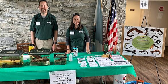
At the Eastern Ecological Science Center (EESC), we strive to provide world-class science to inform natural resource decisions that preserve and enhance our quality of life.
Connect with Us
Connect with Us
Find locations, staff profiles and contact information for our team.
EESC's Latest Findings
EESC's Latest Findings
Search for EESC publications by location, author, year or keyword.
Filter Total Items: 310
Attribution of stream habitat assessment data to NHDPlus V2 and NHDPlus HR catchments within the Chesapeake Bay Watershed Attribution of stream habitat assessment data to NHDPlus V2 and NHDPlus HR catchments within the Chesapeake Bay Watershed
This data release links habitat assessment sites to both the NHDPlus Version 2 and NHDPlus High Resolution Region 02 networks using the hydrolink methodology. Linked habitat sites are those compiled by the Interstate Commission on the Potomac River Basin (ICPRB) during creation of the Chesapeake Bay Basin-wide Index of Biotic Integrity (Chessie BIBI) for benthic macroinvertebrates (https...
Data describing the use of retention ponds on commercial poultry facilities on Delmarva by wild waterfowl Data describing the use of retention ponds on commercial poultry facilities on Delmarva by wild waterfowl
These data support a paired USGS publication and document the use of retention ponds on commercial poultry farms by wild waterfowl.
Attribution of fish sampling data to NHDPlus HR catchments within the Chesapeake Bay Watershed Attribution of fish sampling data to NHDPlus HR catchments within the Chesapeake Bay Watershed
This data release links fish survey data from a suite of programs in the Chesapeake Bay watershed to the NHDPlus High Resolution Region 02 networks, hereafter referred to as NHDPlusHR. The data set contains site name, survey program, coordinates of sample, ancillary information such as sample date and site location information where available, and HR Permanent Identifier. It also...
North American Bird Banding Program Dataset 1960-2023 retrieved 2023-07-12 North American Bird Banding Program Dataset 1960-2023 retrieved 2023-07-12
The North American Bird Banding Program is administered through the U.S. Geological Survey (USGS) Bird Banding Laboratory (BBL), Eastern Ecological Science Center at the Patuxent Research Refuge (EESC) and the Bird Banding Office (BBO), Environment and Climate Change Canada (ECCC). The respective banding offices have similar functions and policies and use the same bands, reporting forms...
Data describing habitat use and availability for wild waterfowl in California, USA Data describing habitat use and availability for wild waterfowl in California, USA
These data describe the overlap of wild waterfowl and domestic poultry operations in California, USA. These data support a paired USGS publication.
Data from Assessing the added value of antecedent streamflow alteration in modelling stream condition Data from Assessing the added value of antecedent streamflow alteration in modelling stream condition
The dataset contains long-term and short-term summaries of streamflow alteration and measures of biological condition (fish multi-metric index). Streamflow alteration metrics include the magnitude, duration, frequency, and seasonality of high and low flow streamflow. Biological condition was estimated from the National Rivers and Streams Assessment and National Water Quality Assessment...
The North American Breeding Bird Survey, Analysis Results 1966 - 2022 The North American Breeding Bird Survey, Analysis Results 1966 - 2022
This data product consists of a database of population change and abundance estimates for North American birds, estimated from North American Breeding Bird Survey (BBS) data. Data are presented for 548 species of birds in 4 spreadsheets containing trend estimates and annual indices for 2 time periods. Estimates are derived for each species using the 1 of 4 alternative models, and a cross
Biological Indicators and Mercury Concentrations in Smallmouth Bass Biological Indicators and Mercury Concentrations in Smallmouth Bass
Biological indicators including morphometric (length, weight), age, sex and health indicators including organismal (health assessment index, condition factor), organ (hepatosomatic index, gonadosomatic index), cellular (intersex, parasite density, macrophage aggregate density), subcellular (plasma vitellogenin, estradiol, testosterone, 11-keto testosterone) and molecular (hepatic...
Individual assignments and microsatellite genotypes for Atlantic Sturgeon from 2021 (ver. 4.0, September 2025) Individual assignments and microsatellite genotypes for Atlantic Sturgeon from 2021 (ver. 4.0, September 2025)
This dataset includes genotypes and individual-based assignment tests for 1394 Atlantic Sturgeon selected for assignment by the National Marine Fisheries Service to meet management requirements under the Endangered Species Act.
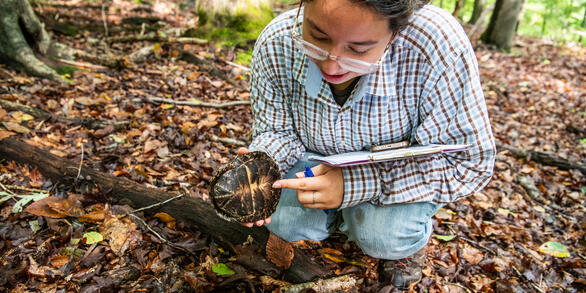
Patuxent box turtle data set 2020 Patuxent box turtle data set 2020
The data set consists of capture information on individual box turtles at Patuxent Research Refuge Laurel, MD. Location, date, morphometrics, and other information.
Mountain Plover population and habitat assessments in Texas, 2019–2020 Mountain Plover population and habitat assessments in Texas, 2019–2020
We conducted population and habitat assessments for Mountain Plovers in Texas during winters of 2019 and 2020. We used roadside surveys and distance-sampling to estimate bird density and calculate population totals for the study area, which included parts of five ecoregions (Chihuahuan Deserts, High Plains, Central Great Plains, Southern Texas Plains, Texas Blackland Prairies, and...
“ChesBay 24k – LU": Land Use/Land Cover Related Data Summaries for the Chesapeake Bay Watershed Within NHD Plus HR catchments (ver. 3.0, August 2025) “ChesBay 24k – LU": Land Use/Land Cover Related Data Summaries for the Chesapeake Bay Watershed Within NHD Plus HR catchments (ver. 3.0, August 2025)
These tabular data are the summarization of land use/land cover related variables within the Chesapeake Bay watershed using the xstrm methodology bringing these data to the 1:24,000 scale. Variables being counted as land use/land cover related include all land use and land cover data. This also contains datasets that are split off or combined from source data (eg. agriculture or...