
Data
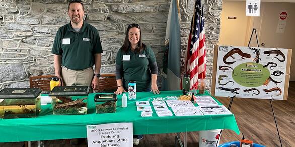
At the Eastern Ecological Science Center (EESC), we strive to provide world-class science to inform natural resource decisions that preserve and enhance our quality of life.
Connect with Us
Connect with Us
Find locations, staff profiles and contact information for our team.
EESC's Latest Findings
EESC's Latest Findings
Search for EESC publications by location, author, year or keyword.
Filter Total Items: 310
Records of vessel-Florida manatee collision outcomes and empirical boat speeds in Florida waters, 1978 - 2014 Records of vessel-Florida manatee collision outcomes and empirical boat speeds in Florida waters, 1978 - 2014
The dataset contains observational records detailing collisions between boats and Florida manatees (Trichechus manatus latirostris). Data include boat speeds, collision locations, and manatee injury outcomes, and are intended for ecological analysis and conservation purposes.
Estimated Densities of Residential Septic Tanks across the Conterminous United States for HUC12, NHDV2 Catchment, and Block Group Scales Estimated Densities of Residential Septic Tanks across the Conterminous United States for HUC12, NHDV2 Catchment, and Block Group Scales
This dataset provides estimates of residential septic tank densities at 12-digit Hydrologic Unit Code (HUC12), National Hydrography Dataset (NHD Plus version 2.1, 1:100k scale) catchment, and 2020 Census Block Group (version 2021) scale for the conterminous United States. Using United States Legacy Census data from the 1990s and the land use classification from the National Land Cover...
Bsal Not Detected After Pet Release in Western Massachusetts Pond Bsal Not Detected After Pet Release in Western Massachusetts Pond
These data have been collected by the United States Geological Survey’s Northeast Amphibian Research and Monitoring Initiative (USGS NEARMI) scientists. We collected these data to examine if Bsal was introduced to a site where there was a known pet release in Western, Massachusetts.
Counts and measurements for specimens of Percina crypta and Percina nigrofasciata (sensu lato) Counts and measurements for specimens of Percina crypta and Percina nigrofasciata (sensu lato)
Counts and measurements were made on specimens of the Halloween darter (Percina crypta) and of the Blackbanded darter (Percina nigrofasciata, sensu lato). Data used in the original description of Percina crypta are included, in addition to counts (and in some cases measurements) for 66 additional Percina nigrofasciata from the Savannah, Altamaha, and upper Chattahoohee river systems, and...
Data describing the lack of Avian influenza infection and antibodies in Eastern Wild Turkeys (Meleagris gallopavo silvestris) sampled in Delmarva, USA Data describing the lack of Avian influenza infection and antibodies in Eastern Wild Turkeys (Meleagris gallopavo silvestris) sampled in Delmarva, USA
These data describe avian influenza sampling efforts for eastern wild turkeys (Meleagris gallopavo silvestris) across the Maryland portion of the Delmarva Peninsula, USA in the winter of 2023-2024
Data exploring the impact of road watering on dust accumulation and monarch distribution on Poplar Island Data exploring the impact of road watering on dust accumulation and monarch distribution on Poplar Island
This data release supports a paired USGS publication that explores how road watering on an active construction site impacts dust accumulation and monarch distribution.
Data describing the use of a newly identified staging area on Patuxent River Naval Air Station by banded Common Terns Data describing the use of a newly identified staging area on Patuxent River Naval Air Station by banded Common Terns
These data describe the demographic composition of Common Terns at a newly identified staging area on the Patuxent River Naval Air Station and evaluates the importance of this location to the local breeding population. Specifically, we sought to identify the number of individuals using this potential staging area, the origins of those individuals, and the relative importance of this...
Attributes for NHDPlus Version 2.1 Catchments and Modified Routing of Upstream Watersheds for Selected Regions of the Conterminous United States Attributes for NHDPlus Version 2.1 Catchments and Modified Routing of Upstream Watersheds for Selected Regions of the Conterminous United States
This metadata record describes a series of data sets of climate and land-use/land-cover features (provided in parquet file format) linked to NHDPlus Version 2.1’s (NHDPlusV2) stream segments, their associated catchments and their upstream watersheds within selected regions in the conterminous United States. All data can be linked to NHDPlusV2 using the COMID field in these tables and the...
Transcriptomic Responses to Hexabromocyclododecane in Japanese Quail Transcriptomic Responses to Hexabromocyclododecane in Japanese Quail
This study examined effects of the brominated flame retardant hexabromocyclododecane (HBCD) on the avian endocrine system. Japanese quail (Coturnix japonica) were exposed to multiple doses of HBCD over multiple generations through feed and by maternal deposition into the egg. Liver transcriptomes were examined to identify genes and pathways directly affected by HBCD to better understand...
Patuxent River Basin Environmental Variable Rasters: Climate, Topography, Land Use and Land Cover Patuxent River Basin Environmental Variable Rasters: Climate, Topography, Land Use and Land Cover
Natural resource managers worldwide grapple with protecting aquatic environments and species in the face of intensifying land use and climatic changes. The hierarchical landscape theory suggests that a species distribution is impacted by multiple series of environmental factors affecting the species at multiple spatial resolutions. For a species to inhabit an area, it must pass through...
Passive integrated transponder tag data from the West Brook, MA, USA Passive integrated transponder tag data from the West Brook, MA, USA
The Ecology Section at the USGS Conte Laboratory has studied fish in the West Brook since 1997. The goal is to understand the strength and direction of drivers on fish growth, movement, reproduction and survival in the wild. We hope to provide a comprehensive understanding of fish population dynamics for this stream network and ultimately individual fitness (natural selection and...
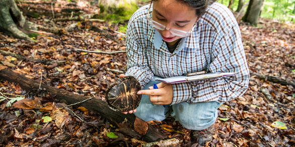
Capture records of Desmognathus salamanders in Shenandoah National Park, 2007-2013 Capture records of Desmognathus salamanders in Shenandoah National Park, 2007-2013
Mark-recapture records of salamanders in the genus Desmognathus within stream habitat at Shenandoah National Park, Virginia from 2007-2013