
Annual NLCD Collection 1.2 Now Available
Widely used land cover resource adds 2025 mapping
The U.S. Geological Survey (USGS) is excited to announce the release of the Annual National Land Cover Database (NLCD) Conterminous U.S. (CU), Collection 1.2. This release builds on the popular Annual NLCD CU Collection 1.0 by extending the dataset through 2025.
Produced at the USGS Earth Resources Observation and Science (EROS) Center, Annual NLCD now provides land cover and land cover change information for the conterminous United States for each year from 1985 through 2025.
While Annual NLCD focuses on monitoring the surface of the Earth, it relies on imagery captured from 438 miles up. Satellites in the Landsat Program provide the extensive time series of data required to characterize distinct features and change on the ground.
Land Cover Characteristics in a Suite of Six Products
Annual NLCD CU Collection 1.2 adds 2025 to the established suite of six raster-based land use and land cover science products for the conterminous United States:
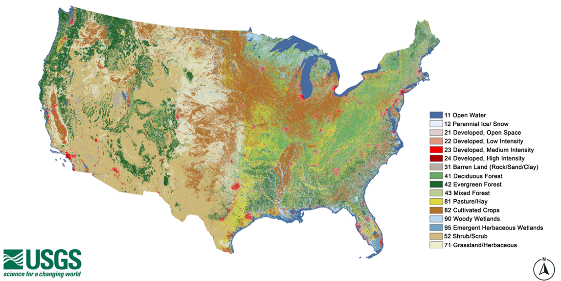
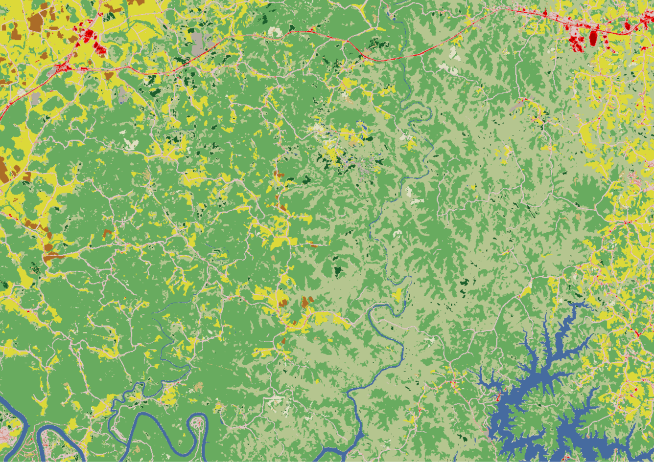
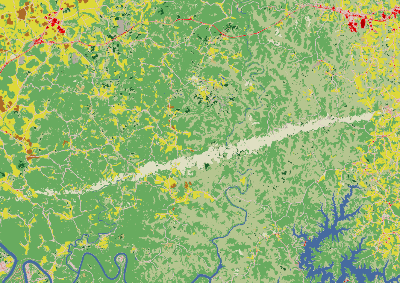
- Land Cover – This dataset provides 16 land cover classes such as deciduous and evergreen forest, grassland, cultivated crops and developed.
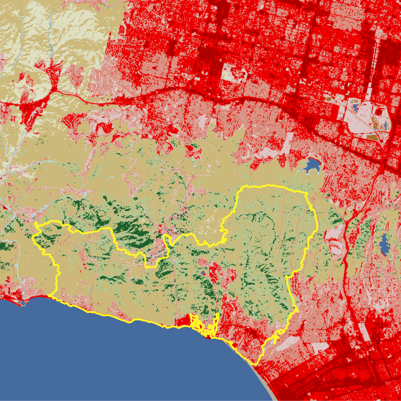
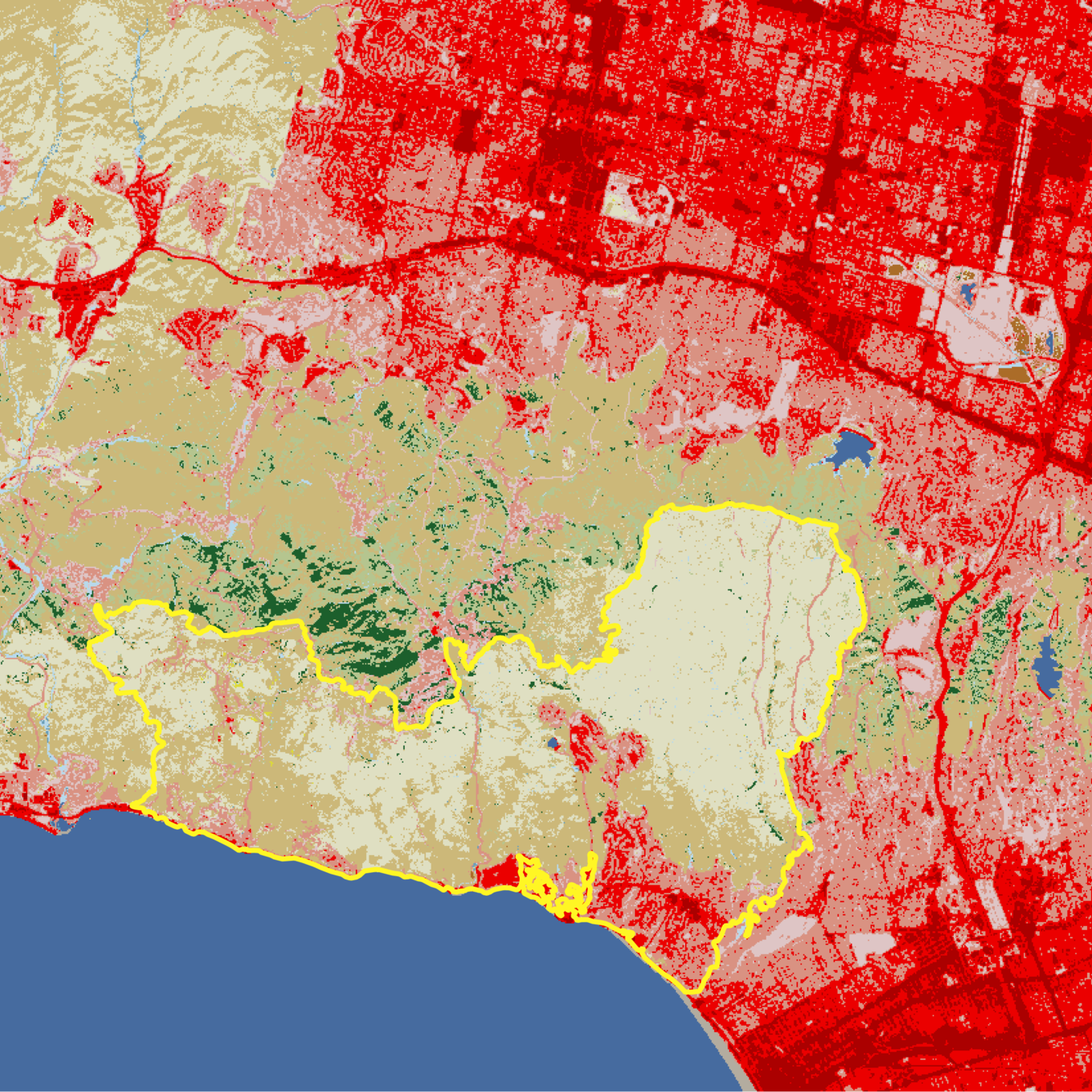
- Land Cover Change – These data represent annual land cover changes from one year to the next.
- Land Cover Confidence – This layer provides confidence levels for the land cover classifications.
- Fractional Impervious Surface – This component provides the proportion of land covered by developed surfaces, such as roads and rooftops.
- Impervious Descriptor – This feature offers additional information about impervious surfaces by distinguishing between roads and other built surfaces.
- Spectral Change Day of Year – This attribute captures the specific day of the year when significant changes in surface reflectance occurred.
The Annual NLCD intra-collection annual update strategy was designed to ensure consistency with previous product releases (i.e., 1.0, 1.1), maintain reliability in time-series analyses, and develop products in a resource-efficient manner. Users of the data can expect the core algorithms of Annual NLCD to remain stable throughout the duration of all Collection 1 dot product releases. Items below detail what’s new in Collection 1.2:
- New 2025 data for all 6 products listed above.
- Updated Spectral Change Day of Year products for 2021 – 2024 to maintain consistency between spectral change characteristics and the downstream land cover products.
Data Access
The Annual NLCD products are available for download on EarthExplorer, the MRLC Web Viewer, the MRLC Mosaic Download website, ScienceBase, as Annual NLCD web services, and through USGS AWS S3 (Oregon us-west-2 region).
For quick and easy change analyses, try out the NLCD Enhanced Visualization and Analysis (EVA) tool.
See more information on the Annual NLCD data access page.
More About the Database
NLCD supports thousands of applications in the private, public, and academic sectors. It has been used to assess ecosystem status and health, examine spatial patterns of biodiversity, and develop land management policies. It also serves as a critical data layer in national assessments of surface and ground water quality, wildfire monitoring and modeling, biodiversity conservation efforts and more.
Related
Learn more about Annual NLCD.

Annual National Land Cover Database
View or listen to additional Annual NLCD resources.
 National Land Cover Database: Improving on a 30-Year Legacy")
The New Annual (1985-2023) National Land Cover Database: Improving on a 30-Year Legacy
This video is a recording of a previous webinar entitled: “The New Annual (1985-2023) National Land Cover Database: Improving on a 30-year Legacy.” This webinar was recorded on October 24, 2024 at the USGS EROS. The United States Geological Survey (USGS) Earth Resources Observation and Science (EROS) Center maintains one of the largest civilian collection of images of the Earth’s land surface. At...
Related
Learn more about Annual NLCD.
Annual National Land Cover Database
View or listen to additional Annual NLCD resources.
The New Annual (1985-2023) National Land Cover Database: Improving on a 30-Year Legacy
This video is a recording of a previous webinar entitled: “The New Annual (1985-2023) National Land Cover Database: Improving on a 30-year Legacy.” This webinar was recorded on October 24, 2024 at the USGS EROS. The United States Geological Survey (USGS) Earth Resources Observation and Science (EROS) Center maintains one of the largest civilian collection of images of the Earth’s land surface. At...