
50 years of teamwork. 50 years of innovation. 50 years of resilience. In 1966, Secretary of the Interior Stewart Udall announced his vision to create a program aimed at gathering facts about the natural resources of the Earth from Earth orbiting satellites. It was a bold proclamation. It was also an idea that worked and continues to work 50 years on.
EROS 50th History, 1966-1979: How Sioux Falls Ingenuity Secured the Center
First in a series of three EROS 50th History stories
First in a series of three EROS 50th History stories
1980-1999: Through Uncertainty to a Firm Footing
Second in a series of three EROS 50th History stories
Second in a series of three EROS 50th History stories
2000-2023: Data and Science Surge
Third in a series of three EROS 50th History stories
Third in a series of three EROS 50th History stories
By Earth Resources Observation and Science (EROS) Center
June 29, 2023
“We’ll give the land.”
When a member of the Sioux Falls business community blurted out that promise in Washington, D.C., in early 1970, it tipped the scales in the city’s favor: Sioux Falls, South Dakota, would be the future home of the U.S. Geological Survey’s Earth Resources Observation and Science (EROS) Center.
1980-1999: Through Uncertainty to a Firm Footing
1980-1999: Through Uncertainty to a Firm Footing
2000-2023: Data and Science Surge
2000-2023: Data and Science Surge
Sioux Falls boosters were lobbying for a program that was full of promise but largely untested. Who could have anticipated that 50 years, nine satellites and thousands of employees later, the EROS Center would host one of the largest image archives in the world, with a staggering 73 petabytes of data. Or that the Landsat satellite program and EROS research, ranging from fire and forest monitoring to urban heat mapping to agriculture and vegetation analysis, would have an annual economic impact of \$3.45 billion worldwide, with \$2.06 billion in the United States.
It's no stretch to say these remarkable accomplishments would not have come to pass without the hard work, creativity and determined Midwestern attitudes. In turn, EROS—with its educated workforce, scientific prestige and economic contributions to the community—brought instant credibility to Sioux Falls business leadership as the first gem in a long string of successes.


Sources/Usage: Public Domain. View Media Details
A Satellite Focused on Earth
Media

Sources/Usage: Public Domain. View Media Details
In the post-Sputnik mad dash to explore space in the 1960s, NASA was focused on the moon. But the U.S. Geological Survey saw equal promise in the early Earth images taken by U.S. astronauts. Scientists William Fischer and Charles Robinove pitched the idea of a fixed-orbit satellite trained on Earth’s landscapes, collecting consistent images of the entire planet to observe change.
USGS Director William Pecora sold the idea to Secretary of the Interior Stewart Udall, who essentially created the EROS program via press release in 1966. In 1968, NASA agreed to build the Earth Resources Technology Satellite (ERTS-1) and launch it in 1971 or 1972. (In 1975, the ERTS mission was renamed Landsat, just in time for the launch of Landsat 2.)
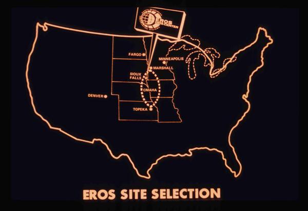
Once the Department of the Interior determined the center of the lower 48 states would be the best place for satellite reception, cities from Topeka, Kansas, to Sioux Falls started competing to host a space-age, high-tech data center to develop, catalog and interpret what was estimated to be 25,000 images in the first year.
Media

Sources/Usage: Public Domain. View Media Details
South Dakota had an edge with its high-powered congressional delegation. Senate Minority Leader Karl Mundt, a personal friend of then-President Richard Nixon, and Rep. Ben Reifel both were the ranking members of their respective Interior Appropriations Committees. They worked to secure funding for the project and tipped off Sioux Falls Development Foundation members about the possibilities.
On March 30, 1970, another preemptive press release, this one from Mundt’s office, proclaimed that Sioux Falls had been chosen—somewhat before it was 100% official. Now the hard work of making the center a reality began.
Operation Ground Shot
In addition to lobbying for the EROS Center, the Development Foundation and the Chamber of Commerce had long wanted to build an industrial park to attract more businesses to Sioux Falls, so they tied the two projects together, launching Industrial Development Week on April 23, 1970. Pecora spoke at the kickoff event, and a traveling display was created with exhibits about EROS, other local industries, samples of moon dust and a South Dakota flag that had been carried to the moon by Apollo 11 astronauts. For a $2 donation to the Development Foundation, people received a button proclaiming them as “Sioux Empire Builders.”
Media

Sources/Usage: Public Domain. View Media Details
Next came Operation Ground Shot. On May 21, 1970, dozens of members started a fund-raising drive in the business community, with a goal of raising \$390,000 to buy the land for EROS and the industrial park. By the end of July, \$480,000 had been raised—and now it was time to find a site for the data center.
The USGS had some specific requirements. The EROS center would have to be within 10 miles of the airport and meet soil stability and water requirements. It would also have to ensure low electronic interference. And instead of the 10 acres envisioned when the Sioux Falls business community made the offer of land, the site itself would require 100 acres, plus a 200-acre buffer zone! Sioux Falls leaders said: “Whatever is required, we will do it.”
The Sioux Falls Development Foundation bought 318 acres of land from the Froseth and Hegge farms. Federal funding to build the center stalled in Washington, D.C., so an innovative solution was devised: the Development Foundation would secure the \$5.5 million loan, build the center, then lease it back to the federal government for 20 years until it was paid off.
Media

The EROS Site in 1971, before construction.
Sources/Usage: Public Domain. View Media Details
Media

South Dakota representatives Al Schock (far left), Governor Frank Farrar (third from left) and Bob McCaughey (far right), aide to Senator Karl Mundt, present the deeds for EROS land to President Nixon (second from left) on October 26, 1970, in the Oval Office at the White House.
Sources/Usage: Public Domain. View Media Details
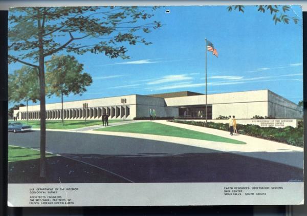
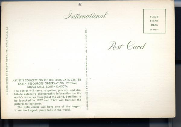
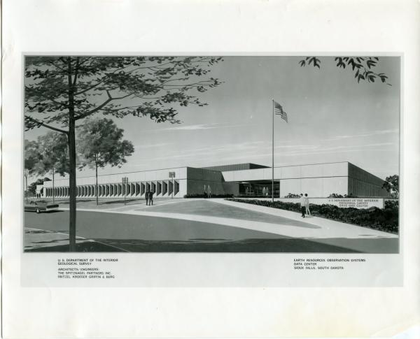
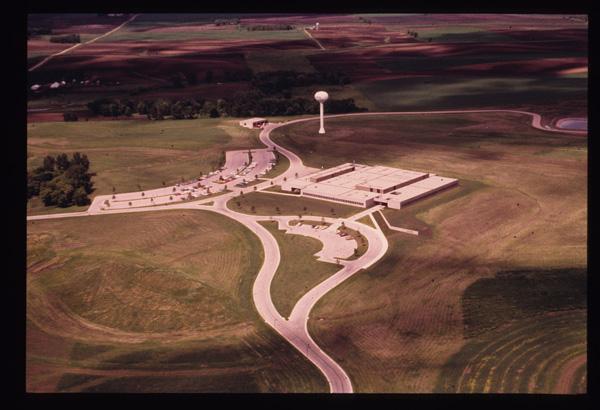
Media

The completion of the EROS Data Center, support building, water tower and parking lots.
Sources/Usage: Public Domain. View Media Details
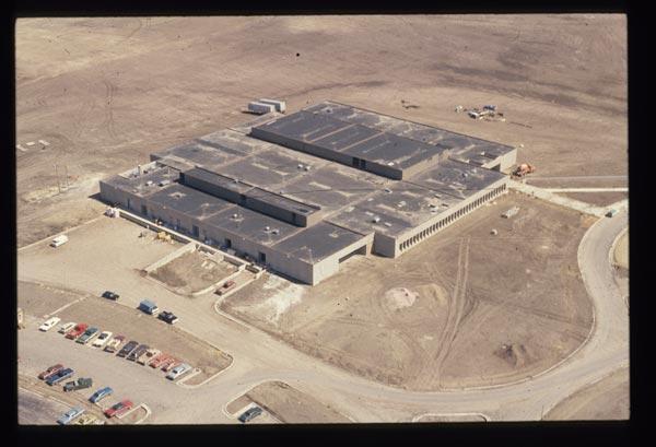
Breaking New Ground
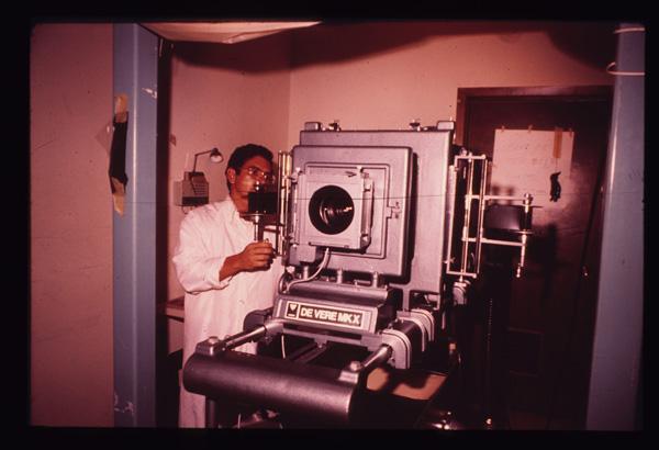
There was no template for how to build a photo processing and interpretation facility on this scale. Sioux Falls architectural and engineering firms Spitznagel Partners Inc. and Fritzel, Kroeger, Griffin and Berg designed the building and infrastructure, including five processing pools to ensure that photochemicals didn’t enter the groundwater system.
That “from scratch” quality permeated much of the activity required to make EROS a reality:
- When farmers were worried about potential electrical effects and land price issues, SFDF members helped county commissioners and EROS chief Glenn Landis communicate about rezoning—which eventually passed with no protest.
- The new building would not be ready in time to begin processing Landsat 1 photos, so the Soo Hudson building at 10th Street and Dakota Avenue in Sioux Falls became the Downtown Office. No telephones or typewriters were present for the office’s opening September 28, 1971, but it eventually housed the film, the photo processing equipment and the IBM 360-30 computer—with a memory capacity of 64 kilobytes.
- A federal hiring freeze posed problems for hiring the workers needed, but the Job Service of South Dakota coordinated training programs for unemployed people using the Work Incentive Program. Fifteen new employees learned the complexities of photo processing in an intensive six-week program.
Media

Sources/Usage: Public Domain. View Media Details
With a lot invested, the Development Foundation staged the groundbreaking ceremony with characteristic panache. Pecora, now Undersecretary of the Interior, Merlyn Veren (who lobbied for the project in Washington, D.C.) and Landis helped guide a mule-drawn plow to turn earth at the EROS site on a cool morning, April 14, 1972.
During the ceremonies, Fischer, one of the scientists who conceived of EROS, summed up the massive scale of the project: “It is the largest Earth scientific experiment ever undertaken by man, and possibly the most significant.”
An Explosion of Discoveries
Media

Sources/Usage: Public Domain. View Media Details
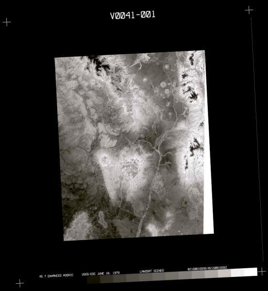
Landsat 1 launched on July 23, 1972, from Vandenberg Air Force Base in California. A delegation from South Dakota in attendance included Governor Dick Kneip and many of the SFDF supporters who had worked to make EROS a reality.
The “first light” images of Dallas, Texas, on July 25, caused a stir at EROS—the negatives were barely usable! Eventually, the EROS team blasted enough light through them to produce usable photos, and the process was adjusted for the subsequent discoveries, which came pouring in:
- Shortly after launch, an 81,000-acre fire was revealed in isolated central Alaska.
- “Galloping glaciers” were observed on Mount McKinley) on January 11, 1973.
- Volcanoes and glaciers in Iceland were seen on January 23.
- Previously undetected faults in Tennessee and South Carolina were noted in March and April.
Media

Sources/Usage: Public Domain. View Media Details
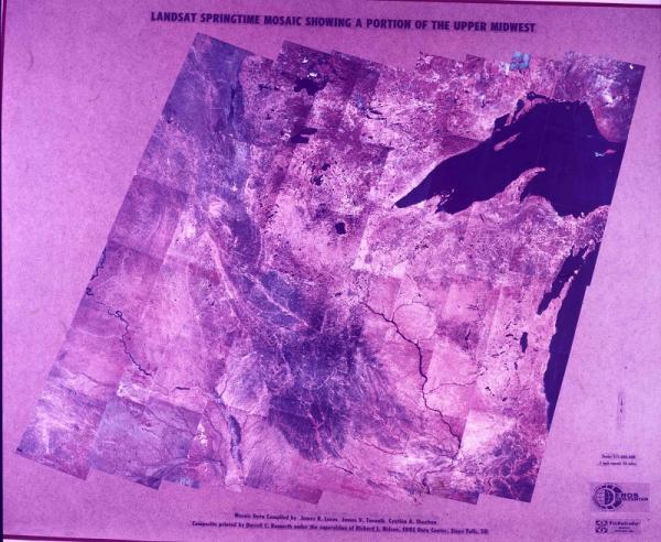
And on May 15, a press release noted what might be the first ever remote sensing land change observation: a comparison of the Mississippi River from October 1972, at normal flow, with the same area flooded in March 1973. In June, a composite false-color map was released that included 600 miles of the Mississippi River and a 150-mile stretch of the Ohio River.
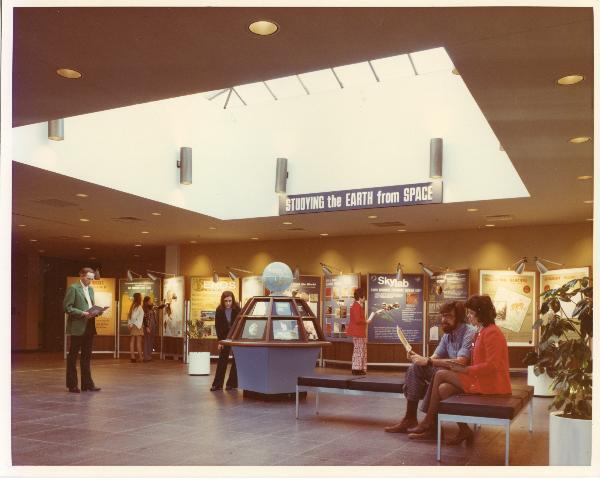
The World Comes to Sioux Falls
Every 18 days, Landsat 1 recorded a complete scan of the entire Earth, and that ability to consistently detect land change over time across the globe was unprecedented in human history. Scientists immediately saw the possibilities for mapping, agriculture, disaster relief, locating minerals, forestry and dozens of other applications.
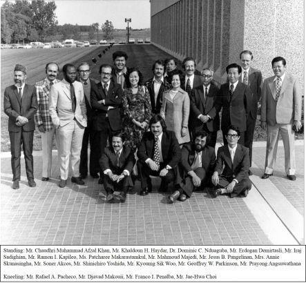
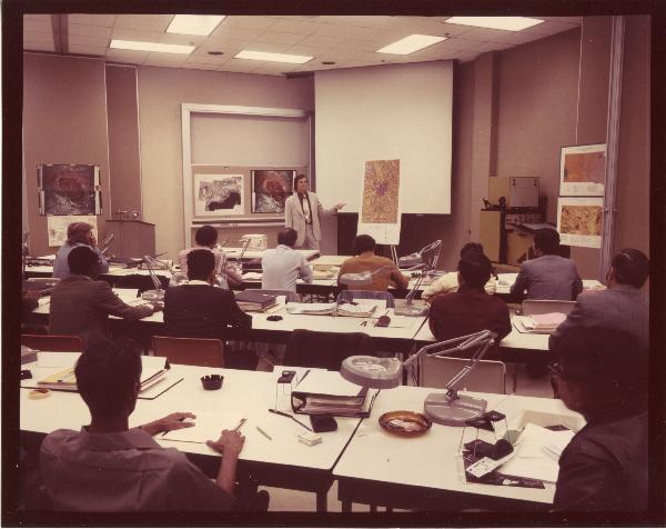
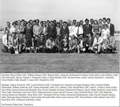
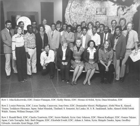
Even before the EROS Center opened its doors, 33 researchers from around the world came to Sioux Falls for the first international training course in June 1973, learning how to read satellite imagery. These particular workshops continued to bring in visitors from Afghanistan to Zimbabwe twice a year through the late 1980s, offering not only training but also imagery useful in their home countries. EROS employees also went abroad throughout the 1970s to train scientists in Australia, Nairobi and Iran, among others, and there were National EROS Centers in Uruguay, Argentina, Paraguay, Chile, Bolivia, and Peru.
Media

Sources/Usage: Public Domain. View Media Details
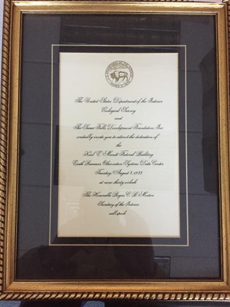
On August 7, 1973, 2,000 people attended the opening of the EROS Center, holding their programs to shade their eyes on a bright summer day. There was so much interest in the new site that a second event was held August 12, this time pulling in 5,000 visitors!
Along with international visitors, officials and scientists from state and federal agencies also flocked to EROS in those early years, all hungry for training and data. By April 1975, for example, projects included the South Dakota Land Use Project; flood and flood-plain analyses; an inventory of shelterbelts in the Plains states; an environmental evaluation of strip mines; and assistance for the Algerian Ministry of Hydraulics to establish remote sensing planning.
Settling in at the New Center
Media

Sources/Usage: Some content may have restrictions. View Media Details
In September 1973, as administration and data production moved into the new facility, a new director was named: Allen Watkins, formerly the deputy program manager for NASA’s Earth Resources Program. This allowed Glenn Landis to focus on the massive tasks of data production and distribution. There were now 124 employees, but more were needed, so in the face of a federal hiring freeze, Technicolor, Inc., was named as the first contractor at EROS to oversee the onsite technical support staff.
Toward the end of September, Eastman Kodak did a surprise “favor” for EROS by running an ad in Scientific American and 50 other magazines telling readers to write or call EROS to get ERTS images. EROS staff found out the Thursday before that the ad would be running Monday. The customer service department moved from downtown Sioux Falls to the new center in 48 hours, anticipating the overwhelming number of orders for satellite photos that poured in over the next few weeks. By November, the customer services department added seven employees to help with the backlog.
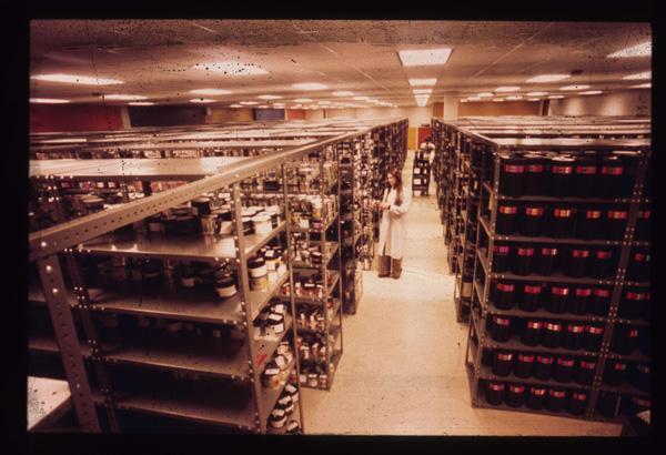
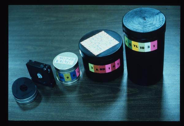
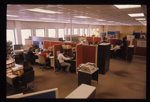
At the beginning of 1974, the new facility went fully operational, with 210 employees—and it just kept growing. The Data Analysis Lab was installed for research. By the end of the year, EROS employed almost 300 people, with a payroll of \$2.5 million; 12,000 Landsat satellite images were added every month, and the total number of images in the archives (including aerial imagery) was close to 6 million.
Media

Sources/Usage: Public Domain. View Media Details
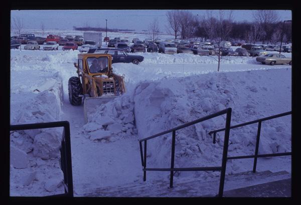
A Super Bowl weekend blizzard that hit Friday, January 10, 1975, trapped 30 employees at EROS. They waited out the storm by eating at the cafeteria, creating playing cards from computer data cards and watching the Super Bowl. The roads were cleared on Sunday, January 12, and thereafter, the administration stocked the center with blankets and other emergency supplies.
Just a few days later, January 14, 1975, NASA renamed the ERTS program to Landsat. Folks at EROS weren’t consulted, but they liked the rebranding. The announcement coincided with the launch of Landsat 2 on January 22. This satellite, originally designed to last one year, provided imagery for the next seven years.
Expanding Influence
As NASA and EROS finalized an agreement in 1975 ensuring that EROS would continue to distribute data, the Center was flourishing. Sioux Falls hosted the first Pecora Symposium, sponsored by EROS and NASA, in October that same year; the theme was how satellite data can be used to search for fuel and mineral deposits. On January 5, 1976, the Burroughs 6700 mainframe computer was installed, making EROS home to one of the biggest computer systems in the Midwest.
Media

Sources/Usage: Public Domain. View Media Details
Other events large and small show how EROS was increasingly viewed as a valuable resource:
- The Los Angeles County District Attorney’s Office in October 1975 requested information on Landsat satellite images of the Island of Hawaii. The images were to be used in a \$500,000 land swindle case as evidence of the fraudulent claim of the defendant regarding terrain in the area where lots were sold.
- Major studies in 1976 involved field validation of Bureau of Land Management ground cover types of 2.5 million acres in Denali National Park and the Arizona Vegetation Research Inventory (AVRI), which included a test for whether big horn sheep could be moved into the research area.
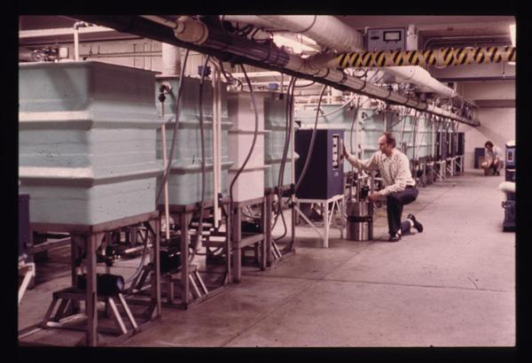
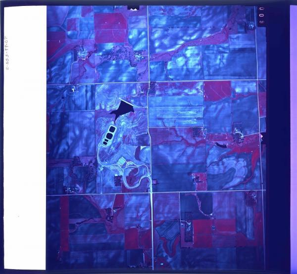
- About this time, EROS received equipment that would allow staff users to scan Landsat film chips into a computer; the resulting images could then be used to make color composites. It was followed by equipment that read images off magnetic tapes and enabled spectral signature classification. For the first time, scientists could group ground features by spectral characteristics, classifying bare ground, grassland, forest, water, and other land covers.
- March 5, 1978, Landsat 3 launched. Research at EROS abounded, including maps of Cape Cod; a glacier atlas; studies of desertification, surface water, and snow area; geological research in Iceland and Alaska; monitoring of evaporites and oil slicks; UN-sponsored research of karsts in Turkey; luminescence studies; and mapping of shallow water features near Palau. The center did an additional \$394,000 of research in conjunction with other U.S. agencies.
The last year of the decade brought a key improvement: The Domsat antenna was installed to receive Landsat MSS data directly from Goddard Space Flight Center. It became operational in May after testing, ending the era of receiving film and computer tape via mail or commercial aircraft and greatly improving data processing time.


EROS and Sioux Falls
In the 50 years since the EROS Center opened its doors, Sioux Falls has tripled in population, while the workforce at EROS has doubled. Time and again, the Sioux Falls Development Foundation has supported the center, hosting anniversary celebrations over the decades and even participating in a ceremonial burning of the original 20-year lease in 1994. In turn, SFDF has been able to tap EROS’ scientific cachet in seeking to attract businesses and people to the metro area.
Ultimately, the city’s decision to do “whatever is required” to acquire EROS created a ripple effect of scientific discovery that started in Sioux Falls and spread around the world—monitoring fires, floods and famines as well as human impacts from mining to agriculture. Observing and recording how land changes over time is a powerful tool that reaches into the past to help explain the present and predict the future.
Related
Listen to Eyes on Earth podcast episodes about EROS and history, and watch videos about the early promises of Landsat 1, the 50-year history of EROS and of the Landsat Program, and Landsat launches.
Episodes About EROS
Episodes About EROS
Episodes Related to History
Episodes Related to History

USGS EROS: Celebrating 50 Years of Excellence
For 50 years, the people of EROS have overcome difficulties and celebrated triumphs together, always centered on providing a perspective of the Earth that helps us better understand its condition. This video, timed with the 50th anniversary celebration at EROS in August of 2023, explores the center's history. 00:00 Introduction 00:08 1966-1979 - How Sioux Falls Ingenuity Secured the Center 08:26...
")
Landsat: Celebrating 50 Years (Extended Edition)
50 years of teamwork. 50 years of innovation. 50 years of resilience. In 1966, Secretary of the Interior Stewart Udall announced his vision to create a program aimed at gathering facts about the natural resources of the Earth from Earth orbiting satellites. It was a bold proclamation. It was also an idea that worked and continues to work 50 years on.

Landsat Launches - Looking Back
A short look back at the the history of Landsat launches through the historic articles of the Lompoc Record publication.
A short look back at the the history of Landsat launches through the historic articles of the Lompoc Record publication.
")
EROS Data Center Earth Resources Technology Satellite (ERTS)
EROS Data Center Earth Resources Technology Satellite (ERTS)A 1973 video from the EROS History Project on the value of the Earth Resources Technology Satellite (ERTS), which was later renamed Landsat.
EROS Data Center Earth Resources Technology Satellite (ERTS)
EROS Data Center Earth Resources Technology Satellite (ERTS)A 1973 video from the EROS History Project on the value of the Earth Resources Technology Satellite (ERTS), which was later renamed Landsat.
Related
Listen to Eyes on Earth podcast episodes about EROS and history, and watch videos about the early promises of Landsat 1, the 50-year history of EROS and of the Landsat Program, and Landsat launches.
Episodes About EROS
Episodes About EROS
Episodes Related to History
Episodes Related to History
USGS EROS: Celebrating 50 Years of Excellence
For 50 years, the people of EROS have overcome difficulties and celebrated triumphs together, always centered on providing a perspective of the Earth that helps us better understand its condition. This video, timed with the 50th anniversary celebration at EROS in August of 2023, explores the center's history. 00:00 Introduction 00:08 1966-1979 - How Sioux Falls Ingenuity Secured the Center 08:26...
Landsat: Celebrating 50 Years (Extended Edition)
50 years of teamwork. 50 years of innovation. 50 years of resilience. In 1966, Secretary of the Interior Stewart Udall announced his vision to create a program aimed at gathering facts about the natural resources of the Earth from Earth orbiting satellites. It was a bold proclamation. It was also an idea that worked and continues to work 50 years on.
50 years of teamwork. 50 years of innovation. 50 years of resilience. In 1966, Secretary of the Interior Stewart Udall announced his vision to create a program aimed at gathering facts about the natural resources of the Earth from Earth orbiting satellites. It was a bold proclamation. It was also an idea that worked and continues to work 50 years on.
Landsat Launches - Looking Back
A short look back at the the history of Landsat launches through the historic articles of the Lompoc Record publication.
A short look back at the the history of Landsat launches through the historic articles of the Lompoc Record publication.
EROS Data Center Earth Resources Technology Satellite (ERTS)
EROS Data Center Earth Resources Technology Satellite (ERTS)A 1973 video from the EROS History Project on the value of the Earth Resources Technology Satellite (ERTS), which was later renamed Landsat.
EROS Data Center Earth Resources Technology Satellite (ERTS)
EROS Data Center Earth Resources Technology Satellite (ERTS)A 1973 video from the EROS History Project on the value of the Earth Resources Technology Satellite (ERTS), which was later renamed Landsat.