
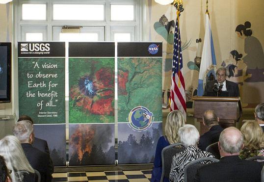
50 years of teamwork. 50 years of innovation. 50 years of resilience. In 1966, Secretary of the Interior Stewart Udall announced his vision to create a program aimed at gathering facts about the natural resources of the Earth from Earth orbiting satellites. It was a bold proclamation. It was also an idea that worked and continues to work 50 years on.
EROS 50th History, 2000-2023: Data and Science Surge
Third in a series of three EROS 50th History stories
Third in a series of three EROS 50th History stories
1966-1979: How Sioux Falls Ingenuity Secured the Center
First in a series of three EROS 50th History stories
First in a series of three EROS 50th History stories
1980-1999: Through Uncertainty to a Firm Footing
Second in a series of three EROS 50th History stories
Second in a series of three EROS 50th History stories
By Earth Resources Observation and Science (EROS) Center
July 11, 2023
As a new millennium dawned, the USGS Earth Resources Observation and Science (EROS) Center looked forward to a future full of new data and new science.
1966-1979: How Sioux Falls Ingenuity Secured the Center
1966-1979: How Sioux Falls Ingenuity Secured the Center
1980-1999: Through Uncertainty to a Firm Footing
1980-1999: Through Uncertainty to a Firm Footing
Data rolled into EROS from Landsat 7 and Terra satellites, which had both launched in 1999. Data headed out of EROS as the data access website EarthExplorer became operational in March 2000 and has grown to contain—beyond the Landsat archive—aerial photography, declassified and additional satellite imagery, Digital Elevation Model datasets and drone and radar imagery.
One scientific feat kicking off the 2000s was completion of the first National Land Cover Dataset, NLCD 1992, offering a 30-meter resolution based on Landsat 5 data. NLCD became the definitive USGS land cover product for the United States.
Art also entered the EROS picture when the first Earth As Art exhibit, based on colorful Landsat 7 imagery, debuted in November 2001 at the Washington Pavilion of Arts and Science in Sioux Falls, South Dakota.
Media

USGS Earth Explorer offers a variety of data sets to searchin the Earth Resources Observation and Science (EROS) Center. archive.
Sources/Usage: Public Domain. View Media Details
Media

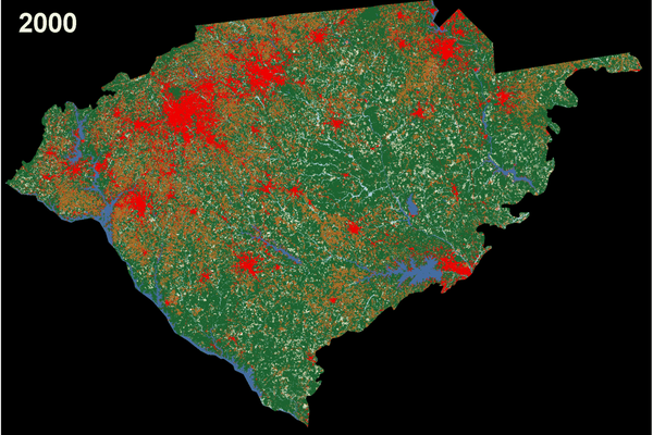
The 2016 National Land Cover Database's 16 classes of land cover are shown for the conterminous United States.
Sources/Usage: Public Domain. View Media Details
Media

A Landsat 8 Earth As Art image.
Sources/Usage: Public Domain. View Media Details
Developments since then—such as the pivotal 2008 decision to offer Landsat data at no cost to the public—have propelled EROS to marking a half-century of progress in 2023. In August, EROS will celebrate the 50th anniversary of turning South Dakota farm fields into the grounds for our nation’s land remote sensing data archive building. And although it seems appropriate to note this change in land cover, given the nature of EROS science, the facility isn’t really what we’re celebrating.
We’re celebrating the countless people who walked through the doors, and more recently logged in from afar, to devote themselves to the mission of supplying information that helps make our planet a better home, able to meet the safety and needs of its inhabitants. We’re celebrating their scientific wisdom, their perseverance during significant challenges and their ingenuity and determination to make things work out well time after time.
These people led EROS to become the trusted institution it is today. And in a changing world, these people will carry on work that grows ever more vital to humankind.


Sources/Usage: Public Domain. View Media Details
Trials and Triumphs in Getting Imagery
Events in the life of the Landsat Program usually affect EROS in some way—often in a big way. In 2003, for example, the Scan Line Corrector failed on Landsat 7’s Enhanced Thematic Mapper Plus sensor, resulting in data gaps for each scene. EROS staff worked to find strategies to fill in missing data so scientists could still use the imagery smoothly. However, with lower prices and demand for Landsat 7 data, the EROS workforce was affected.
Some other significant events in the EROS archive history include:
- Landsat 4 retiring in 2001, the same year EROS began directly downlinking Landsat 5 data and received the Landsat 5 archive from the commercial operator.
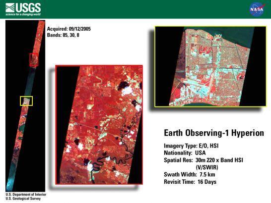
Media

Sources/Usage: Public Domain. View Media Details
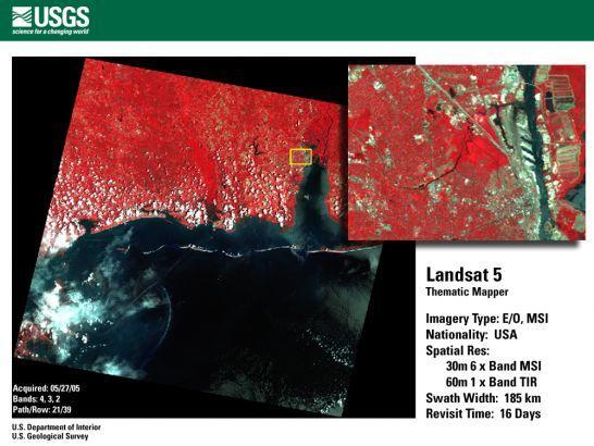
- Landsat 5 surviving potentially mission-ending developments during the first decade of the 21st century and providing data without the gaps that plagued Landsat 7 scenes through early 2013. The Guinness Book of World Records recognized Landsat 5 as the “Longest-operating Earth Observation Satellite” after its 28 years and 10 months of service.
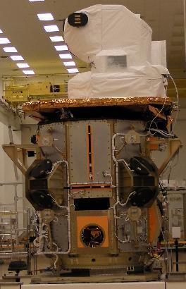
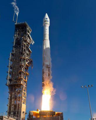
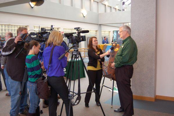
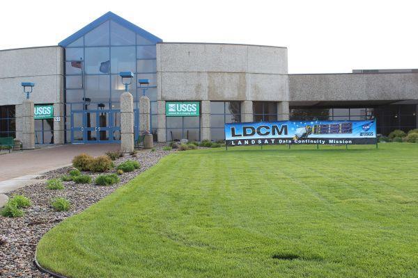
- Landsat 8 launching February 11, 2013, from Vandenberg Air Force Base, after much research and discussion about what the Landsat Data Continuity Mission should include. Some EROS staff attended in person; others watched remotely from the auditorium. The newest satellite met the high hopes of scientists with the new Operational Land Imager (OLI) and Thermal Infrared Sensor (TIRS) instruments. Interior Secretary Sally Jewell was among guests at EROS attending the transfer of ownership to USGS from NASA on May 30, 2013.
Media

Sources/Usage: Some content may have restrictions. View Media Details
- Gathering reels and tapes of older imagery from far-flung Landsat ground receiving stations around the world for the Landsat Global Archive Consolidation (LGAC) project. LGAC has added more than 6 million images to the Landsat archive, which now contains a total of more than 11 million images.
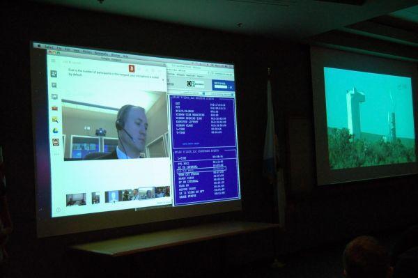
- Landsat 9 launching with a similar design to Landsat 8 on September 27, 2021, and EROS hosting the transfer ceremony the following August.
Media

Sources/Usage: Public Domain. View Media Details
- Landsat 7 remaining in service, when normally it would have shut down after the launch of Landsat 9. Landsat 7 currently orbits at a slightly lower altitude but still collects data in its Extended Science Mission. And around 2026, NASA will attempt the first refueling of a live satellite by sending up a robotic spacecraft to refuel Landsat 7.
- Looking forward to the launch of the 10th Landsat satellite, Landsat Next, which will bring a new era of design and data to the program. In about 2030, the constellation of three smaller satellites is planned to begin orbiting with a closer look at Earth on a more frequent basis and with more capability for collecting additional data.
Beyond Landsat, EROS continues to add aerial and drone imagery, and the Land Processes Distributed Active Archive Center at EROS has greatly increased its offerings as new NASA satellites and sensors have been deployed.
Improving How We Offer Data
EROS has always tried to help more people get easier access to its data, and the 2000s really demonstrated this.
When data still came with a price tag, EROS provided infrastructure support for AmericaView to be implemented in 2000 and later incorporated as a nonprofit in 2003. This followed a pilot project with OhioView, also involving EROS, which shared remote sensing data among universities to help overcome cost and data access barriers.
A pivotal event that sent Landsat demand soaring came in 2008, when the USGS opened the Landsat archive for download at no cost to users. EROS counted more than a million Landsat scenes downloaded in FY 2009, compared to 25,000 scenes delivered in FY 2001, the most in any particular year before the 2008 announcement.
“To me, from 2008 forward is when Landsat really started achieving the expectations, the potential, that was envisioned … in the 1960s.”
Former EROS Chief Scientist Tom Loveland
The EarthExplorer website is a tool that endures today for delivering data from Landsat and other sources, but it’s not the only source. People can now use data right in the cloud—no need for massive downloads—thanks to a reprocessing of the entire Landsat archive, called Collection 2, that also was achieved in the cloud. EROS has also created Landsat science products to make the data more easily usable for researchers.
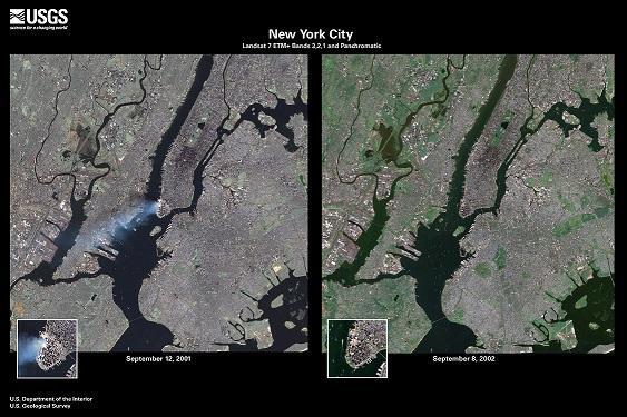
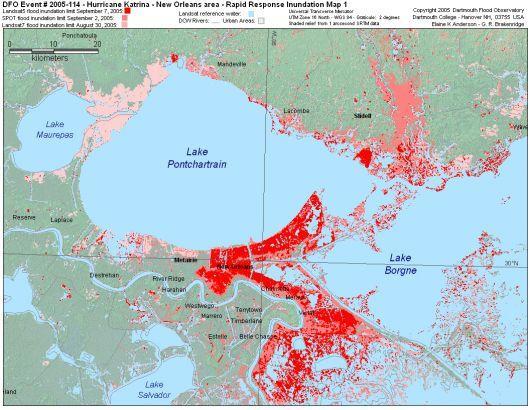
EROS continued its long history of interagency support in supplying imagery during disasters, including the September 11, 2001, terrorist attacks aimed at New York City and Washington, D.C. The facility, like other federal buildings, closed immediately that day, leaving a couple of groups meeting at EROS scrambling—amid the shock of the attacks—to find alternative meeting space in Sioux Falls. Airline shutdowns left some EROS employees stranded away from home and some EROS visitors unable to fly out of Sioux Falls. Landsat 7 captured smoke still rising above Ground Zero of the World Trade Center the following day, and in the aftermath, a portion of EROS staff provided far more imagery access in support of various federal and East Coast state agency requests, including satellite, aerial and lidar imagery.
EROS, as host of the Hazards Data Distribution System (HDDS) of U.S.-produced government and commercial imagery for the International Charter Space & Major Disasters, saw more than 517,000 files downloaded in the two months following the December 2004 Indian Ocean tsunami that killed at least 225,000 people in South and Southeast Asia. Other types of disasters that HDDS has responded to include wildfires, flooding, hurricanes and cyclones, earthquakes, volcanoes, landslides, oil spills and even sunken ships.
Media

Sources/Usage: Public Domain. View Media Details
In 2004, EROS went all digital, no longer distributing aerial photos as photographs but as digital products only. In 2005, after 32 years, the Photo Lab officially closed, and equipment and supplies were removed. In 2009, an ambitious project began to scan film for a high-resolution digital copy of all aerial photography at EROS with custom-built Phoenix systems operating 24 hours a day, five days a week.
In 2017, the EROS Calibration Center of Excellence (ECCOE) began with the aspiration of being the leading organization for improving the accuracy, precision and efficiency of optical satellite and sensor calibration, characterization and cross-calibration—ensuring high-quality data for users worldwide.
Strategic Science Efforts
In tandem with more and better data accumulating in the EROS archive, scientists at EROS developed new ways to help a changing world in need of guidance for making decisions.
Knowledge of what covers the land, how the land is being used and how that land has changed over time is foundational for local, state and federal agencies, nonprofit organizations, private land managers and commercial industries. EROS efforts to provide land cover information at 30-meter resolution grew beyond NLCD to programs like Landscape Fire and Resource Management Planning Tools (LANDFIRE), hosted at EROS, chartered in 2004 after a prototype began in 2002. LANDFIRE provides details relevant in wildfire and prescribed burning situations about a variety of conditions such as fire fuels and disturbances.
Media

Sources/Usage: Public Domain. View Media Details
Examples of other land cover science and information efforts include:
- Ongoing mapping of wildfires for Burned Area Emergency Response teams, starting in 2001, and through the Monitoring Trends in Burn Severity program, enacted in 2005
- The 2005 publication of the book “One Planet, Many People: Atlas of Our Changing Environment” by the United Nations Environmental Program’s Global Resource Information Database office at EROS, showing land change over time from human causes
- Development in 2006 of a model, FOREcasting SCEnarios of land-use change (FORE-SCE), to help anticipate future effects of land use using land cover data and analysis
Media
Sources/Usage: Public Domain. View Media Details
- The creation of regional models for the Coastal National Elevation Database (CoNED) showing land elevation and water depth, beginning with Mobile, Alabama, in 2010
- Creation of a global map of mangroves using more than 1,000 Landsat scenes in 2011
- Publication of an atlas, “Landscapes of West Africa, A Window on a Changing World,” and dataset in 2016 that used satellite data and field photography to show land change over time in 17 countries
- Creation of a 30-meter land cover product of all of North America in 2017 under the North American Land Change Monitoring System
- Development of the Land Change Monitoring, Assessment, and Projection (LCMAP) program, providing ready-to-use annual Landsat-based land change and land use data on a continuous schedule that started in 2020; it is in the process of integrating with NLCD
- Mapping of western rangeland, given the name Rangeland Condition, Monitoring, and Assessment (RCMAP) in 2021
Droughts such as the prolonged one in the western United States that began in 2000 and those that happen periodically in Africa threaten the agricultural industry and the food and water supply. EROS helps producers and government agencies through efforts that include:
- An evapotranspiration model, now called the operational Simplified Surface Energy Balance (SSEBop), developed in 2006 to help account for water use and losses in agriculture through irrigation
- The Vegetation Drought Response Index, or VegDRI, depicting drought stress on vegetation, which reached the milestone of covering the conterminous United States at two-week intervals in 2009 and now provides updates weekly
- Online tools to more easily deliver Famine Early Warning System Network data to people in parts of Africa and other food-insecure parts of the world
Improving technology has enabled the more complicated research needed for many of the scientific studies at EROS, including the 2019 arrival of two supercomputers, McKinley and Tallgrass, which are also available for use by other USGS scientists.


Other Significant Events
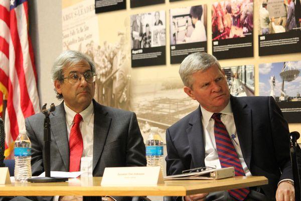
Several names have occupied the top leadership position at EROS during the past couple of decades. R.J. Thompson received a promotion to Chief of EROS in 2002 when Don Lauer left. When Thompson retired in 2007, a series of short-term leaders took the helm until Frank Kelly began serving as Center Director and USGS Space Policy Advisor at the end of 2011. Kelly retired in 2018, and former NASA astronaut Christopher J. Loria took charge of EROS that year. Pete Doucette began serving as acting center director in 2021 after Loria left, and in March 2023, Doucette officially became the current director of EROS.
Celebrations and exhibitions seemed to abound since 2000, in addition to the Landsat 8 and 9 handover ceremonies. Here are some examples:
- EROS celebrated its 30th anniversary in 2003 with an open house that also noted the 200th anniversary of the Lewis & Clark expedition.
- In 2004, an EROS exhibit of satellite images tracing the journey of Lewis and Clark went on display in the Washington Pavilion in Sioux Falls.
- Also in 2004, the staff of EROS received the 2004 Pecora Group Award in recognition of its “outstanding leadership and service in enabling access and use of land remote sensing data.”
- EROS received a name change in 2004 as well—from Earth Resources Observation Systems Data Center to the National Center for Earth Resources Observation and Science—to emphasize the role of EROS in addressing national and international science and land management issues for the DOI, other federal agencies and the public.
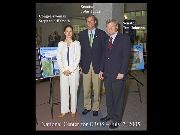
Media

Sources/Usage: Public Domain. View Media Details
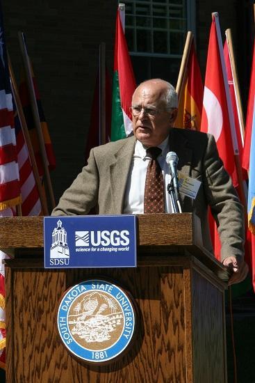
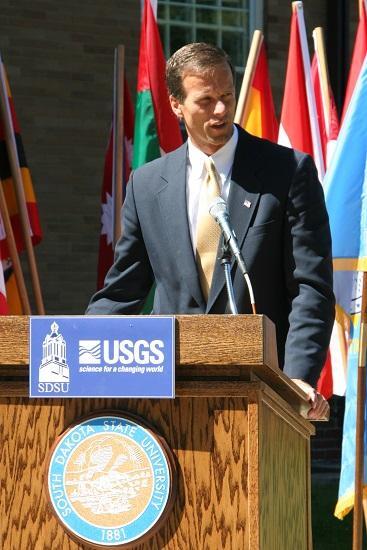
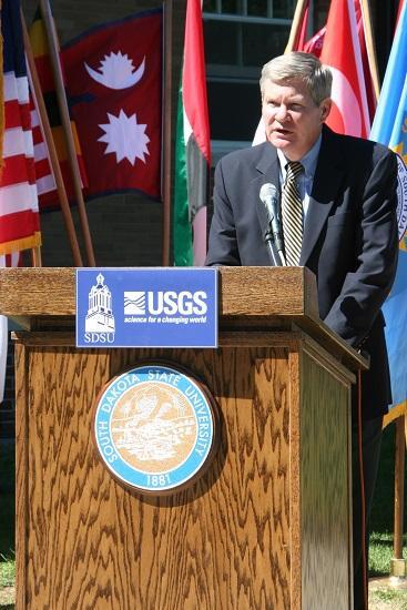
- The USGS and South Dakota State University held a ribbon cutting in 2005 to debut a partnership between EROS and SDSU in SDSU’s new Geographic Information Science Center of Excellence, designed to carry out collaborative research, professional development and educational experiences. Co-directors of the new center were Tom Loveland from EROS and Matthew Hansen from SDSU.
- In addition to its debut exhibition in Sioux Falls, Earth As Art went on to add five more collections of colorful imagery. The Earth As Art 3 exhibit traveled in 2011-2012 to venues that included the Library of Congress.
- In 2013, EROS’ 40th anniversary included festivities for the families of current and alumni staff, with a time capsule marking the occasion.
One recent global event directly and dramatically affected work life at EROS. The COVID-19 epidemic closed the EROS facility to most staff beginning in March 2020, when working from home became the new norm. Employees resumed working in the building in spring 2022.
Caretakers of the Archive
For 50 years, the people of EROS have overcome difficulties and celebrated triumphs together, always centered on providing a perspective of the Earth that helps us better understand its condition.
The EROS archive has become a time-travel treasure for people curious about past changes on the land and what they could reveal about the future. The archive has relied on caretakers at EROS who recognize its value and the vital need to keep it available to the public. They have made extraordinary efforts to preserve the archive amid degrading and distant data and changing technologies, and they have worked to improve the quality of the data to make it more usable for scientists at EROS and around the world.
From the South Dakota countryside, the technology and science at EROS will continue to reach around the world and reveal our connections to our planet—and ultimately, to each other.
Related
Listen to Eyes on Earth podcast episodes about EROS and history. Behold the beauty of imagery through Earth As Art. Explore specific changes on our planet through Earthshots. Watch more videos about EROS and Landsat developments.
Episodes About EROS
Episodes About EROS
Episodes Related to History
Episodes Related to History
View Earth As Art
View Earth As Art
Explore Earthshots
Explore Earthshots

USGS EROS: Celebrating 50 Years of Excellence
For 50 years, the people of EROS have overcome difficulties and celebrated triumphs together, always centered on providing a perspective of the Earth that helps us better understand its condition. This video, timed with the 50th anniversary celebration at EROS in August of 2023, explores the center's history. 00:00 Introduction 00:08 1966-1979 - How Sioux Falls Ingenuity Secured the Center 08:26...
")
Landsat: Celebrating 50 Years (Extended Edition)
50 years of teamwork. 50 years of innovation. 50 years of resilience. In 1966, Secretary of the Interior Stewart Udall announced his vision to create a program aimed at gathering facts about the natural resources of the Earth from Earth orbiting satellites. It was a bold proclamation. It was also an idea that worked and continues to work 50 years on.

EROS in Action - CoNED with Dean Gesch and Jeff Danielson
EROS in Action - CoNED with Dean Gesch and Jeff DanielsonUSGS/EROS Physical Scientist Dean Gesch and USGS/EROS CoNED Applications Project Chief Jeff Danielson discuss the Coastal National Elevation Database (CoNED), its acquisition and its uses.

10th Anniversary of Landsat's Free & Open Data Policy
10th Anniversary of Landsat's Free & Open Data PolicyLeaders in the field of remote sensing discuss working with Landsat data since it began in 1972. With the change to a free and open policy 10 years ago, new and exciting possibilities have opened up.

FORE-SCE Land Use Model with Terry Sohl
Terry Sohl talks about the FORE-SCE Land Use model that is being used to assist a variety of groups. the model uses land cover products from the USGS and extrapolates that data to predict what areas will look like in the future, based on a variety of scenarios.
Terry Sohl talks about the FORE-SCE Land Use model that is being used to assist a variety of groups. the model uses land cover products from the USGS and extrapolates that data to predict what areas will look like in the future, based on a variety of scenarios.
Related
Listen to Eyes on Earth podcast episodes about EROS and history. Behold the beauty of imagery through Earth As Art. Explore specific changes on our planet through Earthshots. Watch more videos about EROS and Landsat developments.
Episodes About EROS
Episodes About EROS
Episodes Related to History
Episodes Related to History
View Earth As Art
View Earth As Art
Explore Earthshots
Explore Earthshots
USGS EROS: Celebrating 50 Years of Excellence
For 50 years, the people of EROS have overcome difficulties and celebrated triumphs together, always centered on providing a perspective of the Earth that helps us better understand its condition. This video, timed with the 50th anniversary celebration at EROS in August of 2023, explores the center's history. 00:00 Introduction 00:08 1966-1979 - How Sioux Falls Ingenuity Secured the Center 08:26...
Landsat: Celebrating 50 Years (Extended Edition)
50 years of teamwork. 50 years of innovation. 50 years of resilience. In 1966, Secretary of the Interior Stewart Udall announced his vision to create a program aimed at gathering facts about the natural resources of the Earth from Earth orbiting satellites. It was a bold proclamation. It was also an idea that worked and continues to work 50 years on.
50 years of teamwork. 50 years of innovation. 50 years of resilience. In 1966, Secretary of the Interior Stewart Udall announced his vision to create a program aimed at gathering facts about the natural resources of the Earth from Earth orbiting satellites. It was a bold proclamation. It was also an idea that worked and continues to work 50 years on.
EROS in Action - CoNED with Dean Gesch and Jeff Danielson
EROS in Action - CoNED with Dean Gesch and Jeff DanielsonUSGS/EROS Physical Scientist Dean Gesch and USGS/EROS CoNED Applications Project Chief Jeff Danielson discuss the Coastal National Elevation Database (CoNED), its acquisition and its uses.
10th Anniversary of Landsat's Free & Open Data Policy
10th Anniversary of Landsat's Free & Open Data PolicyLeaders in the field of remote sensing discuss working with Landsat data since it began in 1972. With the change to a free and open policy 10 years ago, new and exciting possibilities have opened up.
FORE-SCE Land Use Model with Terry Sohl
Terry Sohl talks about the FORE-SCE Land Use model that is being used to assist a variety of groups. the model uses land cover products from the USGS and extrapolates that data to predict what areas will look like in the future, based on a variety of scenarios.
Terry Sohl talks about the FORE-SCE Land Use model that is being used to assist a variety of groups. the model uses land cover products from the USGS and extrapolates that data to predict what areas will look like in the future, based on a variety of scenarios.