
Cloud-based Applications and Data Processing
Cloud-based Applications and Data Processing
Filter Total Items: 11
Web application development to support decision making and deliver actionable science
FORT web applications support management decisions in the Department of the Interior (DOI) related to management of public lands, invasive species, outdoor recreation, and fish and wildlife health. These applications are developed in partnership with resource managers from Federal, State, local, and Tribal governments, industry, and nongovernmental organizations, empowering local and rural...

KWIC Science: Rapid response products to meet resource managers’ priority science needs
Federal public land managers in the US are required by law to use science to inform management decisions. However, managers have limited time to identify science for use in decision making. Literature reviews are one tool to efficiently summarize science for use by managers, but are time-consuming to produce. Keyword in Context (KWIC) text analysis is a straightforward method of locating specific...

AI-driven science synthesis tools for resource managers
The scientific literature is abundant on drought-related topics in the western United States, including areas of the Colorado River Basin and the sagebrush biome. Scientists, resource managers, and decision makers use this science to assess, predict, and respond to the effects of drought on people and the environment. However, it can be difficult to quickly synthesize large amounts of research. To...

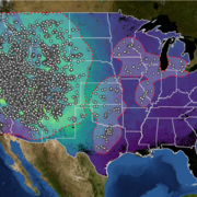
North American Bat Monitoring Program (NABat)
Bats are essential contributing members of healthy, functioning ecosystems. They perform numerous ecosystem services like insect pest control and plant pollination, and provide enormous economic benefits through ecotourism, medical research, and novel biotechnologies. North American bats face unprecedented threats including habitat loss and fragmentation, white-nose syndrome, and wind energy...

Land management research in support of streamlined energy development, economic growth, and wildfire management
FORT researchers provide sound science to support the Department of the Interior in its efforts to streamline reliable energy development, enhance cost efficiency in public lands management, and manage fire-prone habitats for public safety. This research is developed in partnership with resource managers from local, State, Federal and Tribal governments, industry, and nongovernmental organizations...

Research to support conservation of America’s national mammal, the bison
Once numbering in the tens of millions, plains bison ( Bison bison bison) were nearly driven to extinction with only a few hundred individuals remaining by the late 19th century. Plains bison have since recovered to approximately 20,000 animals managed in conservation herds throughout North America, yet substantial challenges to their recovery remain. The Department of the Interior (DOI) stewards...

Smart Energy Development: Tools for Informed Development & Successful Reclamation
The USGS is developing science and decision support tools to inform policy and management decisions about various aspects of the energy development life cycle.

USGS Data at Risk: Expanding Legacy Data Inventory and Preservation Strategies
As one of the largest and oldest science organizations in the world, USGS has produced more than a century of earth science data, much of which is currently unavailable to the greater scientific community due to inaccessible or obsolescent media, formats, and technology. Tapping this vast wealth of “dark data” requires 1) a complete inventory of legacy data and 2) methods and tools to...

Data and Tools for Landscape Assessment
The Information Science Branch develops and applies approaches that integrate natural science, computer technology, and information management to address key natural resource issues. Branch staff work with USGS scientists and data managers to convert field observations into GIS-oriented data and metadata products. The Branch also supports ecological and landscape modeling, including the...

Developing a USGS Legacy Data Inventory to Preserve and Release Historical USGS Data
Legacy data (n) - Information stored in an old or obsolete format or computer system that is, therefore, difficult to access or process. (Business Dictionary, 2016) For over 135 years, the U.S. Geological Survey has collected diverse information about the natural world and how it interacts with society. Much of this legacy information is one-of-a-kind and in danger of being lost forever...

North American Bat Data Integration
The purpose of this project was to integrate the Bat Banding Program data (1932-1972) and the U.S. and Canada diagnostic data for white-nose syndrome with the USGS Bat Population Data (BPD) Project and provide the bat research community with secure, role-based access to these previously unavailable datasets. The objectives of this project were to: 1) integrate WNS diagnostic data into...