
Regional Studies
Regional Studies
Filter Total Items: 9
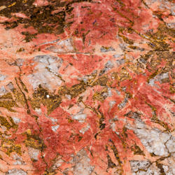
Controls on Critical Element Enrichment in Carbonatite-Alkaline Igneous Complexes
The project seeks to determine the processes responsible for critical element enrichment in carbonatites and to enhance our ability to identify and assess economic deposits. This project will work at various scales to meet this objective and will primarily focus on deposits within the US or our USGS collaborative Nations.

Geothermal Resource Investigations Project
Geothermal energy is a significant source of renewable electric power in the western United States and, with advances in exploration and development technologies, a potential source of a large fraction of baseload electric power for the entire country. This project focuses on advancing geothermal research through a better understanding of geothermal resources and the impacts of geothermal...

San Andreas Fault System in Southern California
Southern California is home to nearly 24 million people and countless visitors who live, recreate, consume resources, and face the risk of natural hazards in the region. This project produces high-quality, multi-purpose geologic maps, databases, and reports that portray our understanding of the region’s four-dimensional geologic framework. We conduct stratigraphic, structural, geomorphological...

Pacific Northwest Geologic Mapping: Northern Pacific Border, Cascades and Columbia
The Pacific Northwest is an area created by active and complex geological processes. On its path to the Pacific Ocean, the Columbia River slices through a chain of active volcanoes located along the western margin of the U.S. in Washington, Oregon, and northern California. These volcanoes rest above the active Cascadia subduction zone, which is the boundary where the oceanic tectonic plate dives...

Drivers and Impacts of North Pacific Climate Variability
Climate model forecasts indicate an increase in extreme hydrologic events, including floods and droughts, for California and the western U.S. in the future. To better understand what the consequences of this future change in climate may be, USGS scientists are studying the frequency, magnitude, and impacts of past hydroclimate variability and extremes in the region. This project produces well...

Pacific Ocean Patterns, Processes, and Productivity (POP3): Impacts of ancient warming on marine ecosystems and western North America
Projections for AD 2100 suggest warming of +1-4°C in the North Pacific Ocean, which will result in widespread transformations throughout the marine environment and western North America. Many of these changes are beyond the predictive capabilities of current climate models. To better address this future uncertainty, our team is developing a geological framework using past warm intervals as...

2D and 3D Geologic Mapping and Earthquake Hazards of California
This project uses geologic and geophysical mapping to build an earth-science framework for scientific investigations that include assessments of critical resources, such as groundwater, and of hazards, such as those resulting from earthquakes, in California west of and including the Sierra Nevada and Cascade arc. Questions of particular interest include: What are the geometries, slip rates, and...

Mineral Resource Assessment of U.S. Territories of the Caribbean Basin Archipelago including Puerto Rico, U.S. Virgin Islands and Adjacent Areas
Project objectives are to develop a modern probabilistic quantitative mineral resource assessment of Puerto Rico, U.S. Virgin Islands and adjacent geologically similar areas that examines the potential for minerals-based economic development and trade within the region.

Headwaters Province - Idaho and Montana: Earth Science Studies in Support of Public Policy Development and Land Stewardship
The Headwaters Province project provided geoscience data and interpretations to the Federal Land Management Agencies (FLMA) that were basic to sound policy and land-stewardship practices.