



Data
The Mineral Resources Online Spatial Data web portal is our primary resource for interactive maps and downloadable data for regional and global geology, geochemistry, geophysics, and mineral resources.
Geophysical Data
Geophysical Data

Find geophysical data from airborne surveys and geophysical data compilations (magnetic, gravity, aeroradiometric).
Geochemical Data
Geochemical Data

Find data from the National Geochemical Database, focused geochemical surveys, and the NURE-HSSR collection.
Mineral Resources Data
Mineral Resources Data
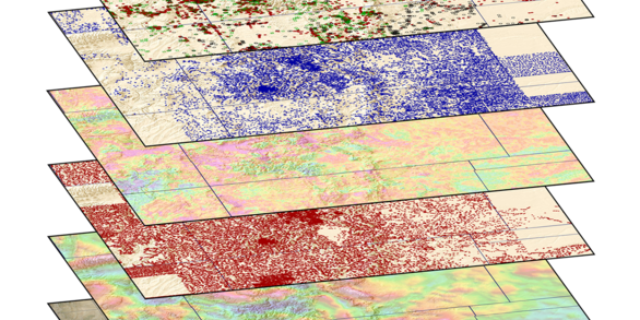
Interactive maps and downloadable data for regional and global analysis.
Filter Total Items: 415
LA-ICP-MS U-Pb Geochronology Data for Igneous Rocks Constraining the Timing of the Great Lakes tectonic zone, central Upper Peninsula, Michigan, USA LA-ICP-MS U-Pb Geochronology Data for Igneous Rocks Constraining the Timing of the Great Lakes tectonic zone, central Upper Peninsula, Michigan, USA
This U.S. Geological Survey (USGS) data release accompanies planned publication ‘New constraints on location and timing of the Great Lakes tectonic zone, central Upper Peninsula, Michigan, USA. The data release includes laser ablation inductively coupled plasma mass spectrometry (LA-ICP-MS) U-Pb zircon data and/or U-Pb apatite data for two samples from the Upper Peninsula, Michigan, USA...
Argon data for samples from Kenya and Ethiopia Argon data for samples from Kenya and Ethiopia
Ar/Ar data are for 12 samples that record the eruption age of tephra. The geochronology provides time constraints for the ages of tephra and interbedded sediments and fossils from Kenya and Ethiopia. Samples were collected by Erin Dimaggio (Pennsylvania State University), who brought them to the USGS Denver Argon Geochronology Laboratory for Ar/Ar analysis. Samples were analyzed in...
Gravity data in the Upper Peninsula, Michigan for geophysical profile modeling of the Midcontinent Rift System and associated structures Gravity data in the Upper Peninsula, Michigan for geophysical profile modeling of the Midcontinent Rift System and associated structures
Gravity data were collected from 2022 through 2024 to provide more detailed data for geophysical profile modeling of the Midcontinent Rift System and associated structures. This data release provides the complete Bouguer anomaly gravity data for 256 new gravity stations to supplement existing data and replace erroneous existing data.
Magnetic susceptibility and gamma ray spectrometry measurements in southwestern Montana, 2023-2024 Magnetic susceptibility and gamma ray spectrometry measurements in southwestern Montana, 2023-2024
This dataset includes rock magnetic susceptibility and gamma ray spectrometer measurements from 243 outcrops in southwest Montana during 2023-2024. The measurements were collected to understand the causative sources of airborne magnetic and radiometric survey anomalies in the Idaho-Montana porphyry belt. Sixteen magnetic susceptibility measurements were collected at each analyzed site...
A global database of porphyry copper deposits and prospects A global database of porphyry copper deposits and prospects
Porphyry copper deposits are the world's primary source of copper and can also host a variety of secondary commodities identified as critical by the U.S. Geological Survey (U.S. Geological Survey, 2022). These deposits occur primarily along convergent plate margins, and their metal association and geochemical characteristics are reflective of whether the deposit formed in continental...
In situ geochemical data for clinopyroxene in igneous rocks of the Bear Lodge and Mineral Hill alkaline complexes, Wyoming In situ geochemical data for clinopyroxene in igneous rocks of the Bear Lodge and Mineral Hill alkaline complexes, Wyoming
Major, minor, and trace element data, as well as backscattered electron images, were collected for clinopyroxene crystals in alkaline silicate rocks (phonolite, tephriphonolite, latite, phonotephrite, and pyroxenite) of the Bear Lodge and Mineral Hill alkaline complexes, Wyoming. Samples of alkaline rocks thought to represent early and later stages of magmatism, based on observed...
Airborne magnetic and radiometric survey, central Arkansas and southern Missouri, 2023 Airborne magnetic and radiometric survey, central Arkansas and southern Missouri, 2023
This publication provides digital flight line data for a high-resolution magnetic and radiometric survey over part of central Arkansas and southern Missouri. The airborne geophysical survey was funded by the Earth Mapping Resources Initiative and was designed to meet the complimentary needs related to geologic mapping and mineral resource research. The survey covers an irregularly shaped...
National Geochemical Database on Ore Deposits: New data featuring fusion digestion analytical methods National Geochemical Database on Ore Deposits: New data featuring fusion digestion analytical methods
There is a growing demand for commodities (elements, compounds, minerals) used in today's advanced technologies. Critical minerals are usually found in ore deposits that are deemed vital to economic and national security. National Geochemical Database on Ore Deposits: New data featuring fusion digestion (NGDOD) analytical methods contains chemistry and geologic information for 16,579 ore...
Airborne Magnetic and Radiometric Survey, Colorado Mineral Belt, Mid Block, 2023 Airborne Magnetic and Radiometric Survey, Colorado Mineral Belt, Mid Block, 2023
This data release provides digital flight-line and gridded data for a high-resolution airborne magnetic and radiometric survey over the central portion of the Colorado Mineral Belt, central Colorado. The Colorado Mineral Belt is a broad, northeast-southwest trending alignment of historic mining districts that have produced multiple types of commodities, including critical minerals that...
Geochemical, petrophysical, and drill hole database for Mesoproterozoic igneous rocks and iron ore deposits of the St. Francois Mountains, southeast Missouri Geochemical, petrophysical, and drill hole database for Mesoproterozoic igneous rocks and iron ore deposits of the St. Francois Mountains, southeast Missouri
Geochemical, petrophysical, and depth to the Paleozoic-Precambrian basement interface from drill hole data for Mesoproterozoic igneous rocks and iron ore deposits of the St. Francois Mountains, southeast Missouri (MMDB) are provided in this data release. The samples were collected as part of various agency programs and projects from 1967 through 2019. Most samples were collected by...
Stable oxygen, hydrogen, sulfur, and carbon isotope analyses of mineral deposits and mineral occurrences in southeast Missouri, Alaska, Arizona, Indonesia, Brazil, and China Stable oxygen, hydrogen, sulfur, and carbon isotope analyses of mineral deposits and mineral occurrences in southeast Missouri, Alaska, Arizona, Indonesia, Brazil, and China
Stable isotope analyses are reported (the ratios deuterium/hydrogen, carbon-13/carbon-12, oxygen-18/oxygen-16, and sulfur-34/sulfur-32) for ores and related rocks from the Pea Ridge, Lower Pilot Knob, Bourbon, Iron Mountain, and Kratz Spring iron oxide-apatite deposits in southeast Missouri; the Boss iron oxide-copper-gold deposit in southeast Missouri; the Gagaryah stratiform barite...
Surface geophysical data from Ollalie North springs, west-central Oregon Surface geophysical data from Ollalie North springs, west-central Oregon
Surface electrical resistivity tomography (ERT) data were collected in September of 2018 near Ollalie North springs in the upper McKenzie River watershed of west-central Oregon. ERT data were acquired along a single transect on the north bank of Ollalie Creek using a combination of inverse Schlumberger, dipole-dipole, and Wenner arrays. These data were collected to contribute high...