



Data
The Mineral Resources Online Spatial Data web portal is our primary resource for interactive maps and downloadable data for regional and global geology, geochemistry, geophysics, and mineral resources.
Geophysical Data
Geophysical Data

Find geophysical data from airborne surveys and geophysical data compilations (magnetic, gravity, aeroradiometric).
Geochemical Data
Geochemical Data

Find data from the National Geochemical Database, focused geochemical surveys, and the NURE-HSSR collection.
Mineral Resources Data
Mineral Resources Data
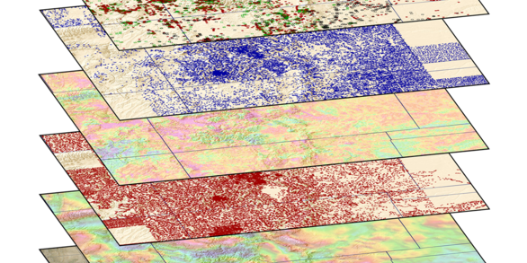
Interactive maps and downloadable data for regional and global analysis.
Filter Total Items: 415
Chemistry of groundwater, pore water, and surface water near wetland P1 in the Cottonwood Lake Study Area, Sutsman County, ND - August 2013 Chemistry of groundwater, pore water, and surface water near wetland P1 in the Cottonwood Lake Study Area, Sutsman County, ND - August 2013
Groundwater, soil pore water, and surface water were collected in and near wetland P1 in the Cottonwood Lake Study Area, Stutsman County, North Dakota in August 2013. Groundwater was collected from established wells (17, 18, and 22) via peristaltic pump. Surface water was collected from P1 ponded water via grab sample. Soil pore water was collected using drive point samplers and one...
Method development data – Stabilization of volatile silicon species in hydrofluoric acid (HF) digests of biological samples for HF-free silicon analysis by ICP-MS Method development data – Stabilization of volatile silicon species in hydrofluoric acid (HF) digests of biological samples for HF-free silicon analysis by ICP-MS
Experiments were conducted in the U.S. Geological Survey (USGS) Aqueous Trace Element Analysis Laboratory (ATEAL) in Denver, CO to support development and validation of a method for preparing biological materials for silicon analysis by solution phase inductively coupled plasma mass spectrometry (ICP-MS). The objective was to stabilize volatile silicon species resulting from a digestion...
Magnetic susceptibility measurements on rocks in Alaska to aid geophysical interpretation Magnetic susceptibility measurements on rocks in Alaska to aid geophysical interpretation
The U.S. Geological Survey (USGS) collects magnetic susceptibility measurements on in-situ and laboratory rock samples to help identify the sources of anomalies in aeromagnetic surveys in Alaska. Magnetic susceptibility is a measure of how much a material will become magnetized in an applied magnetic field and is the ratio of magnetization, M (magnetic moment per unit volume), to the...
Geochemistry and Environmental Tracer Data for Groundwater and Stream Water from the Perigo Mine Site, Colorado, 2024 Geochemistry and Environmental Tracer Data for Groundwater and Stream Water from the Perigo Mine Site, Colorado, 2024
This U.S. Geological Survey (USGS) data release contains data from stream water and groundwater samples collected in July through October 2024 at the Perigo Mine site in Gilpin County, northern Colorado. Data were collected as part of a study aimed at characterizing the local groundwater flow system in the hillslope hosting the mine’s draining crosscut tunnel, and identifying sources of...
Airborne magnetic and radiometric survey, Laramie Mountains region, Wyoming, 2024-2025 Airborne magnetic and radiometric survey, Laramie Mountains region, Wyoming, 2024-2025
This data release provides digital flight line data for a high-resolution airborne magnetic and radiometric survey over the Laramie Mountains region of Wyoming. The airborne survey was funded by the Earth Mapping Resources Initiative (Earth MRI). The survey was designed by the USGS in collaboration with the Wyoming State Geological Survey and contracted by the USGS. The survey was...
Airborne electromagnetic and magnetic survey of the western Mojave Desert, California, 2024 Airborne electromagnetic and magnetic survey of the western Mojave Desert, California, 2024
Airborne electromagnetic (AEM) and magnetic survey data were collected during November 4–20, 2024 over a distance of 3,251 line kilometers in the western Mojave Desert, California. These data were collected in support of the U.S. Geological Survey (USGS) Earth Mapping Resources Initiative (Earth MRI), which aims to improve knowledge of the geologic framework of the United States through...
Airborne magnetic and radiometric survey over northwest Arkansas, 2019-2020 (ver 2.0, May 2026) Airborne magnetic and radiometric survey over northwest Arkansas, 2019-2020 (ver 2.0, May 2026)
This data release contains digital radiometric flight line data for a high-resolution airborne magnetic and radiometric survey over an area of northwest Arkansas (version 2.0, May 2026). Data and documentation for the original version, including associated airborne magnetic data, can be found at https://doi.org/10.5066/P91O2Y8W. The airborne geophysical survey was jointly funded by the...
Airborne magnetic and radiometric survey, Elk Creek region, Nebraska and Kansas, 2024-2025 Airborne magnetic and radiometric survey, Elk Creek region, Nebraska and Kansas, 2024-2025
This data release provides digital flight line data for a high-resolution airborne magnetic and radiometric survey over the Elk Creek region of Nebraska and Kansas. The airborne survey was funded by the Earth Mapping Resources Initiative (Earth MRI). The survey was designed by the USGS in collaboration with the Nebraska Conservation and Survey Division and the Kansas Geological Survey...
Airborne Magnetic and Radiometric Survey, Colorado Mineral Belt, Northeast Block, 2024 Airborne Magnetic and Radiometric Survey, Colorado Mineral Belt, Northeast Block, 2024
This data release provides digital flight-line and gridded data for a high-resolution airborne magnetic and radiometric survey over the northeastern portion of the Colorado Mineral Belt, northern Colorado. The Colorado Mineral Belt is a broad, northeast-southwest trending alignment of historic mining districts that have produced multiple types of commodities, including critical minerals...
Probabilistic groundwater salinity mapping results of the southwestern San Joaquin Valley derived from airborne electromagnetic and groundwater salinity data Probabilistic groundwater salinity mapping results of the southwestern San Joaquin Valley derived from airborne electromagnetic and groundwater salinity data
This data release contains the results of three-dimensional, probabilistic, categorical groundwater salinity mapping of the alluvial and Tulare aquifers near areas of oil and gas development in the southwestern San Joaquin Valley of California. These results were derived from airborne electromagnetic (AEM) survey data collected between 2016 and 2018 in areas hydrogeologically...
Radiometric data collected from an uncrewed airborne system and handheld meters at the Grand Junction Regional Airport radiometric calibration facility, 2023-2024 Radiometric data collected from an uncrewed airborne system and handheld meters at the Grand Junction Regional Airport radiometric calibration facility, 2023-2024
Radiometric data were collected at the Grand Junction Regional Airport radiometric calibration facility in March 2023 and August 2024. The facility consists of five ~9 by ~12 m (30 x 40 feet) concrete pads, each 18 in thick. Each pad provides sources of radioelements that are spatially homogeneous (see Ward, 1978). Three pads are dedicated K, Th, and U pads, each of which contains high...
Airborne electromagnetic and magnetic survey near Coalinga and Pyramid Hills, California, 2022 Airborne electromagnetic and magnetic survey near Coalinga and Pyramid Hills, California, 2022
Airborne electromagnetic (AEM) and magnetic survey data were collected during November 2022 over a total distance of 2,372 line kilometers over two study areas in the Pleasant Valley near the city of Coalinga, California and the region surrounding the Pyramid Hills. These data were collected adjacent to areas of oil and gas production in support of groundwater salinity mapping and...