
U.S. flag

An official website of the United States government

Groundwater Contaminant

Filter Total Items: 14
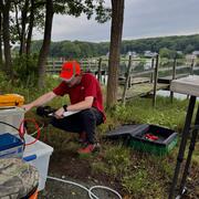
Changes in Nitrogen Contributions from Groundwater to the Niantic River Before and After Sewering

Onsite residential septic systems can be a major nonpoint source of nitrogen contamination. The excess nitrogen entering Connecticut’s Niantic River estuary is associated with high nitrate concentrations in the groundwater of the river’s 28-square-mile watershed, creating unsuitable habitat for the growth and recovery of eelgrass (Zostera marina). In an attempt to improve the river’s water quality...
Changes in Nitrogen Contributions from Groundwater to the Niantic River Before and After Sewering

Changes in Nitrogen Contributions from Groundwater to the Niantic River Before and After Sewering

Onsite residential septic systems can be a major nonpoint source of nitrogen contamination. The excess nitrogen entering Connecticut’s Niantic River estuary is associated with high nitrate concentrations in the groundwater of the river’s 28-square-mile watershed, creating unsuitable habitat for the growth and recovery of eelgrass (Zostera marina). In an attempt to improve the river’s water quality...
Learn More

Estimating Nitrogen Loading from Groundwater and Potential Effects of Sea-Level Rise in Rhode Island's Salt Ponds Region

The U.S. Geological Survey (USGS), in cooperation with the Southeast New England Program of the U.S. Environmental Protection Agency, is estimating the magnitude, spatial distribution, and travel times of nitrogen-loading to ponds and streams in the Salt Ponds region of southern Rhode Island. This information can be used to guide conservation-management efforts aimed at reducing nitrogen inputs to...
Estimating Nitrogen Loading from Groundwater and Potential Effects of Sea-Level Rise in Rhode Island's Salt Ponds Region

Estimating Nitrogen Loading from Groundwater and Potential Effects of Sea-Level Rise in Rhode Island's Salt Ponds Region

The U.S. Geological Survey (USGS), in cooperation with the Southeast New England Program of the U.S. Environmental Protection Agency, is estimating the magnitude, spatial distribution, and travel times of nitrogen-loading to ponds and streams in the Salt Ponds region of southern Rhode Island. This information can be used to guide conservation-management efforts aimed at reducing nitrogen inputs to...
Learn More

Potential Effects of Reductions in Wastewater Return Flow on the Freshwater Flow System in Falmouth, Massachusetts

The U.S. Geological Survey (USGS), in cooperation with the Town of Falmouth, is simulating the potential effects of proposed changes to wastewater return flow on the freshwater system in Falmouth, Massachusetts, using an existing regional groundwater flow model.
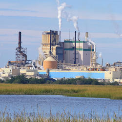
Potential Effects of Reductions in Wastewater Return Flow on the Freshwater Flow System in Falmouth, Massachusetts

Potential Effects of Reductions in Wastewater Return Flow on the Freshwater Flow System in Falmouth, Massachusetts

The U.S. Geological Survey (USGS), in cooperation with the Town of Falmouth, is simulating the potential effects of proposed changes to wastewater return flow on the freshwater system in Falmouth, Massachusetts, using an existing regional groundwater flow model.
Learn More

Collaborations with EPA on Contaminated Site Hydrology

The U.S. Geological Survey (USGS), in cooperation with the U.S. Environmental Protection Agency (EPA), is developing tools and methods to help assess the fate and transport of anthropogenic and geologically sourced contaminants in the water cycle at waste sites throughout the nation.
Collaborations with EPA on Contaminated Site Hydrology

Collaborations with EPA on Contaminated Site Hydrology

The U.S. Geological Survey (USGS), in cooperation with the U.S. Environmental Protection Agency (EPA), is developing tools and methods to help assess the fate and transport of anthropogenic and geologically sourced contaminants in the water cycle at waste sites throughout the nation.
Learn More

Augmented Site Characterization of PFAS Manufacturing and Processing Facilities

The U.S. Geological Survey (USGS) is supporting the U.S. Environmental Protection Agency (EPA) in assessing facilities nationwide that have historically produced per- and polyfluoroalkyl substances (PFAS) or used them in chemical manufacturing processes. In collaboration with EPA subcontractors, USGS is providing subject-matter expertise in PFAS fate and transport in the vadose zone and...
Augmented Site Characterization of PFAS Manufacturing and Processing Facilities

Augmented Site Characterization of PFAS Manufacturing and Processing Facilities

The U.S. Geological Survey (USGS) is supporting the U.S. Environmental Protection Agency (EPA) in assessing facilities nationwide that have historically produced per- and polyfluoroalkyl substances (PFAS) or used them in chemical manufacturing processes. In collaboration with EPA subcontractors, USGS is providing subject-matter expertise in PFAS fate and transport in the vadose zone and...
Learn More

Detailed Characterization of the Savage Superfund Site, New Hampshire

The U.S. Geological Survey (USGS), in cooperation with the U.S. Environmental Protection Agency and the New Hampshire Department of Environmental Services, is conducting advanced site characterization activities at the Savage Municipal Water Supply Superfund site in Milford, New Hampshire, and implementing new remediation efforts based on USGS science and tools.
Detailed Characterization of the Savage Superfund Site, New Hampshire

Detailed Characterization of the Savage Superfund Site, New Hampshire

The U.S. Geological Survey (USGS), in cooperation with the U.S. Environmental Protection Agency and the New Hampshire Department of Environmental Services, is conducting advanced site characterization activities at the Savage Municipal Water Supply Superfund site in Milford, New Hampshire, and implementing new remediation efforts based on USGS science and tools.
Learn More

USGS Assessment of Water Resources near Hanscom Air Force Base

The United States Geological Survey (USGS) New England Water Science Center is expanding its scientific investigation to better understand the water resources at, and in the vicinity of, Hanscom Air Force Base (AFB) and the potential impacts from historical base operations and other sources.
USGS Assessment of Water Resources near Hanscom Air Force Base

USGS Assessment of Water Resources near Hanscom Air Force Base

The United States Geological Survey (USGS) New England Water Science Center is expanding its scientific investigation to better understand the water resources at, and in the vicinity of, Hanscom Air Force Base (AFB) and the potential impacts from historical base operations and other sources.
Learn More

Geochemical Fingerprinting of Anthropogenic and Geologically Sourced Uranium at the Homestake Superfund Site, New Mexico

The U.S. Geological Survey (USGS), in cooperation with the U.S. Environmental Protection Agency, the Nuclear Regulatory Commission, and the New Mexico Environment Department, utilized a multiparameter geochemical-isotopic fingerprinting approach to differentiate anthropogenic and natural signatures of uranium contamination near the Homestake uranium mill Superfund site near Milan, New Mexico.
Geochemical Fingerprinting of Anthropogenic and Geologically Sourced Uranium at the Homestake Superfund Site, New Mexico

Geochemical Fingerprinting of Anthropogenic and Geologically Sourced Uranium at the Homestake Superfund Site, New Mexico

The U.S. Geological Survey (USGS), in cooperation with the U.S. Environmental Protection Agency, the Nuclear Regulatory Commission, and the New Mexico Environment Department, utilized a multiparameter geochemical-isotopic fingerprinting approach to differentiate anthropogenic and natural signatures of uranium contamination near the Homestake uranium mill Superfund site near Milan, New Mexico.
Learn More

Hydrologic Site Assessment for Passive Treatment of Groundwater Nitrogen with Permeable Reactive Barriers, Cape Cod, Massachusetts

In 2019 USGS completed a study designed to develop and evaluate a phased site-assessment approach for determining the hydrologic suitability of sites being considered for permeable reactive barrier installation on Cape Cod. The approach provides a template for town officials and other stakeholders to follow when considering PRBs for passive treatment of nitrogen in groundwater on Cape Cod and...
Hydrologic Site Assessment for Passive Treatment of Groundwater Nitrogen with Permeable Reactive Barriers, Cape Cod, Massachusetts

Hydrologic Site Assessment for Passive Treatment of Groundwater Nitrogen with Permeable Reactive Barriers, Cape Cod, Massachusetts

In 2019 USGS completed a study designed to develop and evaluate a phased site-assessment approach for determining the hydrologic suitability of sites being considered for permeable reactive barrier installation on Cape Cod. The approach provides a template for town officials and other stakeholders to follow when considering PRBs for passive treatment of nitrogen in groundwater on Cape Cod and...
Learn More

Assessment of Hydrologic and Water-Quality Changes in Shallow Groundwater Beneath a Coastal Neighborhood Being Converted from Septic Systems to Municipal Sewers

The U.S. Geological Survey and the U.S. Environmental Protection Agency are collaborating on a study to better understand changes to groundwater quality beneath a densely developed coastal neighborhood as it undergoes conversion from onsite wastewater disposal to municipal sewering.
Assessment of Hydrologic and Water-Quality Changes in Shallow Groundwater Beneath a Coastal Neighborhood Being Converted from Septic Systems to Municipal Sewers

Assessment of Hydrologic and Water-Quality Changes in Shallow Groundwater Beneath a Coastal Neighborhood Being Converted from Septic Systems to Municipal Sewers

The U.S. Geological Survey and the U.S. Environmental Protection Agency are collaborating on a study to better understand changes to groundwater quality beneath a densely developed coastal neighborhood as it undergoes conversion from onsite wastewater disposal to municipal sewering.
Learn More

Preliminary Research into the Causes of Iron Fouling in Water at Roadway Construction Sites

The USGS and the New Hampshire Department of Transportation are conducting preliminary research into the causes of iron fouling in water at roadway construction sites where blasted bedrock is used as on-site fill material.
Preliminary Research into the Causes of Iron Fouling in Water at Roadway Construction Sites

Preliminary Research into the Causes of Iron Fouling in Water at Roadway Construction Sites

The USGS and the New Hampshire Department of Transportation are conducting preliminary research into the causes of iron fouling in water at roadway construction sites where blasted bedrock is used as on-site fill material.
Learn More

Study to Test a Novel Shallow Well Design that May Provide Contaminant-Free Water Supply to Domestic Well Users in Arsenic-Prone Parts of the United States

The USGS, the University of New Hampshire, U.S. Environmental Protection Agency, the New Hampshire Department of Environmental Services, and the Maine Geological Survey are collaborating on a study of a novel shallow well design that might be able to provide safe drinking water to domestic well users in arsenic-prone parts of the Nation.
Study to Test a Novel Shallow Well Design that May Provide Contaminant-Free Water Supply to Domestic Well Users in Arsenic-Prone Parts of the United States

Study to Test a Novel Shallow Well Design that May Provide Contaminant-Free Water Supply to Domestic Well Users in Arsenic-Prone Parts of the United States

The USGS, the University of New Hampshire, U.S. Environmental Protection Agency, the New Hampshire Department of Environmental Services, and the Maine Geological Survey are collaborating on a study of a novel shallow well design that might be able to provide safe drinking water to domestic well users in arsenic-prone parts of the Nation.
Learn More
Was this page helpful?