
USGS 01392650 Newark Bay at PVSC at Newark, New Jersey tide gage.
Images
Images intro.
Filter Total Items: 269
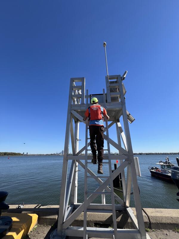
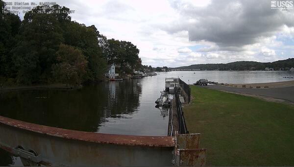
Newark Tide Gage
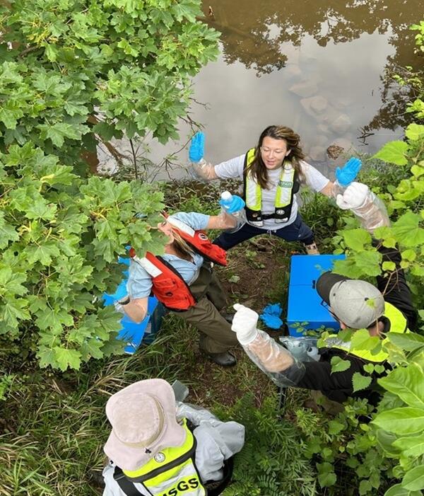
Crypyo Collection
Hydrographers Kat Cahalane, Anna Deetz-Boetsma, and Lucas Sirotniak celebrate a successful Cryptosporidium sample run.
Hydrographers Kat Cahalane, Anna Deetz-Boetsma, and Lucas Sirotniak celebrate a successful Cryptosporidium sample run.
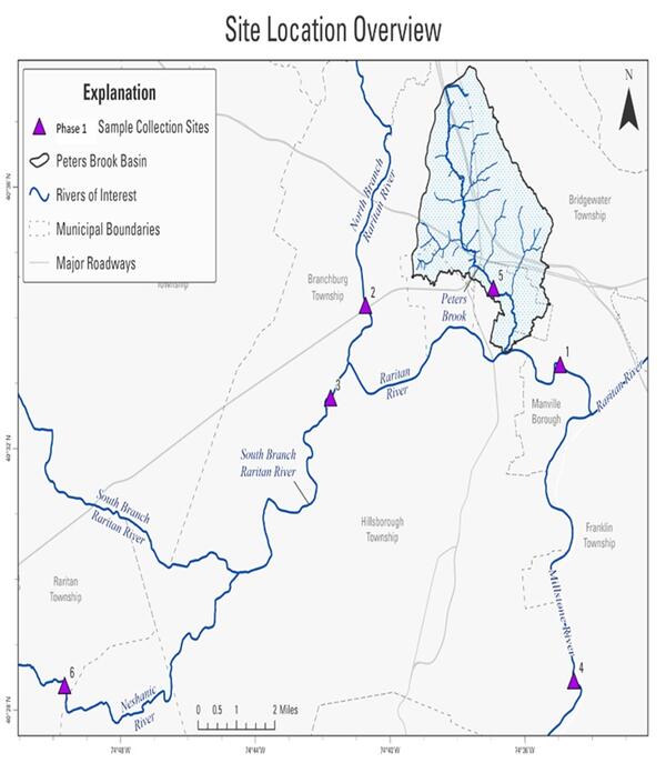
Raritan Site Map
Map of Sampling Locations within the Raritan River Basin from the Phase 1 Track Down Study.
Map of Sampling Locations within the Raritan River Basin from the Phase 1 Track Down Study.
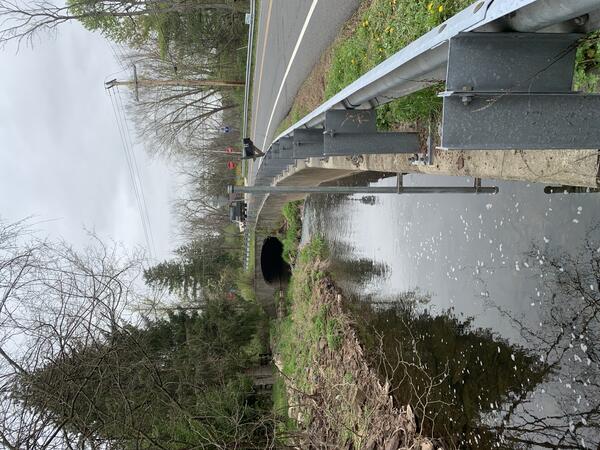
Pleasant Run Site
Crest-stage gage along the retention wall at the Pleasant Run study reach in Hunterdon County, New Jersey
Crest-stage gage along the retention wall at the Pleasant Run study reach in Hunterdon County, New Jersey
Pleasant Run Flood Model
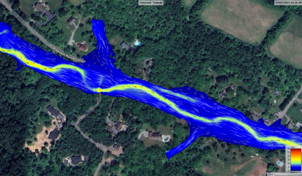
Screen capture showing a provisional section of the Hydraulic Engineering Center’s River Analysis System (HEC-RAS) 2-dimensional hydraulic model along the Pleasant Run reach.
Screen capture showing a provisional section of the Hydraulic Engineering Center’s River Analysis System (HEC-RAS) 2-dimensional hydraulic model along the Pleasant Run reach.
Flood Plane Map of Pleasant Run
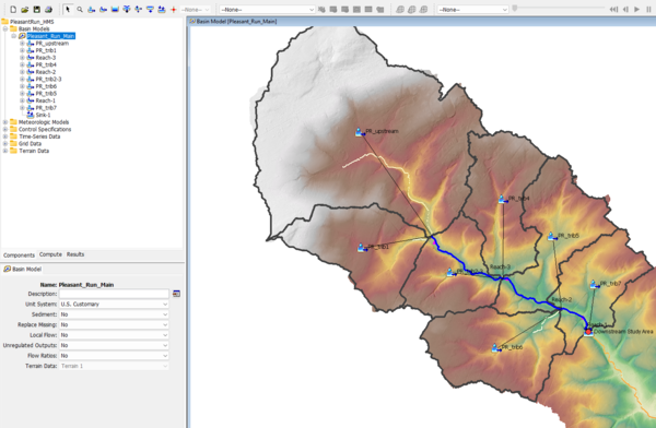
Screen capture showing an example of Hydrologic Modeling System (HMS) model geometry.
Screen capture showing an example of Hydrologic Modeling System (HMS) model geometry.
Hunterdon Study Map
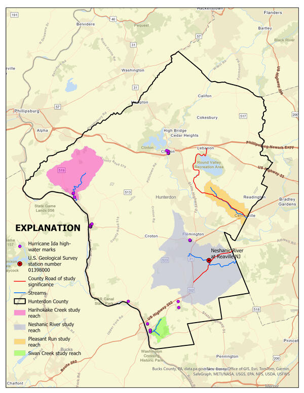
Map showing four study reaches highlighted within the larger frame of Hunterdon County, New Jersey
Map showing four study reaches highlighted within the larger frame of Hunterdon County, New Jersey
NJ Flood Decision Map
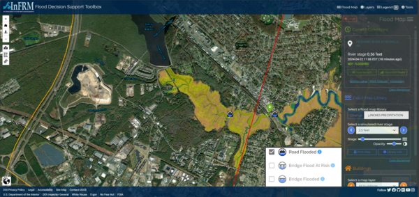
Screen capture showing the New Jersey Flood Decision Support Toolbox Application
Screen capture showing the New Jersey Flood Decision Support Toolbox Application
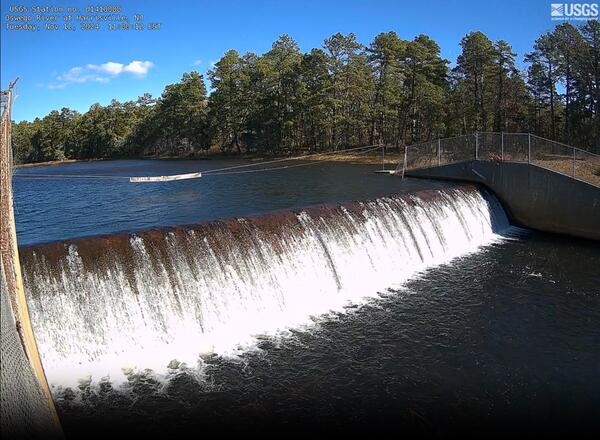
Harrisville Webcam
Looking out from on top of the gage house at the Dam on the outlet of Oswego Lake at the Streamgage 01410000 Oswego River at Harrisville, New Jersey
Looking out from on top of the gage house at the Dam on the outlet of Oswego Lake at the Streamgage 01410000 Oswego River at Harrisville, New Jersey
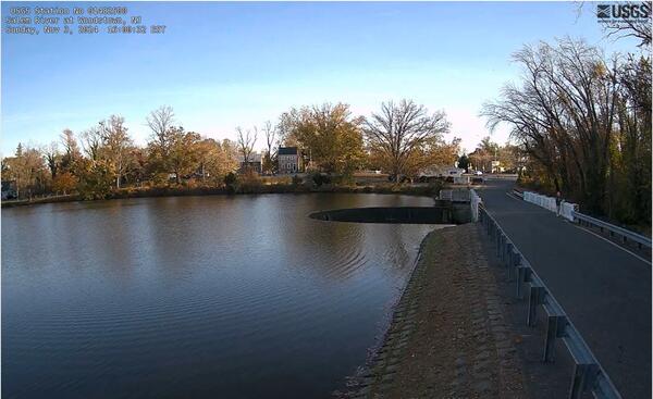
Salem Webcam
Looking out from the gage house at Veterans Memorial Lake at the curved Horseshoe Dam which spills out into the 01482500 Salem River at Woodstown, NJ
Looking out from the gage house at Veterans Memorial Lake at the curved Horseshoe Dam which spills out into the 01482500 Salem River at Woodstown, NJ
Saddle River in Fall
Leaf strewn river at 01390250 Saddle R at Brook Road near Upper Saddle River, New Jersey
Leaf strewn river at 01390250 Saddle R at Brook Road near Upper Saddle River, New Jersey
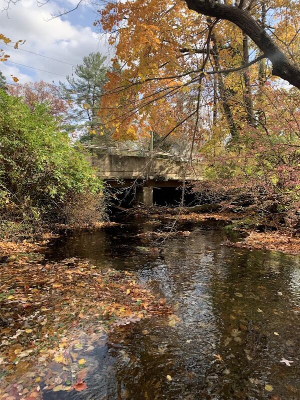
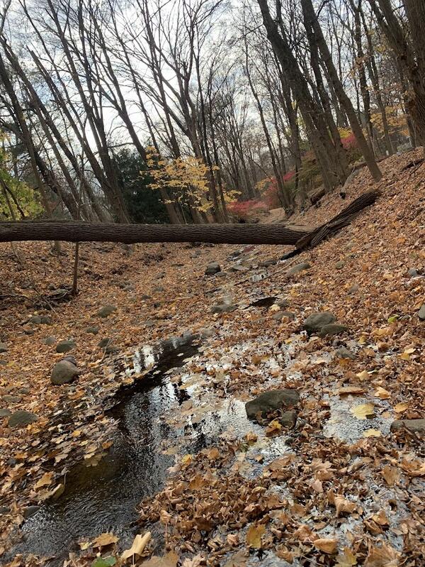
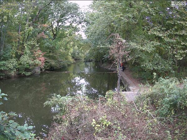
Musquapsink Brook site
Fall leaves edge the river at a bridge at 01377490 Musquapsink Brook at Westwood, New Jersey
Fall leaves edge the river at a bridge at 01377490 Musquapsink Brook at Westwood, New Jersey
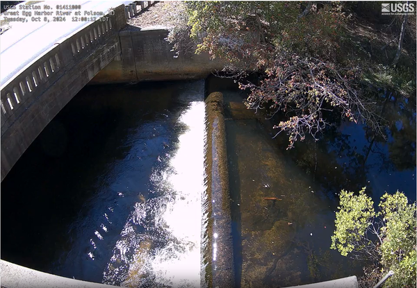
Folsom Webcam
Great Egg Harbor River flowing through channel as seen from on top of the gage house at Streamgage 01411000 Great Egg Harbor River at Folsom, New Jersey
Great Egg Harbor River flowing through channel as seen from on top of the gage house at Streamgage 01411000 Great Egg Harbor River at Folsom, New Jersey
New Milford Webcam
Hackensack River flowing downstream seen from the 01378500 Hackensack River at New Milford, New Jersey gage.
Hackensack River flowing downstream seen from the 01378500 Hackensack River at New Milford, New Jersey gage.
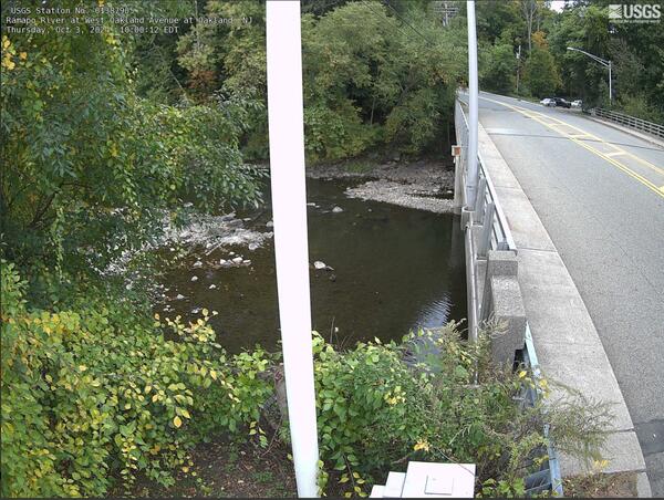
Oakland Webcam
Ramapo river as seen from the 01387905 Ramapo River at West Oakland Avenue at Oakland, New Jersey streamgage
Ramapo river as seen from the 01387905 Ramapo River at West Oakland Avenue at Oakland, New Jersey streamgage
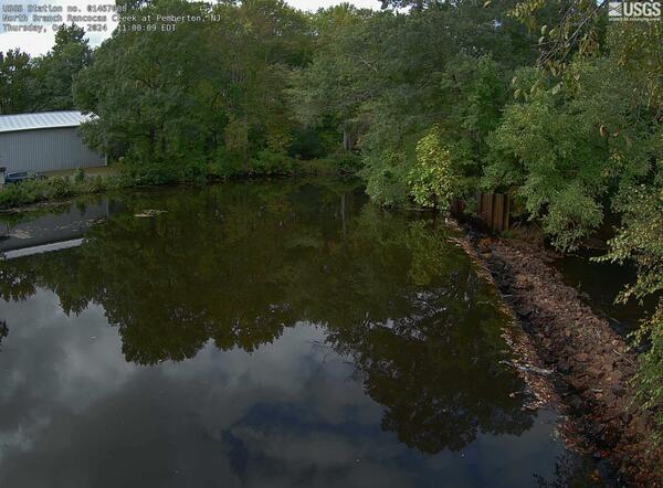
Pemberton Webcam
North Branch Rancocas Creek flowing downstream seen from the 01467000 North Branch Rancocas Creek at Pemberton, New Jersey gage.
North Branch Rancocas Creek flowing downstream seen from the 01467000 North Branch Rancocas Creek at Pemberton, New Jersey gage.
Hopatcong Landing Webcam
01455400 Lake Hopatcong at Landing at the gatehouse looks out on Lake Hopatcong.
01455400 Lake Hopatcong at Landing at the gatehouse looks out on Lake Hopatcong.
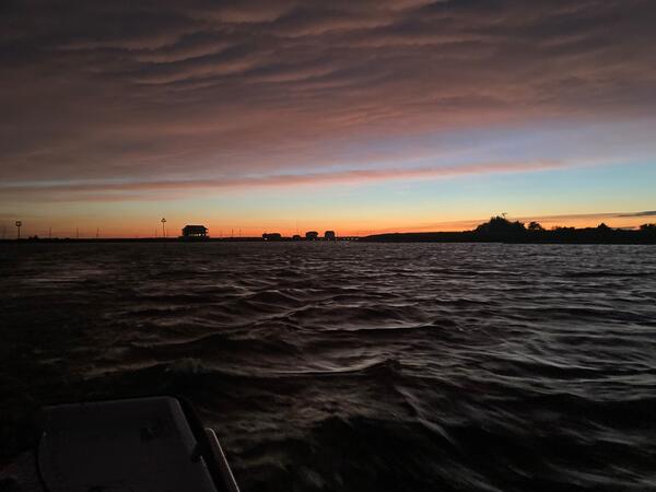
Backbays01
Looking out from the bow of one of New Jersey's boats at the sun setting over the back bays.
Looking out from the bow of one of New Jersey's boats at the sun setting over the back bays.

Blackwells Mills Webcam
Looking down river from atop the gage at Streamgage 01402000 Millstone River at Blackwells Mills, NJ
Looking down river from atop the gage at Streamgage 01402000 Millstone River at Blackwells Mills, NJ
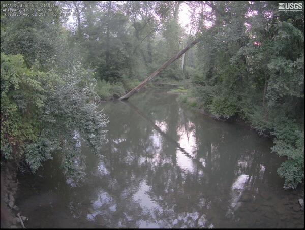
near_Morristown Webcam
Streamgage 01381400 Whippany River near Morristown, NJ, looking down river towards a fallen tree
Streamgage 01381400 Whippany River near Morristown, NJ, looking down river towards a fallen tree

Second River Webcam
Camera looking down on the weir at Streamgage 01392500 Second River at Bellville, NJ
Camera looking down on the weir at Streamgage 01392500 Second River at Bellville, NJ