
This is a picture of a restaurant on River Kwai taken by Sachin Shah working for Oklahoma-Texas Water Science Center
Images
Photographs taken by Oklahoma-Texas Water Science Center employees at local, national, and international project locations.
Filter Total Items: 551

Restaurant on River Kwai for Socio-Hydrology
This is a picture of a restaurant on River Kwai taken by Sachin Shah working for Oklahoma-Texas Water Science Center

River Kwai for Socio-Hydrology
Photograph of River Kwai authored by Sachin Shah working for Oklahoma-Texas Water Science Center with Socio-Hydrology Group
Photograph of River Kwai authored by Sachin Shah working for Oklahoma-Texas Water Science Center with Socio-Hydrology Group

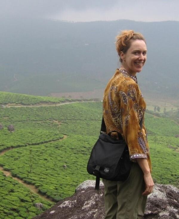
Mountains for Socio-Hydrology
This picture was authored by Sachin Shah working for Oklahoma-Texas Water Science Center at International & Socio-Economic Programs section
This picture was authored by Sachin Shah working for Oklahoma-Texas Water Science Center at International & Socio-Economic Programs section

Bridge on Mekong River
A bridge on Mekong River for Socio-Hydrology site under Oklahoma-Texas Water Science Center
A bridge on Mekong River for Socio-Hydrology site under Oklahoma-Texas Water Science Center

Headline image for Transboundary Aquifer Assessment Program (TAAP)
Headline image for Transboundary Aquifer Assessment Program (TAAP)Headline image for Transboundary Aquifer Assessment Program (TAAP), which is a project lead by Socio-Hydrology Team under OTWSC
Headline image for Transboundary Aquifer Assessment Program (TAAP)
Headline image for Transboundary Aquifer Assessment Program (TAAP)Headline image for Transboundary Aquifer Assessment Program (TAAP), which is a project lead by Socio-Hydrology Team under OTWSC

Transboundary Aquifer Assessment Program
Image for Transboundary Aquifer Assessment Program Stakeholder Mapping (2021-present) by Oklahoma-Texas Water Science Center
Image for Transboundary Aquifer Assessment Program Stakeholder Mapping (2021-present) by Oklahoma-Texas Water Science Center

Downstream view of North Canadian River at Britton Rd at Oklahoma City
Downstream view of North Canadian River at Britton Rd at Oklahoma CityView downstream from the bridge at USGS site 07241520, North Canadian River at Britton Rd at Oklahoma City, OK
Downstream view of North Canadian River at Britton Rd at Oklahoma City
Downstream view of North Canadian River at Britton Rd at Oklahoma CityView downstream from the bridge at USGS site 07241520, North Canadian River at Britton Rd at Oklahoma City, OK

Chinle Creek
Photo at the Chinle Creek location was taken by Christina Ferguson of New Mexico Water Science Center in 2021. It is being used for the project that tracks metal contaminants in San Juan River
Photo at the Chinle Creek location was taken by Christina Ferguson of New Mexico Water Science Center in 2021. It is being used for the project that tracks metal contaminants in San Juan River

Rafts, kayaks, and canoes on the Illinois River near Moodys, Oklahoma, (station 07196320) on a busy summer Saturday during the peak of the recreational floating season
Rafts, kayaks, and canoes on the Illinois River near Moodys, Oklahoma, (station 07196320) on a busy summer Saturday during the peak of the recreational floating seasonRafts, kayaks, and canoes pass downstream of the Illinois River Floatcam on the Illinois River near Moodys, Oklahoma, (station 07196320) on a busy summer Saturday during the peak of the recreational floating season. The Illinois River Floatcam is located at USGS station 0719
Rafts, kayaks, and canoes on the Illinois River near Moodys, Oklahoma, (station 07196320) on a busy summer Saturday during the peak of the recreational floating season
Rafts, kayaks, and canoes on the Illinois River near Moodys, Oklahoma, (station 07196320) on a busy summer Saturday during the peak of the recreational floating seasonRafts, kayaks, and canoes on the Illinois River near Moodys, Oklahoma, (station 07196320) on a busy summer Saturday during the peak of the recreational floating season
Rafts, kayaks, and canoes on the Illinois River near Moodys, Oklahoma, (station 07196320) on a busy summer Saturday during the peak of the recreational floating seasonRafts, kayaks, and canoes pass downstream of the Illinois River Floatcam on the Illinois River near Moodys, Oklahoma, (station 07196320) on a busy summer Saturday during the peak of the recreational floating season. The Illinois River Floatcam is located at USGS station 0719

Upstream of Trinity River at Crockett
Upstream of USGS gage 08065350, Trinity River near Crockett, TX
Upstream of USGS gage 08065350, Trinity River near Crockett, TX

ok_low-flow_norman.jpg
This is an undated image of low flow on Canadian River near Norman, OK for Oklahoma-Texas Water Science Center to be listed on Science ->Streams and Lakes page
This is an undated image of low flow on Canadian River near Norman, OK for Oklahoma-Texas Water Science Center to be listed on Science ->Streams and Lakes page

Sunset on Mekong River, Vietnam
Sunset on Mekong River, Vietnam for the program Gender Vulnerability to Climate Hazards in the Mekong River Basin
Sunset on Mekong River, Vietnam for the program Gender Vulnerability to Climate Hazards in the Mekong River Basin

Mekong River
This is a photo of Mekong River taken probably in November of 2019. The photo is for Socio-Hydrology team
This is a photo of Mekong River taken probably in November of 2019. The photo is for Socio-Hydrology team

ok_flood_meas_muskogee_2019.png
Flood measurement on Arkansas River in Oklahoma. Image taken during a flood sometimes in 2019 for the Oklahoma-Texas Water Science Center
Flood measurement on Arkansas River in Oklahoma. Image taken during a flood sometimes in 2019 for the Oklahoma-Texas Water Science Center

ok_okc5-sampling.png
The image shows water sampling being done in Oklahoma at unknown location and unknown time for the Oklahoma-Texas Water Science Center
The image shows water sampling being done in Oklahoma at unknown location and unknown time for the Oklahoma-Texas Water Science Center

ok_sampling-tahlequah.png
Illinois River near Tahlequah, OK; QW sampling. Image selected for the Science section of the Oklahoma-Texas Water Science Center of USGS
Illinois River near Tahlequah, OK; QW sampling. Image selected for the Science section of the Oklahoma-Texas Water Science Center of USGS

Flood measurement Arkansas River near Muskogee 2019
Flood measurement Arkansas River near Muskogee 2019This is an undated photo of Flood measurement Arkansas River near Muskogee in 2019 for Oklahoma-Texas Water Science Center Science page
Flood measurement Arkansas River near Muskogee 2019
Flood measurement Arkansas River near Muskogee 2019This is an undated photo of Flood measurement Arkansas River near Muskogee in 2019 for Oklahoma-Texas Water Science Center Science page

ok_geoprobe_wilcox.png
The image shows Geoprobe at the Wilcox Superfund Site in Oklahoma. This is for the Science microsite of Oklahoma-Texas Water Science Center
The image shows Geoprobe at the Wilcox Superfund Site in Oklahoma. This is for the Science microsite of Oklahoma-Texas Water Science Center
MaryLynne Musgrove headshot
MaryLynne Musgrove, research physical scientist with the USGS Oklahoma-Texas Water Science Center
MaryLynne Musgrove, research physical scientist with the USGS Oklahoma-Texas Water Science Center

ok_lake-hefner.png
This is a photo of Lake Hefner in Oklahoma to be listed on the Science -> Streams and Lakes page for Oklahoma-Texas Water Science Center
This is a photo of Lake Hefner in Oklahoma to be listed on the Science -> Streams and Lakes page for Oklahoma-Texas Water Science Center

New Gulf of Mexico network speeds USGS hurricane preparations
New Gulf of Mexico network speeds USGS hurricane preparationsEach one these blue dots represents a site where a storm-tide sensor bracket has been installed for the Gulf of Mexico pre-defined network. There are currently 85 brackets in Florida, 6 in Alabama, 3 in Mississippi, 18 in Louisiana and 26 in Texas, for a total of 138 bracketed sites. (Not all brackets will be used in all storms.)