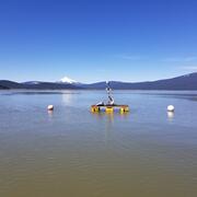
U.S. flag

An official website of the United States government

Bathymetry

Filter Total Items: 3

Controls on habitat for native lamprey in the Siletz River Basin

Chinook Salmon and Pacific Lamprey are culturally significant fishes to the Tribal community along the Siletz River, Oregon. The USGS studied how streamflow and bedload conditions may influence mainstem spawning habitats.
Controls on habitat for native lamprey in the Siletz River Basin

Controls on habitat for native lamprey in the Siletz River Basin

Chinook Salmon and Pacific Lamprey are culturally significant fishes to the Tribal community along the Siletz River, Oregon. The USGS studied how streamflow and bedload conditions may influence mainstem spawning habitats.
Learn More

Integrating water availability in the Klamath Basin: from drought to dam removal

The USGS Water Resources Mission Area is assessing how much water is available for human and ecological needs in the United States and identifying where and when the Nation may have challenges meeting its demand for water. This information helps decision makers manage and distribute water in ways that balance competing needs. Due to its complex and competing water demands, ecological significance...
Integrating water availability in the Klamath Basin: from drought to dam removal

Integrating water availability in the Klamath Basin: from drought to dam removal

The USGS Water Resources Mission Area is assessing how much water is available for human and ecological needs in the United States and identifying where and when the Nation may have challenges meeting its demand for water. This information helps decision makers manage and distribute water in ways that balance competing needs. Due to its complex and competing water demands, ecological significance...
Learn More

Bridge scour monitoring in Oregon

The U.S. Geological Survey is working with the Oregon Department of Transportation (ODOT) and Federal Highway Administration (FHWA) to revolutionize bridge scour monitoring using real-time sonar data collection and bathymetric surveying to remotely monitor sites, collect long-term data for evaluation, and develop and improve hydraulic models that predict scour.
Bridge scour monitoring in Oregon

Bridge scour monitoring in Oregon

The U.S. Geological Survey is working with the Oregon Department of Transportation (ODOT) and Federal Highway Administration (FHWA) to revolutionize bridge scour monitoring using real-time sonar data collection and bathymetric surveying to remotely monitor sites, collect long-term data for evaluation, and develop and improve hydraulic models that predict scour.
Learn More
Was this page helpful?