Shaun Donmoyer and Zachary Houston sampling for ALCOSAN project
Shaun Donmoyer and Zachary Houston sampling for ALCOSAN projectShaun Donmoyer and Zachary Houston sampling at the point location, three rivers, Pittsburgh PA (Jared Carte, USGS).

Official websites use .gov
A .gov website belongs to an official government organization in the United States.
Secure .gov websites use HTTPS
A lock () or https:// means you’ve safely connected to the .gov website. Share sensitive information only on official, secure websites.
Multimedia about Pennsylvania's water resources or created by center staff

Shaun Donmoyer and Zachary Houston sampling at the point location, three rivers, Pittsburgh PA (Jared Carte, USGS).
Shaun Donmoyer and Zachary Houston sampling at the point location, three rivers, Pittsburgh PA (Jared Carte, USGS).
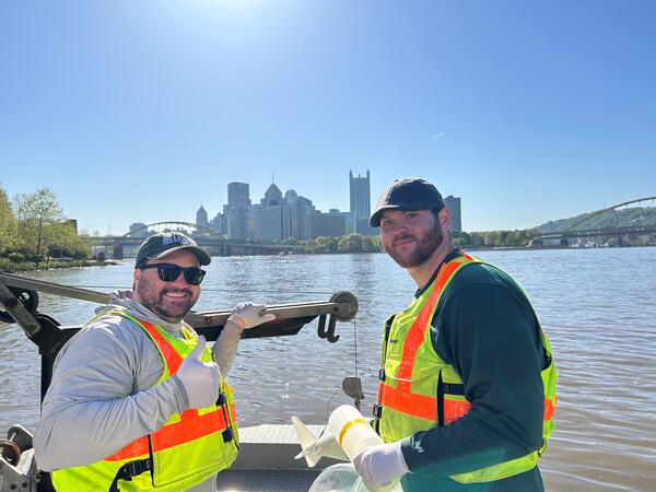
Shaun Donmoyer and Zachary Houston, USGS Pennsylvania Water Science Center, sampling for stream water quality, ALCOSAN project, Pittsburgh, (Jared Carte, USGS).
Initial sampling for monitoring before and after a project to update combined sewer overflow systems in the Pittsburgh area.
Shaun Donmoyer and Zachary Houston, USGS Pennsylvania Water Science Center, sampling for stream water quality, ALCOSAN project, Pittsburgh, (Jared Carte, USGS).
Initial sampling for monitoring before and after a project to update combined sewer overflow systems in the Pittsburgh area.

Shaun Donmoyer and Zach Houston are collecting a water sample to characterize water quality conditions near a combined sewer overflow as part of the Three Rivers Region Water Quality Monitoring with Allegheny County Sanitary Authority project.
Shaun Donmoyer and Zach Houston are collecting a water sample to characterize water quality conditions near a combined sewer overflow as part of the Three Rivers Region Water Quality Monitoring with Allegheny County Sanitary Authority project.
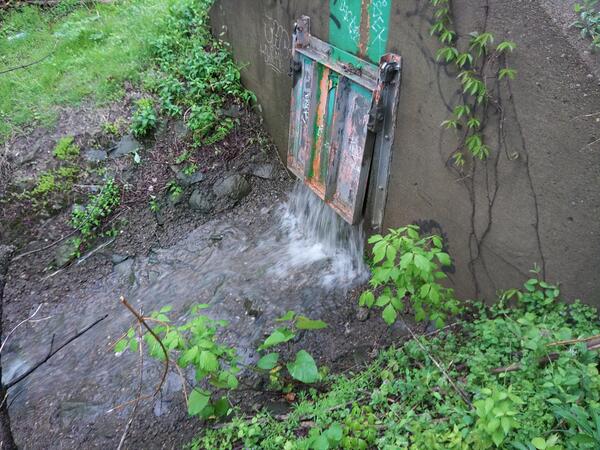
Combined sewer outfall (CSO) at stream sampling location 03085550 Chartiers Creek at Crafton, Pennsylvania, during the wet weather event for the ALCOSAN project (Lee Eicholtz, USGS).
Combined sewer outfall (CSO) at stream sampling location 03085550 Chartiers Creek at Crafton, Pennsylvania, during the wet weather event for the ALCOSAN project (Lee Eicholtz, USGS).

Shohola Creek near Walker Lake, PA (01432495), streamflow monitoring equipment. (USGS)
Shohola Creek near Walker Lake, PA (01432495), streamflow monitoring equipment. (USGS)

Trent Watts, a USGS hydrologic technician, uses an Acoustic Doppler Current Profiler to measure the amount of water flowing in Perkiomen Creek in Graterford, Pennsylvania, on December 18. USGS photo by Cameron Ensor.
Trent Watts, a USGS hydrologic technician, uses an Acoustic Doppler Current Profiler to measure the amount of water flowing in Perkiomen Creek in Graterford, Pennsylvania, on December 18. USGS photo by Cameron Ensor.

The Next Generation Water Observing Program (NGWOS) supports the advancement of water resources observations in order to assess water availability, management, and prediction across the US’s major hydrologic regions.
The Next Generation Water Observing Program (NGWOS) supports the advancement of water resources observations in order to assess water availability, management, and prediction across the US’s major hydrologic regions.

Narrated presentation that provides a unique synthesis of the story of nutrient water quality in the Susquehanna watershed.
Narrated presentation that provides a unique synthesis of the story of nutrient water quality in the Susquehanna watershed.

The Delaware River is rich in history, ecologically diverse, and critical to the regional economy. Water managers in this basin have a long history of applying innovative, regional solutions to ensure the long-term sustainability of this treasured resource which provides drinking water to over 15 million people in the region.
The Delaware River is rich in history, ecologically diverse, and critical to the regional economy. Water managers in this basin have a long history of applying innovative, regional solutions to ensure the long-term sustainability of this treasured resource which provides drinking water to over 15 million people in the region.
")
Narrated presentation that provides a unique, long-term perspective (1950-2050) of the major drivers of nitrogen change up to the present, and forecasts how they may affect nitrogen into the future for the Chesapeake Bay watershed. Information is based off of U.S. Geological Survey Circular 1486.
Narrated presentation that provides a unique, long-term perspective (1950-2050) of the major drivers of nitrogen change up to the present, and forecasts how they may affect nitrogen into the future for the Chesapeake Bay watershed. Information is based off of U.S. Geological Survey Circular 1486.
Narrated presentation that provides a unique, long-term perspective (1950-2050) of the major drivers of nitrogen change up to the present, and forecasts how they may affect nitrogen into the future for the Chesapeake Bay watershed. Information is based off of U.S. Geological Survey Circular 1486.
Narrated presentation that provides a unique, long-term perspective (1950-2050) of the major drivers of nitrogen change up to the present, and forecasts how they may affect nitrogen into the future for the Chesapeake Bay watershed. Information is based off of U.S. Geological Survey Circular 1486.
A view of the latest image of the Susquehanna River at Towanda, PA (01531500). Visit webcam for more details.
A view of the latest image of the Susquehanna River at Towanda, PA (01531500). Visit webcam for more details.
The latest view from the camera at Allegheny River at Franklin, PA (03025500). Visit webcam for more details.
The latest view from the camera at Allegheny River at Franklin, PA (03025500). Visit webcam for more details.
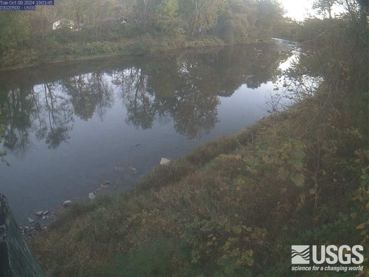
The latest view from Oil Creek at Rouseville, PA (03020500). View the webcam for more details.
The latest view from Oil Creek at Rouseville, PA (03020500). View the webcam for more details.
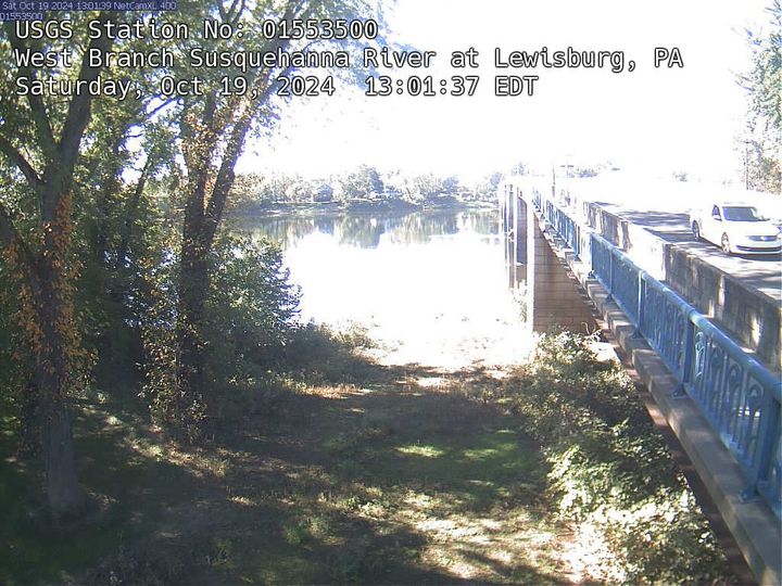
View of the latest image from the West Branch Susquehanna River at Lewisburg, PA (01553500). View webcam for more details.
View of the latest image from the West Branch Susquehanna River at Lewisburg, PA (01553500). View webcam for more details.